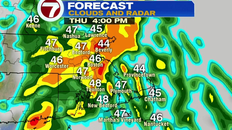
BOSTON (WHDH) - A line of downpours with embedded thunderstorms is moving toward Massachusetts, bringing with it gusty winds, small hail, and some coastal flooding.
Thunderstorms will develop between 1 and 4 p.m. before moving out around 5 and 6 p.m., according to 7NEWS meteorologist Josh Wurster.
The winds that push the storm out to sea will get gusty from the west, with gusts expected to reach up to 50 mph.
All of the Bay State is under a wind advisory from 4 to 9 p.m.
Cape Cod and the eastern coastline may see minor flooding due to the storm and Tuesday’s supermoon causing astronomical high tides.
High tide is slated for 1 to 3 p.m. Thursday, 1 to 2 a.m. Friday and 2 to 3 p.m. Friday.
A coastal flood advisory is in effect for Cape Cod and the eastern coastline until 8 a.m. Friday.
Getting windy today. When storms arrive, gusty winds from the south. When storms exit, gusty winds from the west. Wind Advisory for the whole state 4-9pm. pic.twitter.com/9XIHlHxKWJ
— Josh Wurster (@joshwurster_) April 9, 2020
Coastal flooding possible along the entire coastline of Massachusetts today and tonight especially during high tides. Next three high tide cycles listed below: pic.twitter.com/DXoK63fFpF
— Josh Wurster (@joshwurster_) April 9, 2020
Click here for the latest weather updates.
(Copyright (c) 2024 Sunbeam Television. All Rights Reserved. This material may not be published, broadcast, rewritten, or redistributed.)