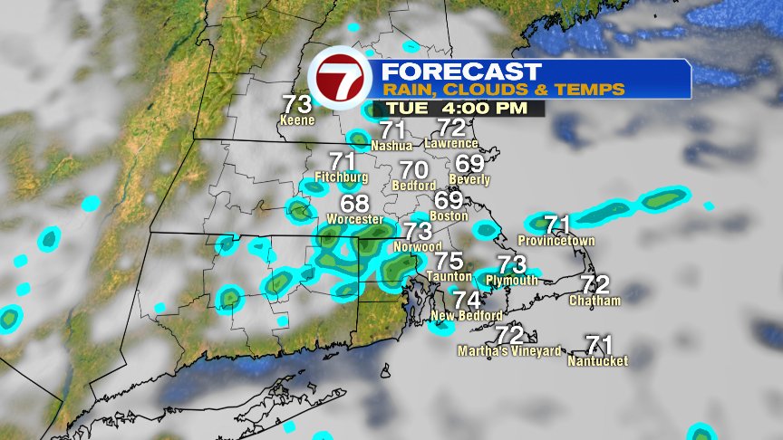
Winds of change were sure with us yesterday as northeasterly breezes kicked in, and that was all she wrote for the high humidity and heat. Today and tomorrow, those easterly breezes continue, providing more relief as highs only top off in the mid 70s on average. This morning we start with lots of clouds and even some spotty light showers, mainly in Southeast Mass. By the afternoon, more breaks of sun will appear as cool ocean breezes continue. While I can’t rule out a spotty shower or two Tuesday, tomorrow’s flavor of the day will be similar to today’s with clouds, breaks of sun and an onshore breeze holding the temps in the mid 70s again.

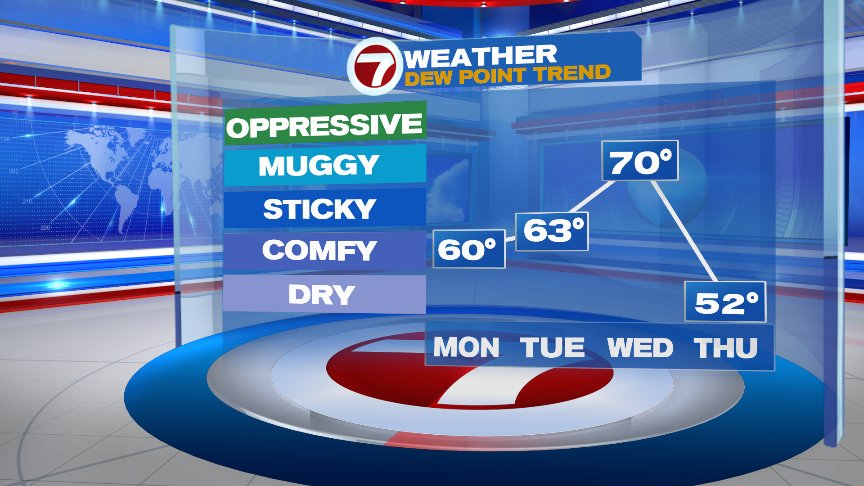
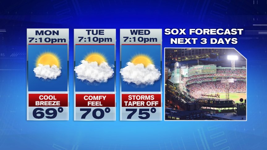
Humidity spikes up for one day and one day only this week. As a warm front lifts through here overnight Tuesday/early Wednesday morning, we’ll watch the potential for scattered storm storms with locally heavy rains. Once that front moves through, dew points spike to near or above 70, allowing for that more uncomfortable feel to the air. A cold front comes crashing through in the afternoon, sparking more scattered storms, and also ending the high humidity as drier air pours back in here in the evening. Storms should end late Wednesday by the time first pitch is thrown at Fenway Park.

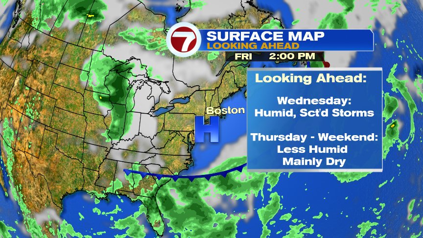
Low humidity and high pressure builds in to end the week, and right now, next weekend looks like a solid summer weekend with highs in the 80s. Humidity starts low Saturday and ends higher Sunday afternoon.
Have a good day.
@clamberton7 – twitter