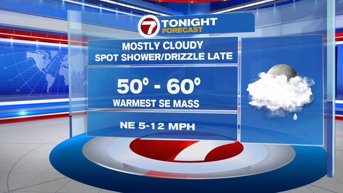
This evening, we’ll see increasing clouds with temperatures on the mild side.
Overnight, a few showers are possible, but these will be spotty.
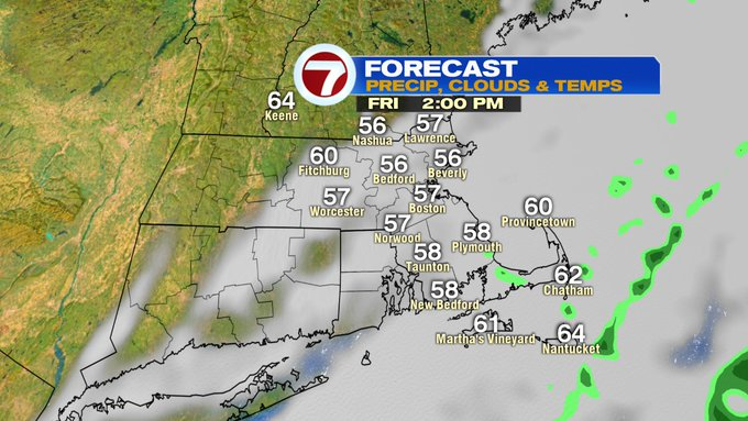
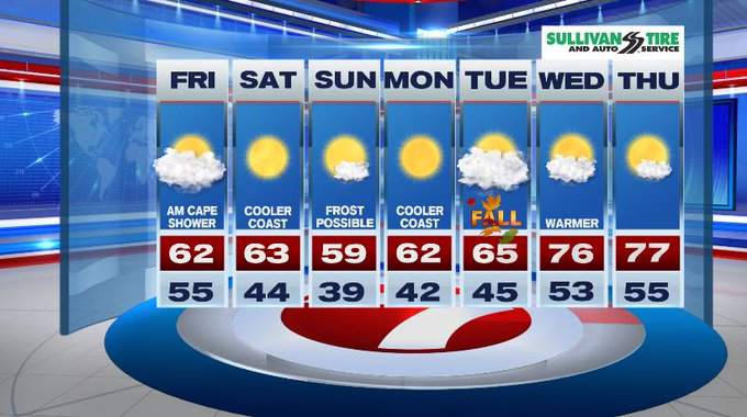
Friday features a few showers in the morning, especially along the Cape and Islands. We’ll also see the clouds sticking around through the middle of the afternoon before clearing out Friday night as a front pushes them out to sea.
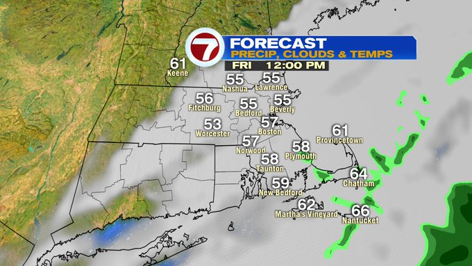
Highs on Friday will be noticeably cooler than today.
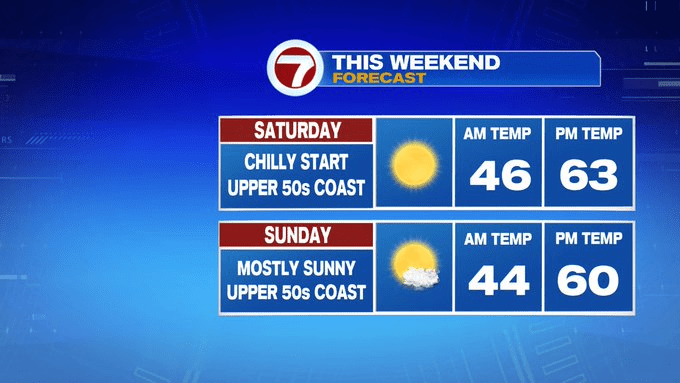
The cooler air from Friday sticks around through the weekend, with highs in the low 60s inland, slightly cooler at the coast due to an onshore wind.
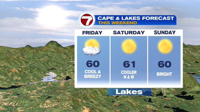
This onshore wind will be strong at times, which will make for rough surf this weekend.
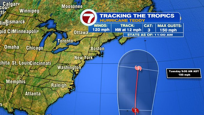
Keeping an eye on the tropics with Hurricane Teddy becoming a Category 3, which is a major hurricane, earlier today.
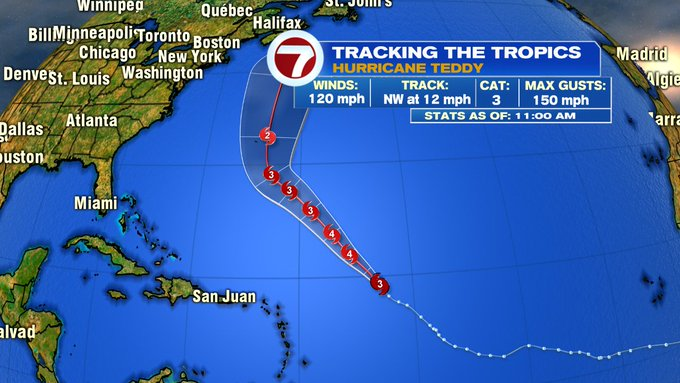
At this point, the track continues to keep it out to sea, but we’ll likely see rough surf through early next week associated with the swells from that hurricane as it climbs northward in the Atlantic.
As for our local weather next week, temperatures remain fall-like through midweek as we inch closer to the first day of fall.
— Jackie Layer