Figures, right? Just as the long weekend came to a close, the clearer skies emerged to finish off the day. Although the nicer weather was too little, too late, it has set the stage for summer’s comeback this week as the warmer and and drier times dominated much of the next 10 days. By the way… we’re good with the sky for now. With 2-4″ falling over the weekend, much of Southern New England is close to average since March 1st.
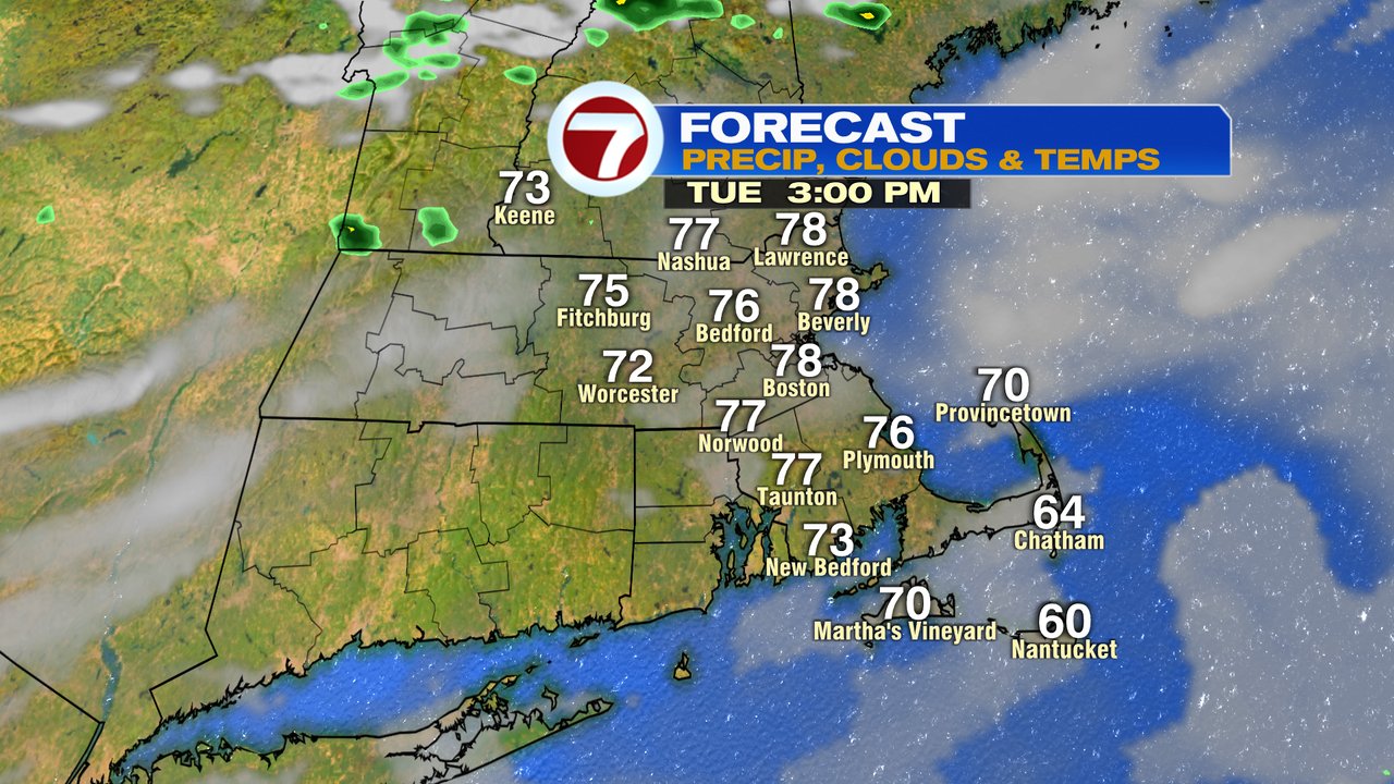
Humidity is in check today while mid to high level clouds filter out the sun at times, but with temperatures running in the mid to upper 70s, it’ll be a comfortable day for sure.
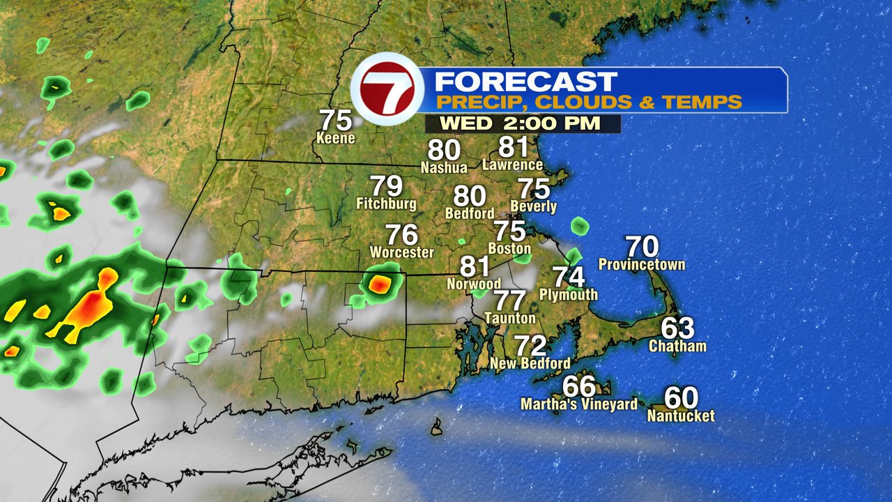
Humidity builds tomorrow as temps warm to near 80. While a spot shower in the afternoon can’t be ruled out, much of the time is going to be rain-free.
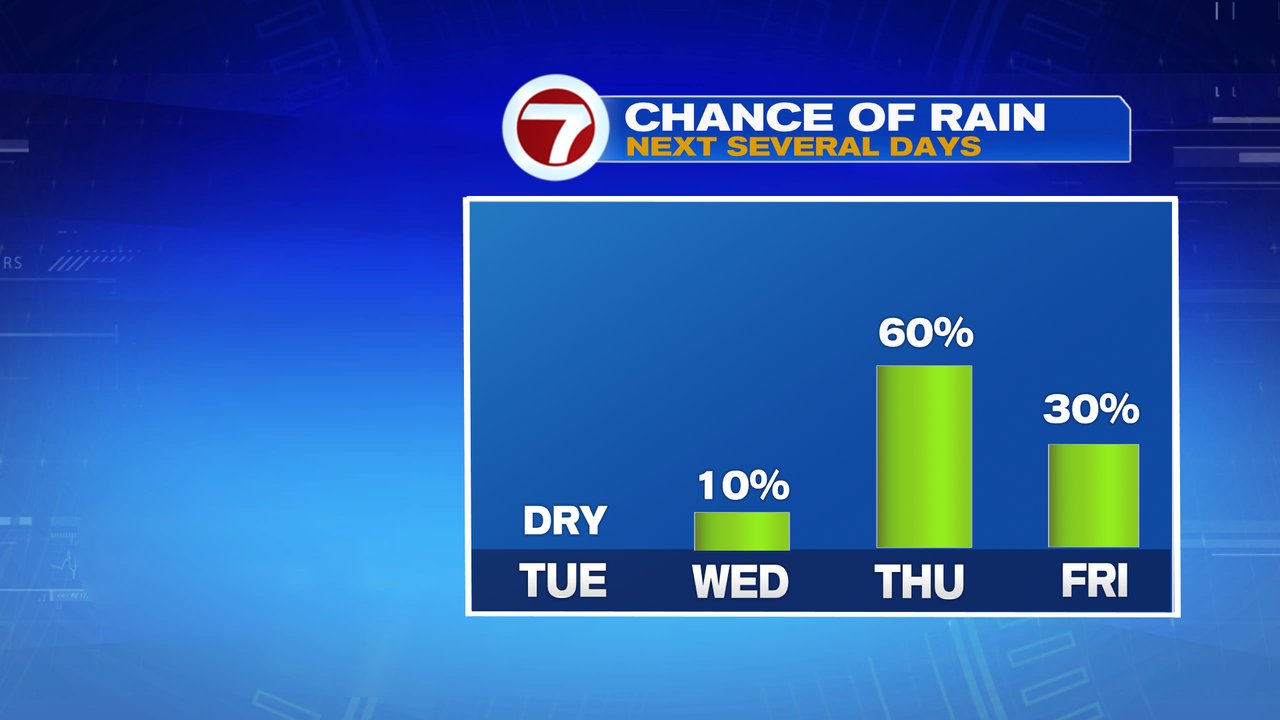
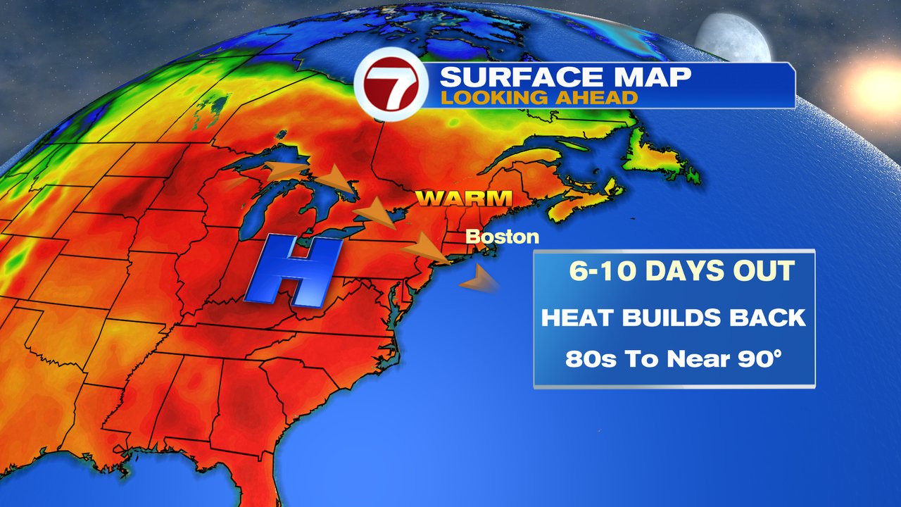
Thursday offers the best chance for showers and storms that’ll be in and out through the day. Once we get into the weekend, it’s all about the warmth building in. Temps run 80-85 Saturday and near 90 on Sunday. That heat has some staying power too as much of the first half of next week looks hot too.
Today also marks the 10 year anniversary of the 2011 tornado outbreak here in New England. The most violent tornado, an EF-3, tore through parts of western and central Mass with peak winds of 160mph. It’s 39 mile path from Westfield to Charlton produced a wide swath of damage and killed 3 people.