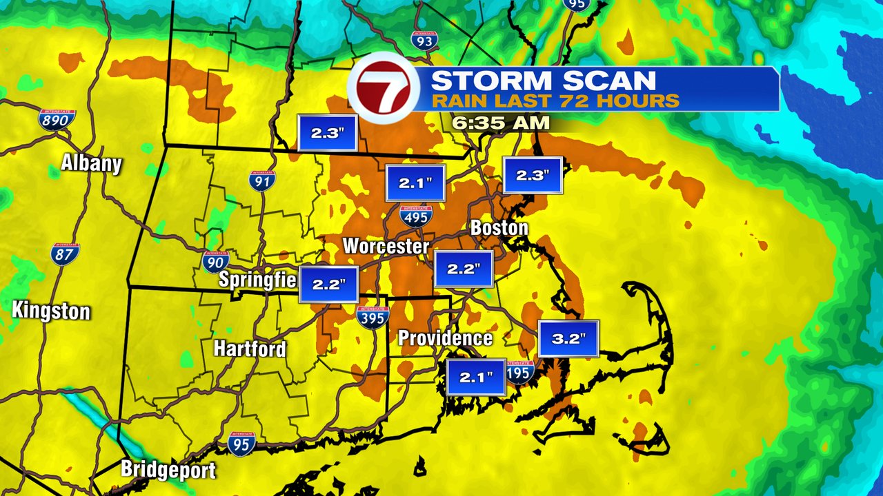
Yikes… tough weather for sure through the long weekend as 2-4″ of rain has been widespread across much of Southern New England. Not only have we dealt with the rain, but also the chill. Temperatures over the weekend were stuck in the 40s to lower 50s, producing record cold high temps for some on Saturday and Sunday.
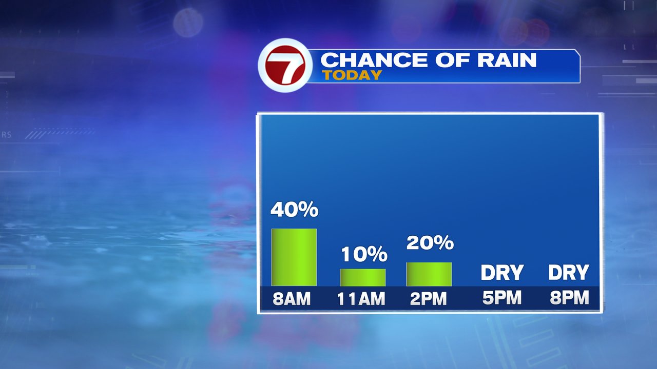
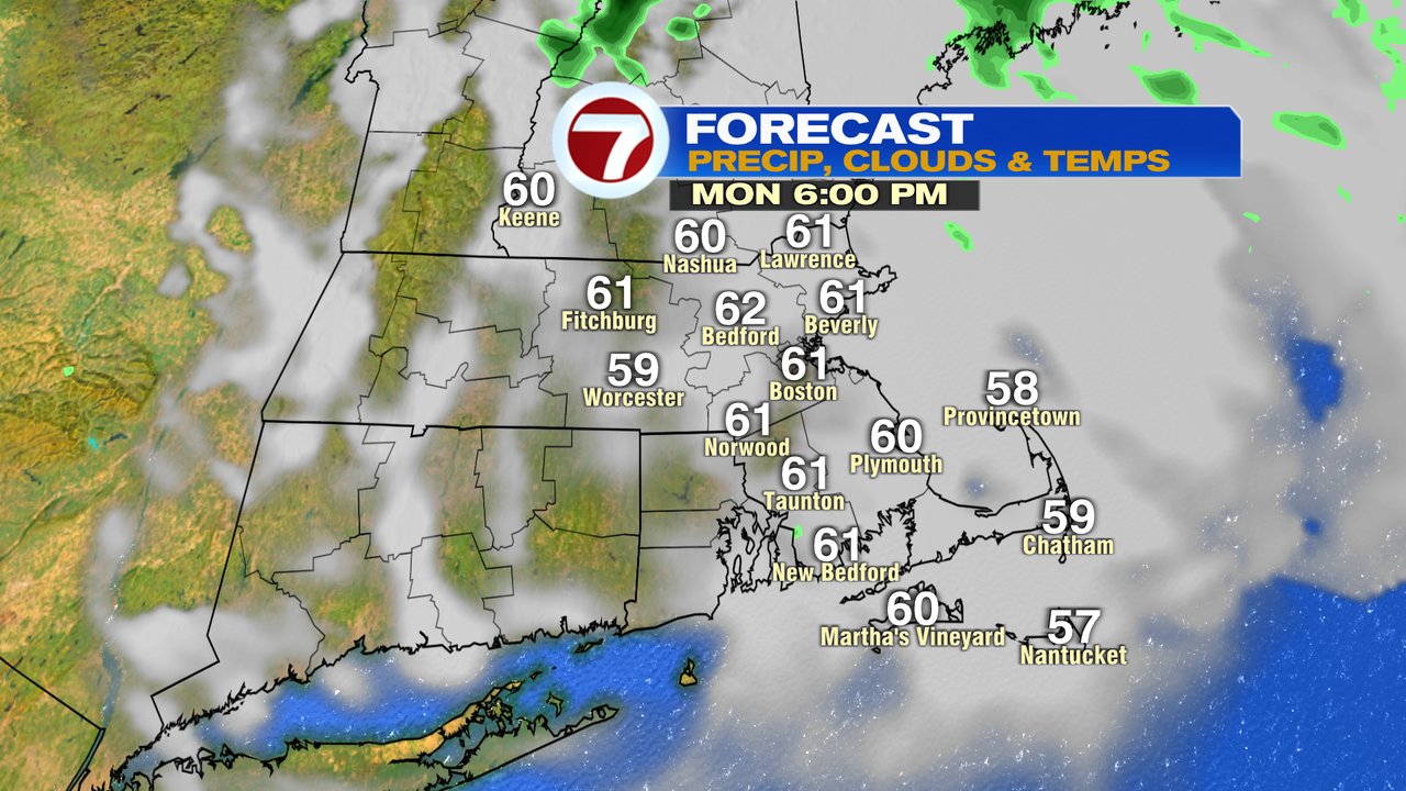
Today, we’ll start to see improvements as morning showers taper off by mid morning. While we’ll start to catch some dry breaks, another passing shower is possible early this afternoon before the rain shuts down for good. A few breaks of late afternoon sun are possible and at that time, temps sneak up toward 60, a good 10-15 degrees warmer than the last couple days.

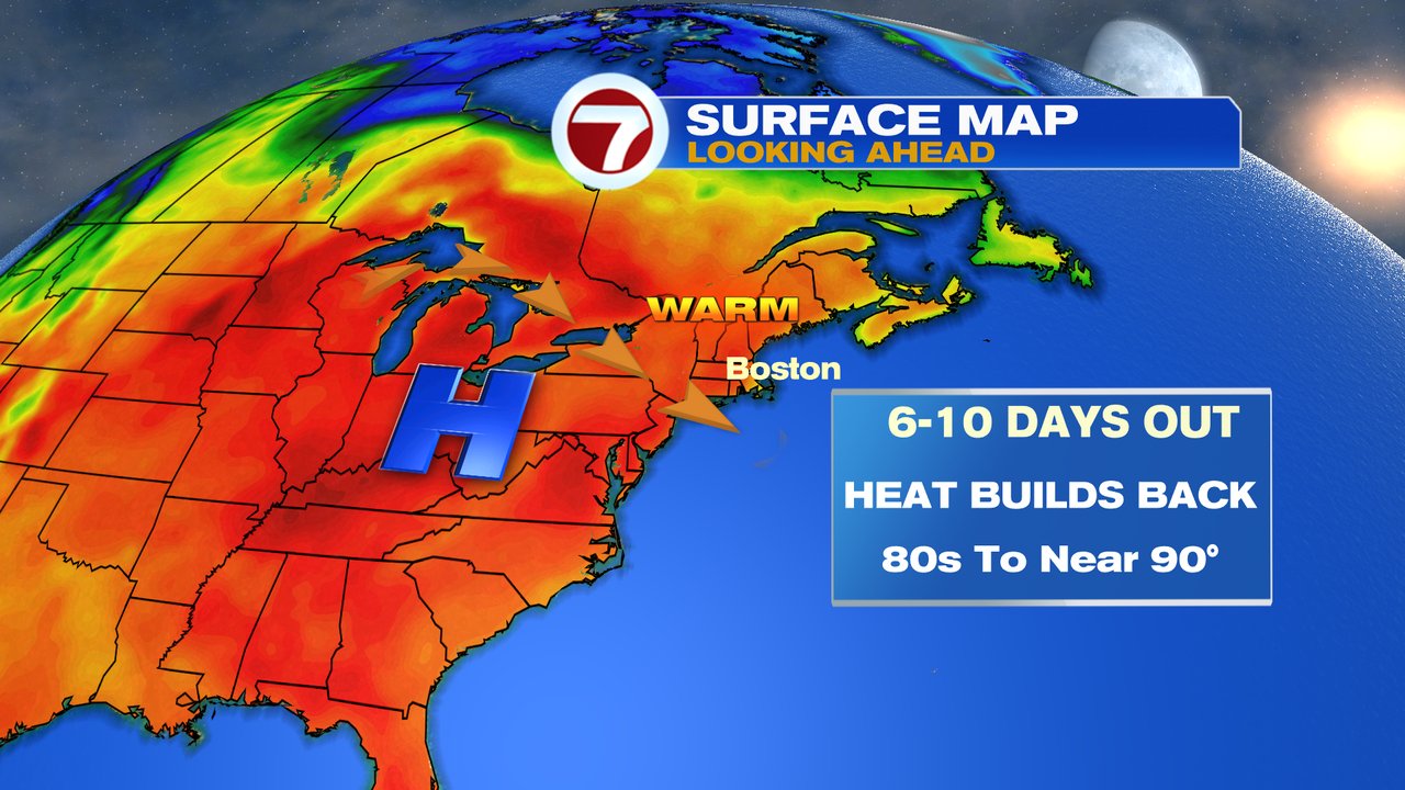
Summery weather returns this week with 70s to near 80 tomorrow, and holding at those levels through the end of the week. Scattered showers and storms return Thursday and Friday, but we’ll tend to dry out for the weekend as temps heat up. Saturday – mid next week, expect a lot of summer time warmth and humidity as temps head for the 80s to lower 90s.