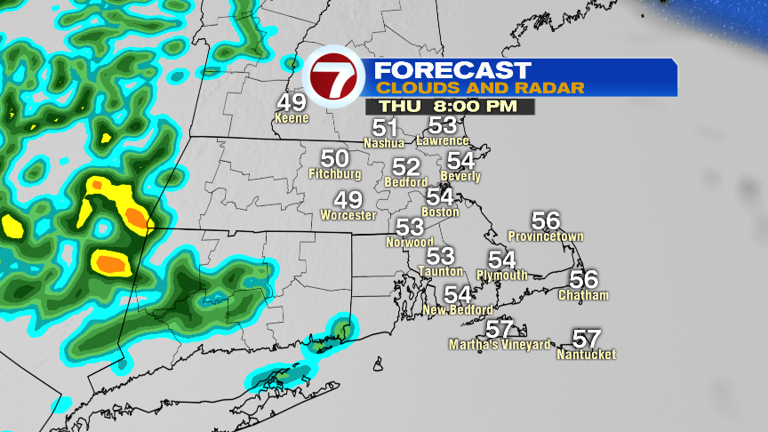
Through the evening commute, expect on and off light showers. These continue to slide through the overnight hours, but should be out of here just in time for Friday morning’s commute.
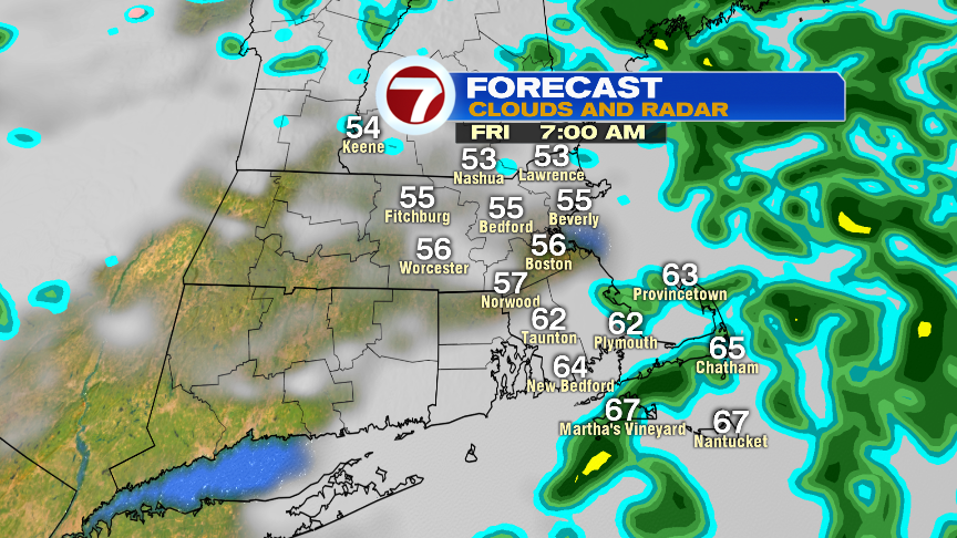
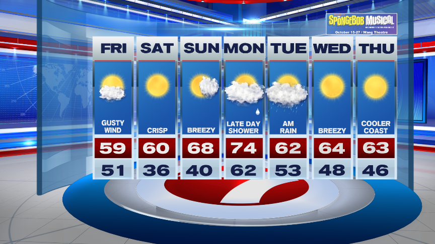
Great news about Friday, not only that it is the last day of the work week, BUT we are tracking the return of some sunshine! We’ll see a few clouds lingering early, otherwise some sunny breaks by the afternoon. It will be quite gusty though with winds out of the northwest, with high temperatures into the upper 50s for most spots.


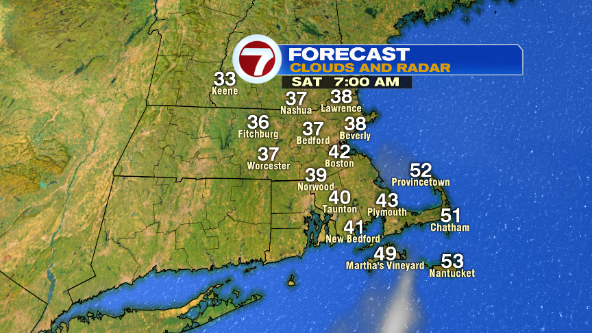
Now Friday night into Saturday morning, a Freeze Watch has been issued for the Berkshires and southern Vermont.

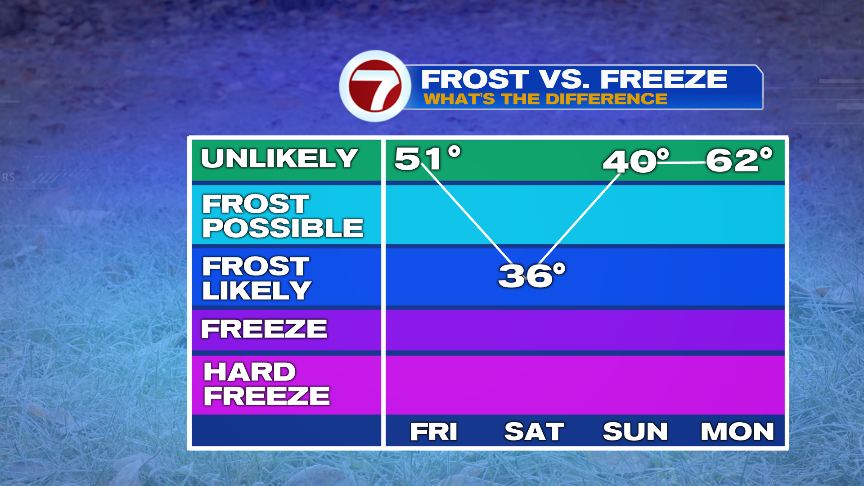
Frost is possible for our area (especially outside of the city) early Saturday morning with lows expected to slip into the mid 30s for a few hours Saturday morning. After a chilly start, temperatures rebound to 60 by mid afternoon under sun-filled skies.
Sunday features breezy conditions and a few more clouds into the afternoon with highs into the upper 60s.
We remain rain free for your weekend plans around town.
We’re tracking a warm-up to kick off the work week, with highs into the low 70s, ahead of a cold front off to the northwest. This front will usher in a late day shower, otherwise the rain holds off until Tuesday morning.
Behind the cold front brings back seasonable temperatures with highs into the low to mid 60s with the return to sunshine Wednesday and Thursday.
