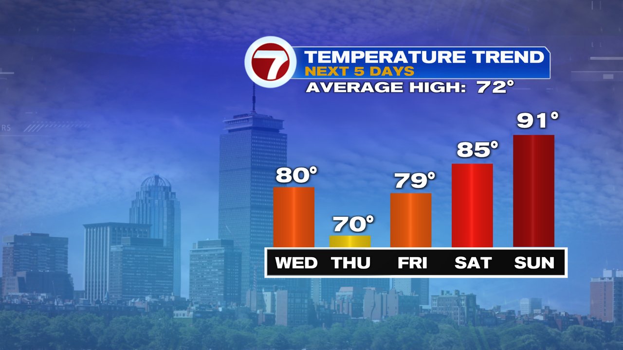
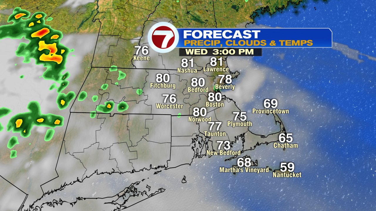
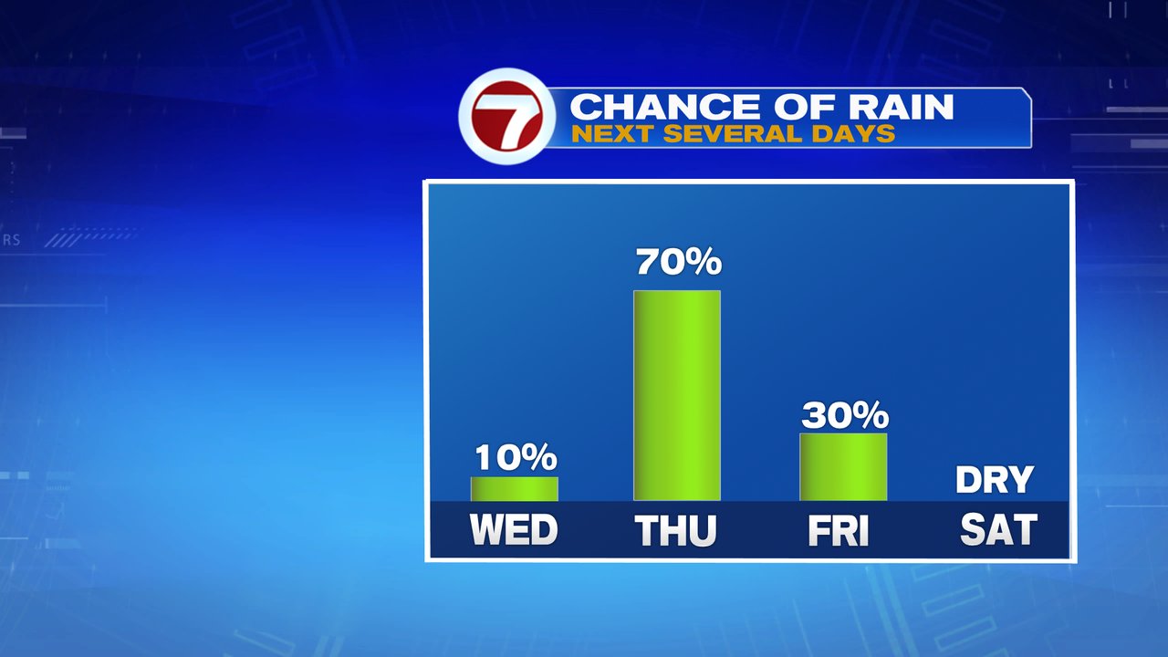
A comfy start yields to a warm afternoon with highs near 80 today. While a few spot showers pop up, much of the time is rain-free this afternoon and this evening.
Tomorrow, the pattern features higher humidity and higher instability as a few rounds of scattered showers and storms move through. While it won’t rain all day, it’ll be one of those days to keep the umbrella handy in case you catch a passing shower or storm when you’re out and about. The coverage area of showers and storms is lower Friday, but a few leftover ones are possible.
Beyond that, we dry out and heat up. Temps top out in the mid to high 80s Saturday, lower 90s Sunday and stay there early next week. 3 days in a row of 90+ is a heat wave, and for many towns and cities, the first heat wave of the year starts Sunday as Monday and Tuesday also feature high heat. With the heat, comes the humidity with dew points in the 60s to near 70 then too. That means some warm overnights and A/C on full blast type pattern.