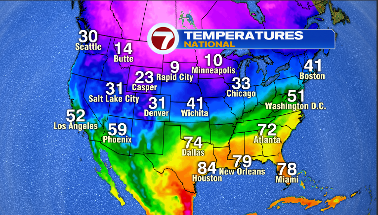
When you take a look at the national temperature map, it sure does have a classic La Nina signal….very warm temps in the southeast and very cold temps across the high plains and northern Rocky mountain states…
The jet stream is shaped like this…
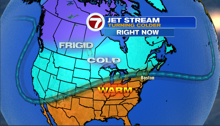
..and that is a classic look for a La Nina winter. I talked about the La Nina winter back in November for my Winter Outlook and sure enough, that is the current pattern. A tough go for snow lovers and for folks who make a living off of the snow but even within a La Nina winter, you can get bouts of cold and snow. Nothing imminent but some of the long range models suggest colder/snowier pattern developing in a week or two. We shall see.
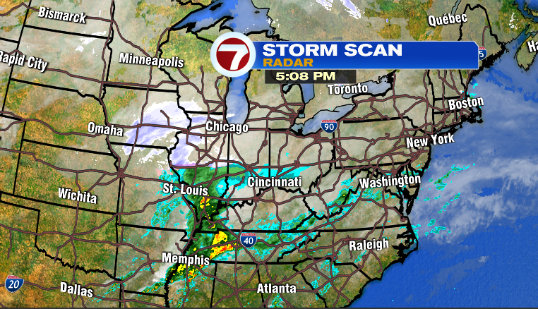
Thankfully, for those of us who have travel plans as well as plans to be outside the next few days and evenings, no signs of arctic air or snowstorms. Even though the pattern is mild, it is busy. Our next storm is taking shape in the lower Mississippi River valley this evening, as seen on this map…
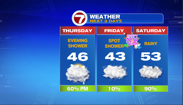
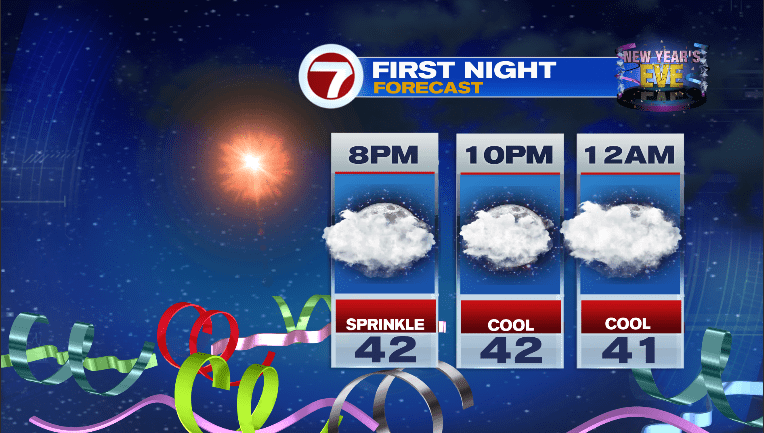
That storm will begin to head for New England and bring some light rain showers Thursday evening. Another storm will bring more rain for the first weekend of the new year but I think we’ll get some dry weather in here perfectly placed in the late Friday afternoon-Friday timeframe for First Night revelers. Here is the 3-day forecast as well as your New Year’s eve forecast…
Be safe and have fun!
~JR