As we approach the 4th of July holiday weekend, we’ll see increasing clouds and a slight cool down.
Before we dive into the holiday, let’s talk about the rest of your Thursday evening. We saw highs surge into the upper 80s to near 90 inland, low 80s at the coast including Boston due to an onshore breeze out of the southeast.
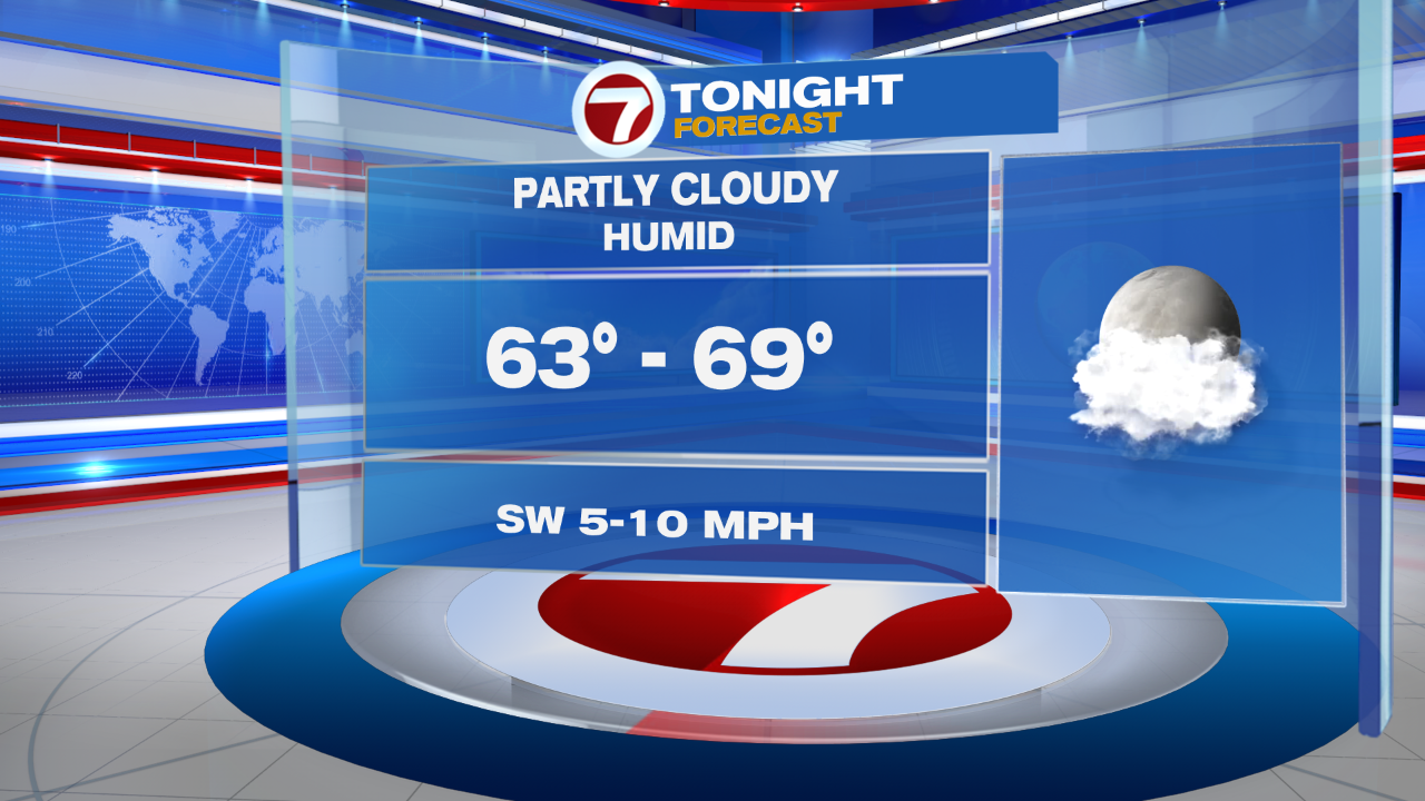
Aside from a spot downpour/thunderstorm, we’re looking at a muggy evening. Tonight, temperatures only simmer into the 60s under partly cloudy skies.
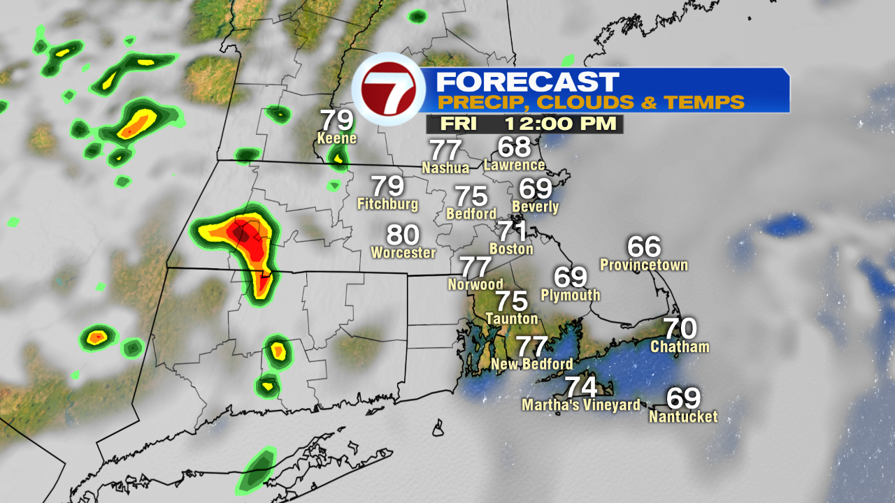
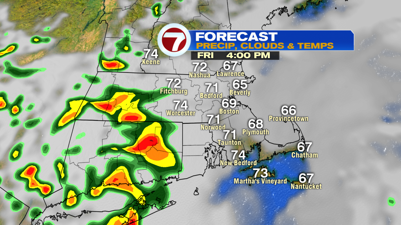
Friday starts with some sunny breaks, then clouds build in through the late morning and continue to linger. Some downpours and thunderstorms are likely for western MA, southern VT and as far east as central MA, but most remain dry especially east of 495 for Friday.

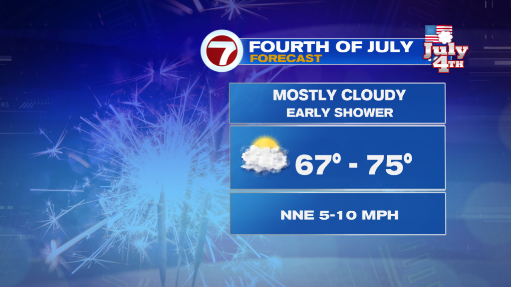
For the 4th of July, we’ll start off with clouds and some patchy fog (especially at the coast) with a few sprinkles, before some partial clearing by late morning and into the afternoon.

Highs on Independence Day will be slightly cooler than previous years (and below normal) with temperatures only warming up into the low to mid 70s.

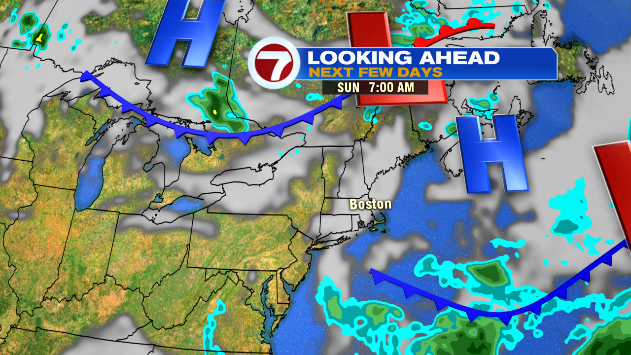
Sunday brings partly cloudy skies with a spot shower chance into the afternoon inland, and warmer with highs into the low to mid 80s.

We continue the warming trend into next week, along with rain chances, but no washouts in the near future.
