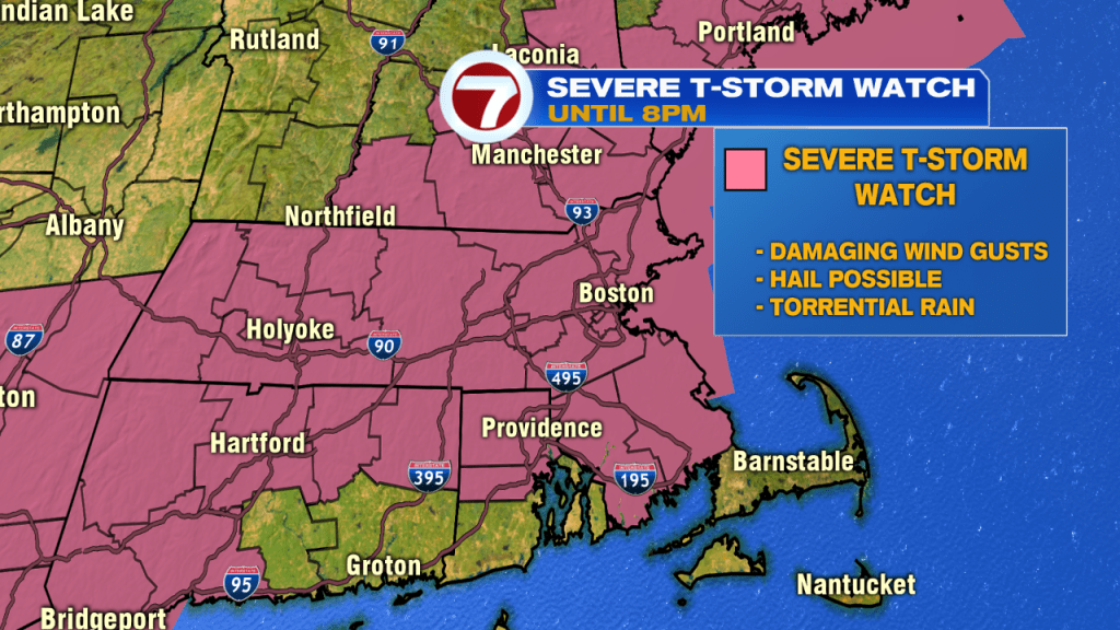
The severe thunderstorm threat sticks around through 8PM as a Severe Thunderstorm Watch remains in effect until 8PM for most of the viewing area (aside from the Cape and Islands).
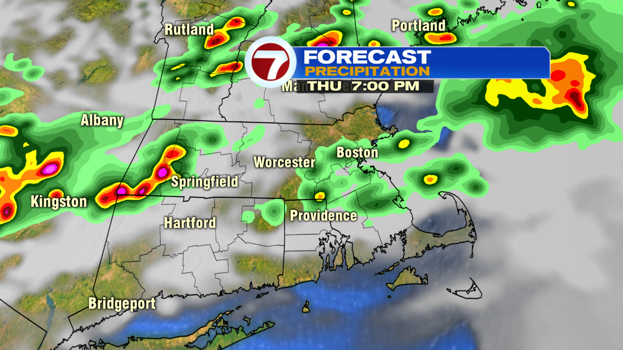
Tonight, with a few lingering downpours and showers moving out, we’ll see mainly cloudy skies with lows into the upper 60s to low 70s. You’ll notice a dip in the humidity into Friday morning.

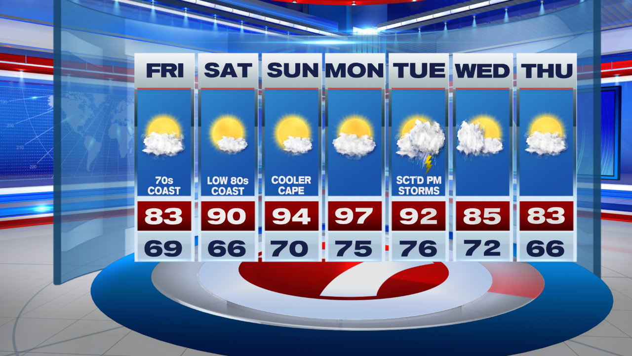
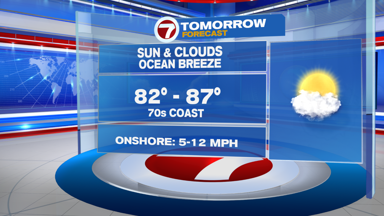
Friday features highs into the low to mid 80s with an onshore breeze that will keep temperatures into the 70s at the coast tomorrow afternoon under a mix of sun and clouds.
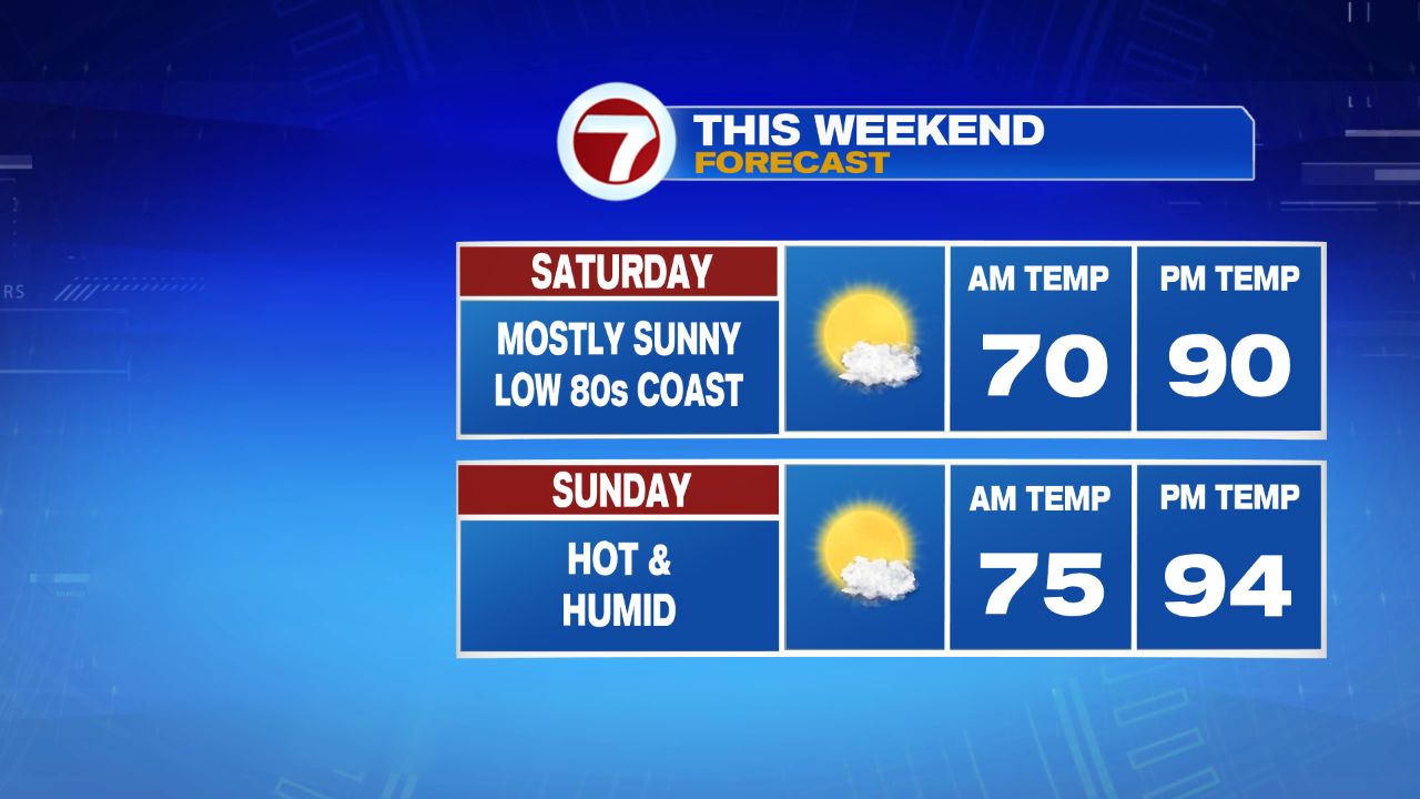
The weekend brings the return the 90s with Saturday reaching highs around 90 inland, low 80s at the coast, while Sunday brings the low 90s for most of the area (away from the South Coast and the Cape and Islands since we’re tracking the winds out of the southwest for the second half of the weekend).
The 90s stick around into the following work week with the extreme heat peaking on Monday with highs into the upper 90s. Tuesday also features highs into the low 90s, which could make for another heat wave after our last one last weekend and into earlier this week. We drop to near seasonable by midweek due to scattered storms Tuesday afternoon that are sparked off by a cold front.