We saw quite a few strong to severe thunderstorms, with the strongest gusts felt along the South Coast and the Cape and Islands earlier this afternoon.
We dry out through this evening (even seeing some sunshine ahead of the sunset at 7:20PM). However, it will be windy.
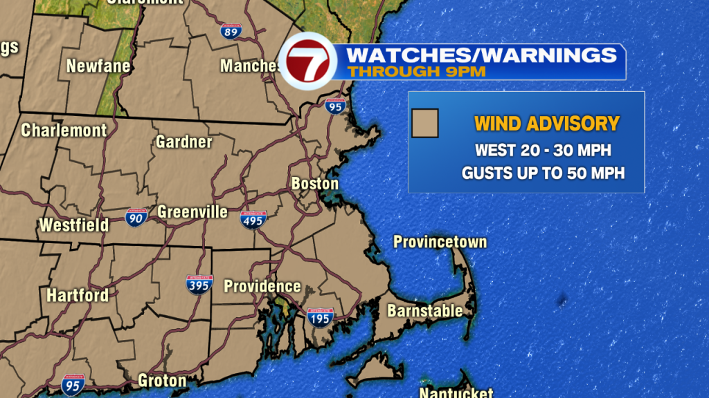
A Wind Advisory remains in effect through 9PM tonight due to gusts up to 50 MPH out of the west as the system departs to our north.

Tonight, we’ll see a partial clearing of the skies and temperatures will nose dive into the mid to upper 30s into early Friday morning.

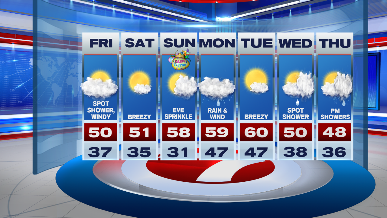
By Friday afternoon, we’ll see increasing clouds and a spotty shower with highs around 50. It will still be windy.

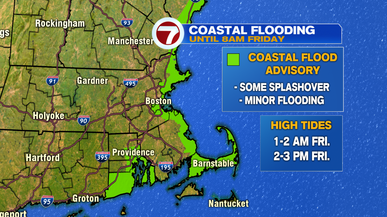
Speaking of Friday, a Coastal Flood Advisory remains in effect around the highs tides overnight tonight and tomorrow afternoon for pockets of splashover and some minor flooding due to astronomical high tides.
For the holiday weekend, Saturday is bright and breezy with highs into the low 50s (which is seasonable). Easter Sunday brings some sun in the morning with increasing clouds through the afternoon and evening ahead of our next system. A few sprinkles possible Sunday evening, but overall remaining dry for your daytime hours for any Easter Egg Hunts you are planning in your own backyard (again, remember social distancing).

It will be a wet and windy start to the week, but by Tuesday, drier and warmer conditions slide in with highs around 60. Then, temperatures slide around 50 by Wednesday and Thursday with a chance for some showers.