A nor’easter expected to last through Friday has started battering parts of Massachusetts with whipping winds and heavy rain.
Light rain began moving into the Bay State on Wednesday morning, with the storm gathering intensity throughout the day.
Periods of prolonged, heavy rain and strong wind will continue throughout Thursday and Friday.
RELATED: Heavy rain, strong winds accompany Bay State’s first nor’easter of the season
Along the south coast, the winds could be seen creating white caps in the water.
“This is a long-duration storm,” Marshfield Police Chief Phil Tavares said. “What we are really concerned about with the high winds and the rains is trees coming down and power outages with lines coming down.”
Fisherman Russ Johnson says the winds are “blowing pretty hard.”
“The waves from my truck, they look like they were about three feet high; then you get out there and they’re four or five feet high. So, a little deceptive,” he said.
Gusts are expected to reach up to 60 mph on the Cape and the Islands, with Southeastern Massachusetts seeing gusts of up to 50 mph.
High wind warnings docked ferries to both Martha’s Vinyard and Nantucket for the day and maybe into Friday as well.
Heavy rain began moving into the Bay State on Thursday morning.
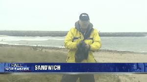
Sandwich Harbormaster Mick Dunning is watching the boats, the water and the whipping winds.
“Anything over 35 [miles per hour] is when I will keep an extra eye out there,” Dunning said.
Residents could experience some flooding, with up to three inches of rain possible in Southeastern Massachusetts.
Several people could be seen taking in the intense views of the storm
Officials are warning those people to use extra caution.
The Coast Guard used the weather to practice searching for a man overboard in the high swells.
When the weather gets rough, the tough go training! Here’s what it looks like approaching a man overboard in heavy winds and seas off #Nantucket this evening during a #Noreaster. #SemperParatus pic.twitter.com/YI54qQqYwI
— USCG Sta Brant Point (@BrantPointCG) October 10, 2019
For more, visit the 7Weather page.
(Copyright (c) 2024 Sunbeam Television. All Rights Reserved. This material may not be published, broadcast, rewritten, or redistributed.)