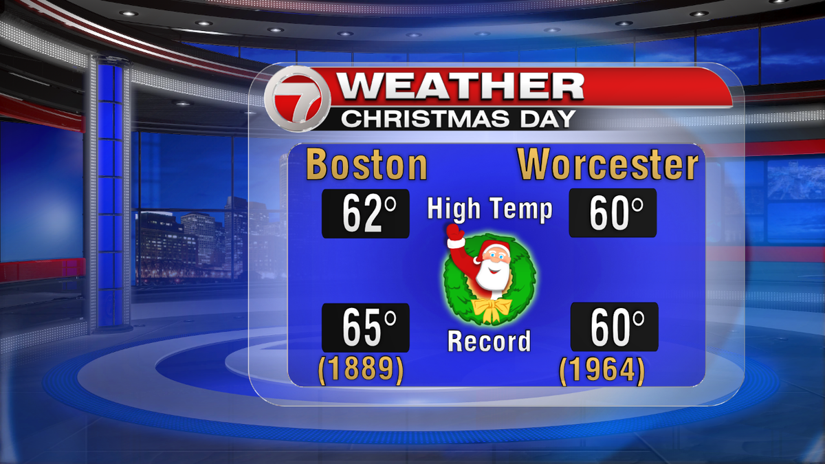
Did you get outside to enjoy our spring-like weather today? It didn’t feel like Christmas at all! However, we weren’t smashing records today like we did yesterday. A new record high was set for Providence (64° beats the old record of 63° from last year). Worcester tied the record from 1964 of 60°. Boston topped out at 62° which fell short of the 65° record high set back in 1889. There is this, though: Boston has only recorded 3 previous Christmases at 60° or above. Today makes #4!! There have now been 4 times Christmas has been 60° or above! Incredible. Took a walk in the park, and it was PERFECT #IMHO!
Some evening showers are possible across the South Coast, Cape and islands – but they won’t last for very long. Remember, that full "Cold" moon is tonight! This is our first full moon on Christmas since 1977, and it won’t happen again until 2034. Some of us will get to enjoy "nature’s flashlight" tonight. Temps are fairly mild as well; mid 30s to mid 40s.
Saturday will be the "coolest" day of the weekend (but only relatively speaking). Most areas will top out around 50° tomorrow. So, while it’s not a beach day like the last couple of days have been, it’s still a "walk in the park" kind of day. The day will be dry until after the sun goes down, and then we have another chance for rain. No snow with this one, as we get another boost in temps on Sunday – near 60° once again! But this sets the stage for a HUGE shock as we move into Monday. Temps will plummet to kick off the work week, and the mid 30s we’re in store for on Monday may hurt a little!
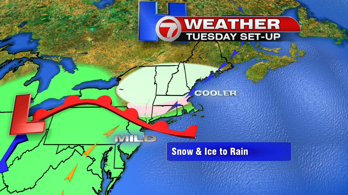
Tuesday is the big "elephant in the room" on the extended forecast. A SNOWFLAKE?! WHAT IS THAT?! *insert dramatic gasp* Well, we’ve been watching this "arrival of winter" for a few days now. The cold is settling in for the start of the work week, and once it arrives it can sometimes be hard to kick out of here. So, with the cold air in place and a system moving in – When the two collide we should see snow. Timing is everything with this one – and I’m still not ready to pump out a snowfall forecast… Especially because recent model runs are trending warmer than previous runs. This would indicate that the day is more wet than white. We still need to watch it closely. I do think we can count on a messy commute for Tuesday morning. STAY TUNED.
Merry Christmas!! – Breezy