BOSTON (WHDH) - A winter storm watch has been expanded to cover much of Massachusetts ahead of nor’easter that is expected to bring heavy snow, strong wind gusts, coastal flooding, and blizzard conditions to New England this weekend.
Barnstable, Dukes, Essex, Norfolk, Plymouth, Bristol, Middlesex, Worcester, and Suffolk counties are all included in the storm watch.
REALTED: South Shore officials prepare for possible flooding ahead of powerful weekend storm
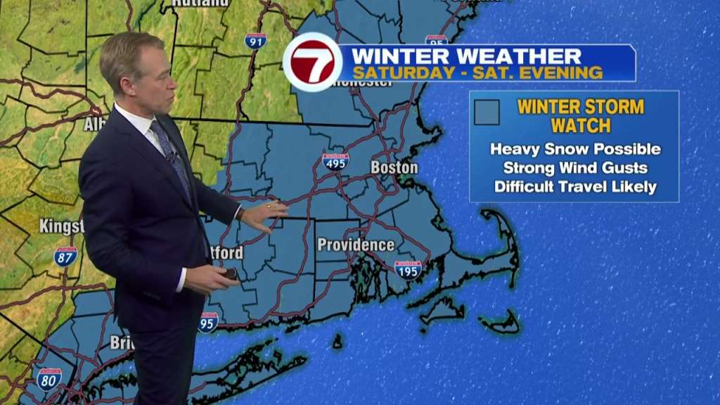
The storm watch is slated to take effect late Friday night and it will remain in place through Saturday evening.
The winter storm is expected to intensify as it moves up the East Coast late Friday night. Flakes will start flying in the Bay State early Saturday morning with snow and wind ramping up by midday.
“The snow intensity should rapidly increase through the morning into the early afternoon,” 7Weather Meteorologist Chris Lambert said. “For many of us, this isn’t a heavy, pasty snow. This is just more of a powdery snow that gets pushed around easier because it’s going to be cold.”
The highest risk for a foot of snow or more is across Eastern and Central Massachusetts, including the North Shore, Boston and Worcester. Total snow accumulations of up to 18 to 24 inches are possible in the South Shore, and South Coast.
The exact track of the storm will ultimately dictate which communities get the most snow and the axis of the heaviest snowfall may shift with later forecasts.
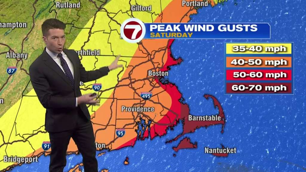
Winds are also slated to intensify by midday Saturday with more than 50 mph gusts expected at the coast and 60 to 70 mph gusts possible across Cape Cod and the Islands.
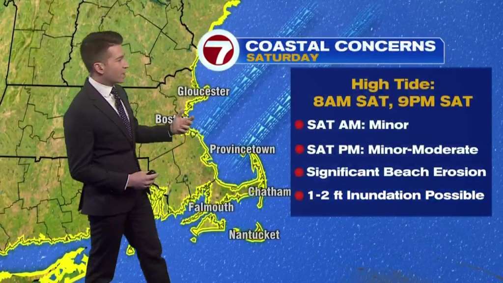
Beach erosion and minor to moderate coastal flooding are possible during high tide at 8 a.m. and 9 p.m. Saturday.
Cars and buildings may take on water in these areas.
RELATED:Storm preparations underway along Mass. coast as residents brace for nor’easter
Travel could be very difficult to impossible due to the flooding and strong winds could cause tree damage, the National Weather Service warned.
The storm is expected to wrap up overnight Saturday with dry conditions by daybreak on Sunday.
Frigid temperatures and subzero wind chills will grip the region on Thursday.
Visit the 7Weather page for the latest storm updates.
(Copyright (c) 2024 Sunbeam Television. All Rights Reserved. This material may not be published, broadcast, rewritten, or redistributed.)