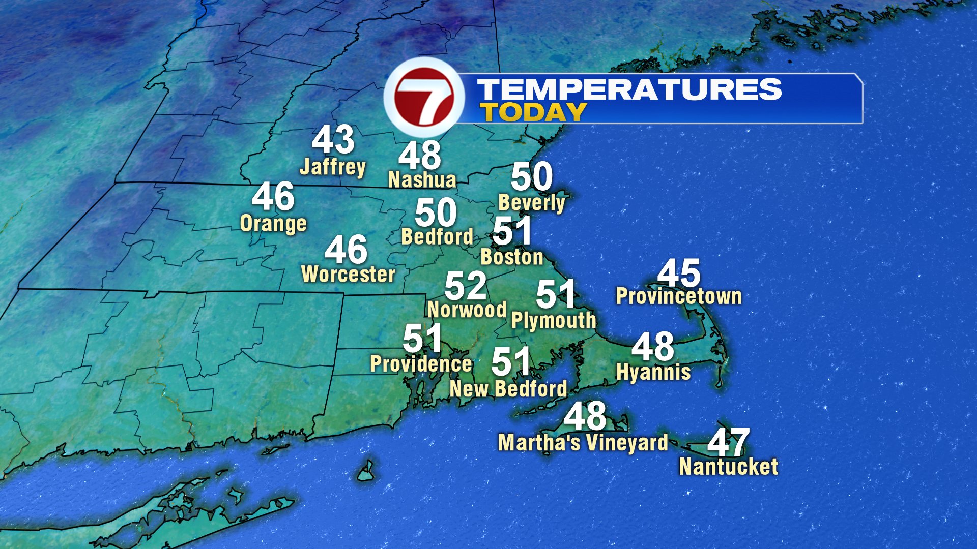
Soak it in folks. 50 degree weather with sunshine will be hard to come by over the next few weeks, so enjoy today if you get a chance to spend some time outside. With returning sunshine and a westerly breeze 8-15mph, it’ll be a pleasant winter day overall.
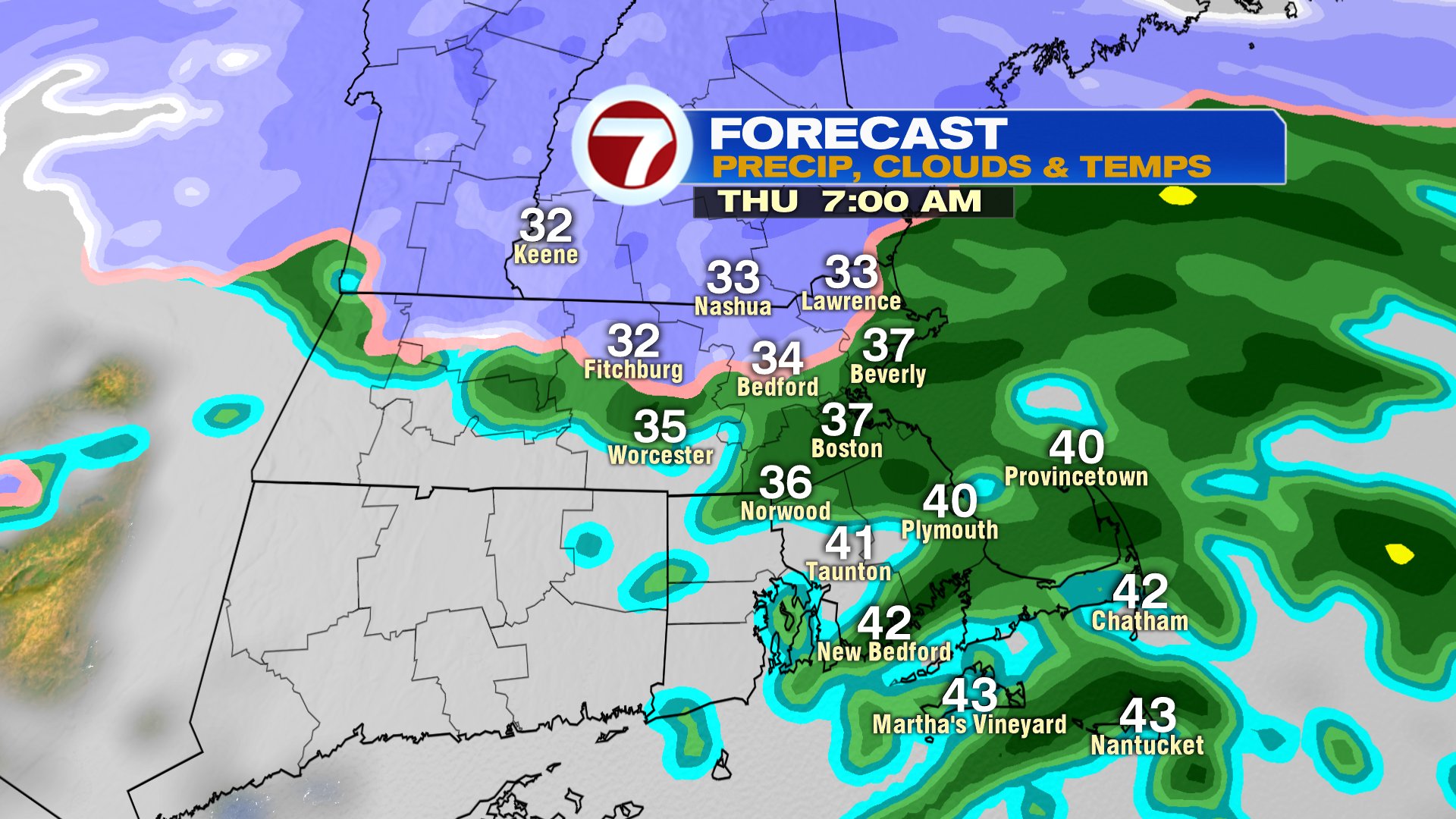
Changes start tonight with rain and snow moving in across the area from 2am to 8am tomorrow. Where temps run in the low 30s, and flakes mix in, expect a coating to an inch of snow across near and outside 495, especially in the northern Worcester Hills and southern NH. Rain and snow tapers off early tomorrow, however, a leftover passing rain or snow shower is possible midday. Gusty winds develop too, pushing past 40mph in the afternoon and at night.
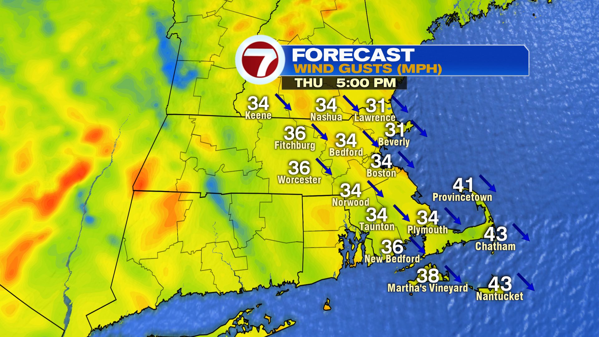
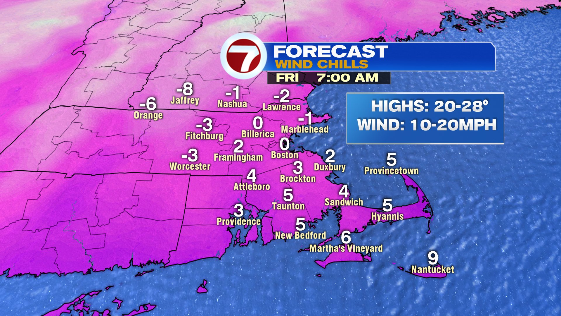
That wind will be transporting a lot of cold air overnight tomorrow, producing wind chills near 0 by Friday morning.
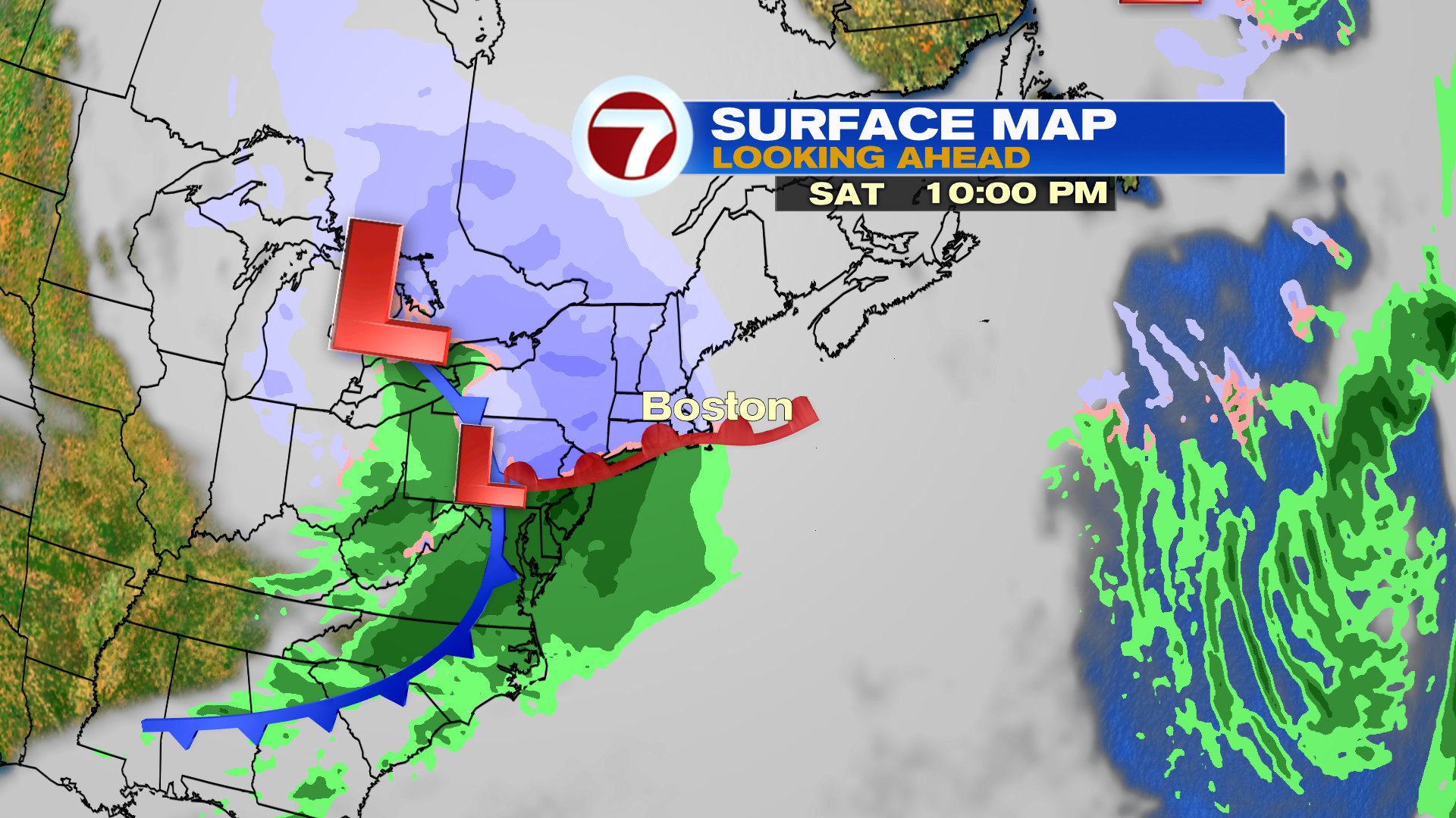
With the cold air entrenched across New England, initially our weekend storm starts as snow late Saturday afternoon, then flips to ice/rain in the evening. A quick couple of inches is possible around Boston before the change to rain, with the best chance for several inches (3-5″) near and northwest of 495. Ski Country will likely pick up 6″+. The numbers aren’t astronomical, but we’ll likely have several hours of slick travel from sunset through the evening on Saturday. The storm wraps up early Sunday morning, leaving the 2nd half of the weekend dry and windy. That wind once again is followed by a lot of cold air to start next week.