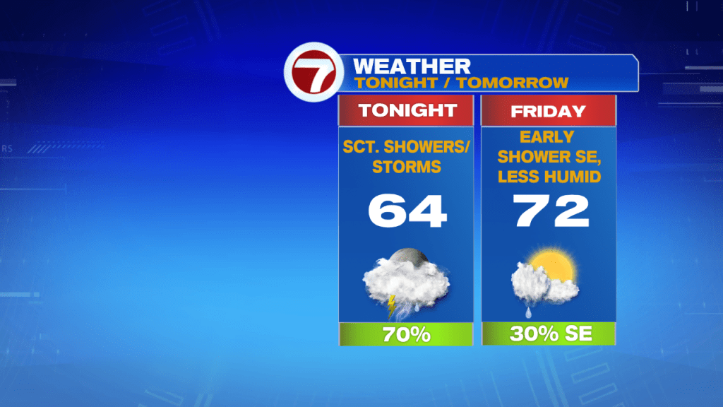
Expect some scattered showers with embedded downpours and thunder through your evening commute with the humidity sticking around through tonight. We finally see the relief from the humidity sweep through Friday the cold front pushes out the 70+ dewpoints.

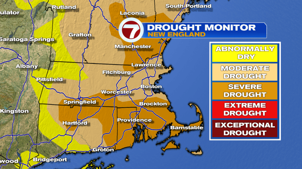
This evening’s scattered downpours are much needed rainfall since most of southern New England is still considered under a moderate drought, with 35% of MA and 28% of NH under a severe drought.
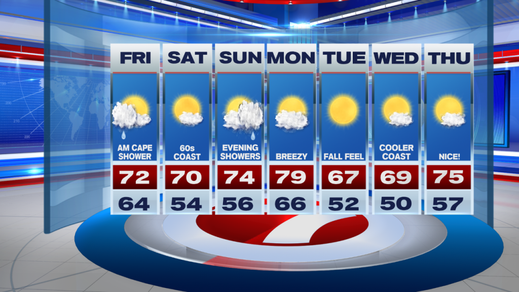
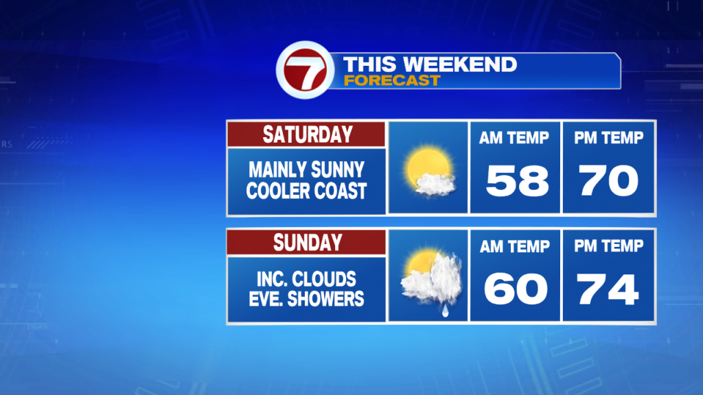
A few showers could linger into early Friday morning for the Cape and Islands, while patchy fog and some clouds will gradually clear inland to some sunshine for Friday midday.
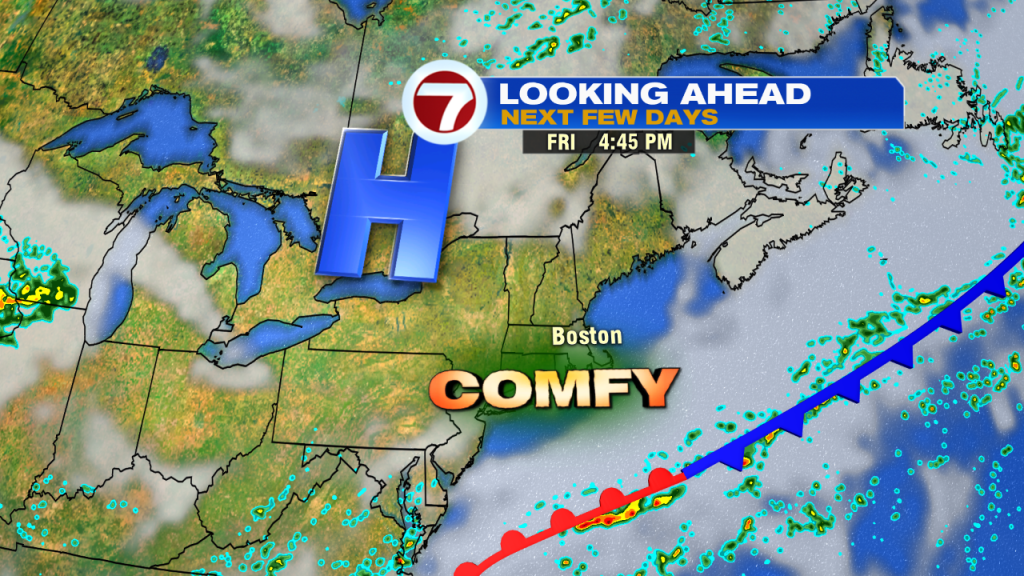
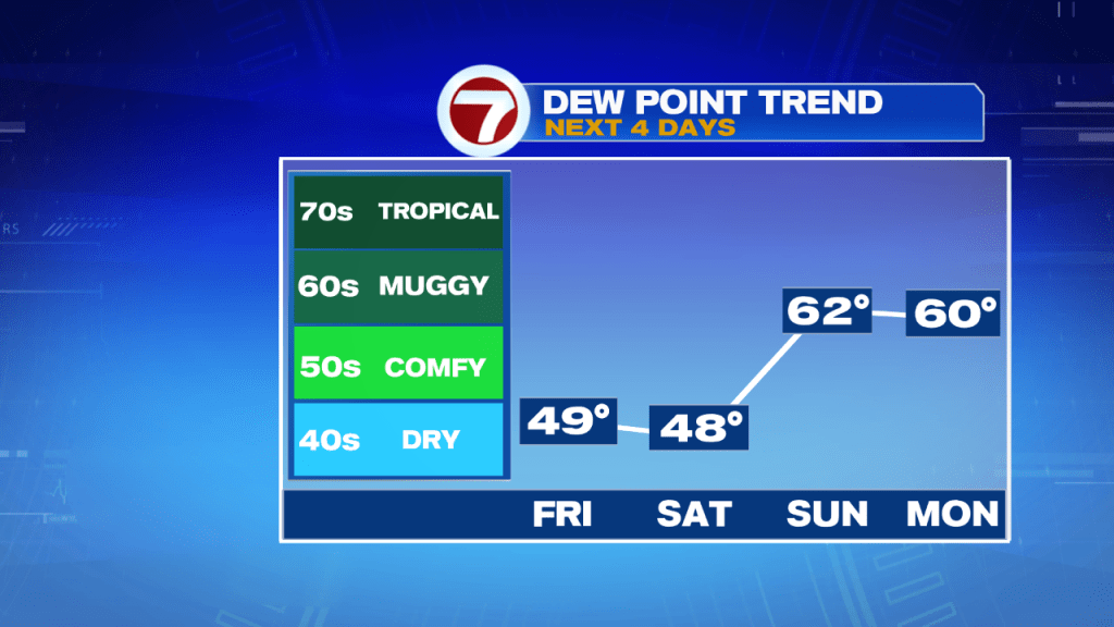
Dewpoints both Friday and Saturday will be in the upper 40s to low 50s, so quite the contrast to the high humidity we felt for our Thursday. Not only are we tracking lower humidity, but we are also tracking drier conditions moving for the first half of the weekend.
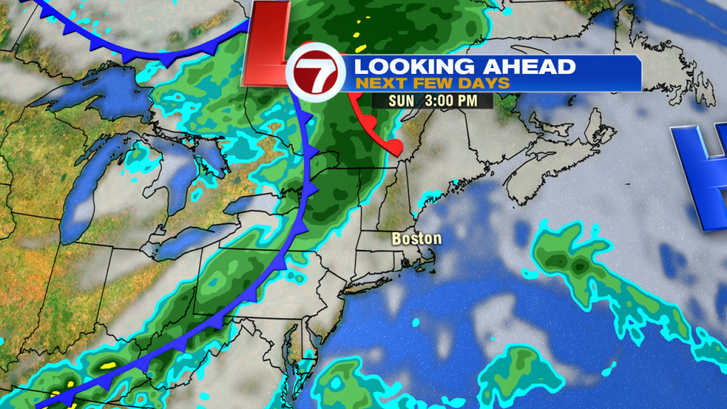
The next few days highs will be in the low 70s (slightly cooler at the coast both Friday and Saturday with an onshore breeze) under mostly sunny skies. Sunday features increasing cloud cover ahead of a cold front that will bring some showers by Sunday evening, but the bulk of the daytime hours will be dry Sunday.
Monday is the warmest day of the 7-day forecast under partly cloudy skies and highs near 80. Tuesday and Wednesday, highs only warm-up into the upper 60s and with lower humidity and mainly sunny skies, it will have more of a fall-feel. By the end of the 7-day, we’re back into the mid 70s.