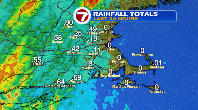
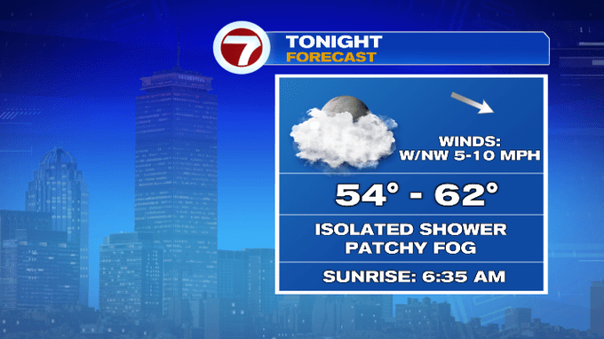
A cold front slowly traversed the region today, allowing for scattered showers with embedded downpours and thunderstorms to push through. A spot shower is possible this evening, otherwise it will be dry under mostly cloudy skies and some areas of patchy fog.
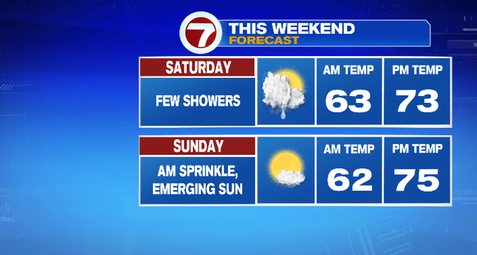
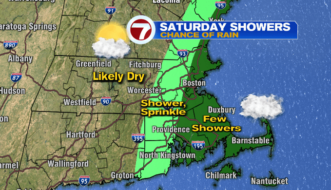
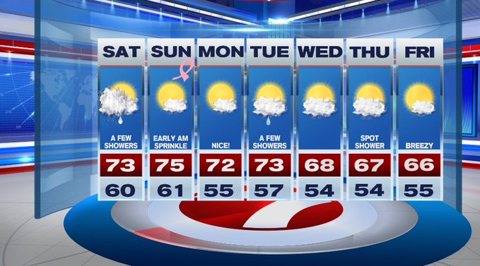
Tomorrow, we’ll see a few showers mainly east of 495 and for our coastal communities as the cold front today stalls just off the coast. It will not be a washout. Father inland will see mainly dry conditions and partial sunshine. Highs tomorrow will range in the upper 60s to low 70s.
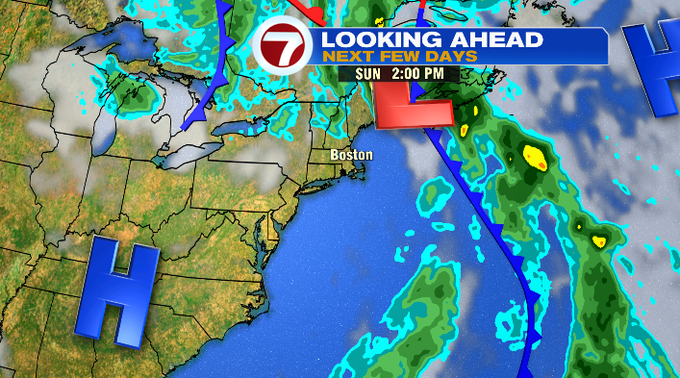
As the front meanders off the coast, we could still be dealing with lingering showers at the coast early Sunday morning before daybreak followed by emerging sunshine and comfortable dewpoints.
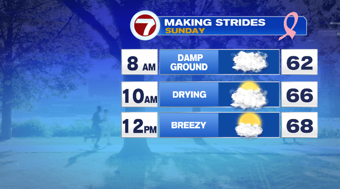
Sunday afternoon looks great for your outdoor plans. For the Making Strides Against Breast Cancer Walk on Sunday in Boston, the ground may be damp at the beginning, otherwise we’re tracking partly sunny skies and temperatures warming up through the 60s.
For the Patriots game at Gillette, temperatures will be in the low 70s under mostly sunny skies.

The nice weather from Sunday trickles into the start of the work week with Monday featuring low humidity and highs into the low 70s. Tuesday features a few showers while midweek brings a cool down with highs in the 60s to round out the week.
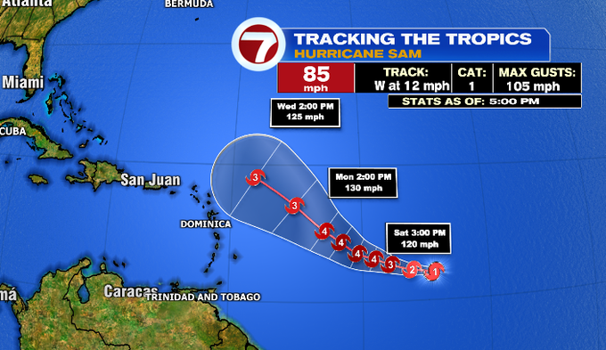
As for the tropics, Hurricane Sam will continue to strengthen over the next 12 to 24 hours, reaching major hurricane status (Cat. 3+) as early as tomorrow as it approaches the northern Leeward Islands.
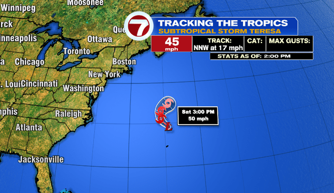
We also have our 19th named storm of the Atlantic Hurricane season, Subtropical Storm Teresa, which has formed just north of Bermuda. It is expected to be short-lived and dissipate over the western Atlantic north of Bermuda by Sunday.