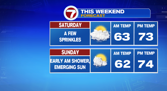
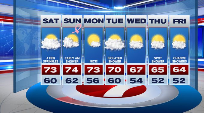
A cold front stalls just off to our east, allowing for the clouds and a few sprinkles for our coastal areas, SE MA and the Cape and Islands. Today will be far from a washout, but those along the South Shore, the Cape and Islands will be dodging a few showers through the day.


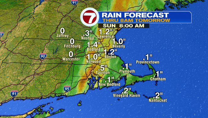
Tonight, after midnight, we see an influx of showers with embedded downpours and thunderstorms due to a low riding along that stalled front.
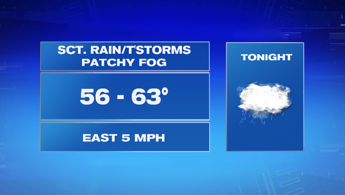
These will dump a quick inch of rainfall for eastern MA, with the heaviest rain from 3am to 6am.
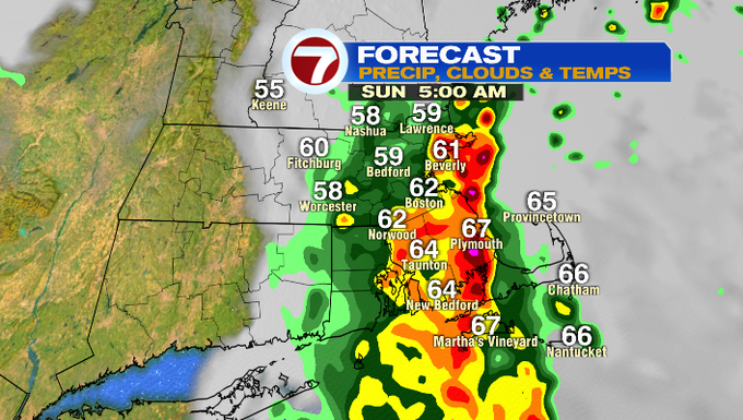
A few lighter lingering showers could be with us by 8am, but the bulk of the rain will have lifted out.

These downpours will dump at least an inch of rainfall for some locations.
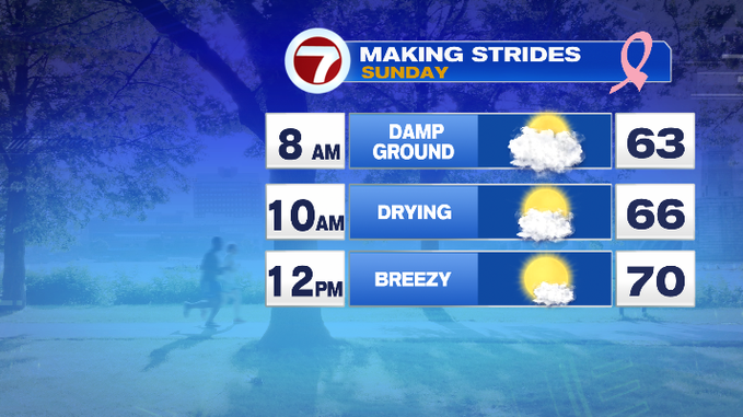
If you’re heading out to the Making Strides Against Breast Cancer Walk at the DCR Hatch Shell, the ground will likely be damp at the start of the event at 8am, but it should be dry with mainly cloudy skies giving way to emerging sunshine through the morning.
Behind the rain, the sunshine will emerge quickly and we’ll dry things out with highs into the low to mid 70s for your Sunday. It will be a beautiful and breezy Sunday afternoon — great weather for the Pats game, too.

The nice weather from Sunday trickles into Monday. Tuesday brings a few showers as a front passes through and then it turns fall like midweek as highs dip into the 60s and that sticks around through the end of the week.
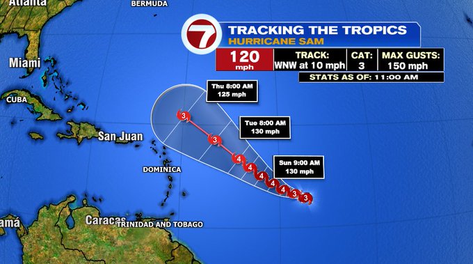
As for the tropics, Hurricane Sam strengthened to a Major Hurricane (Cat. 3+) as of the 11am update. It is forecast to move west-northwest through the weekend and for the first half of the week as it approaches and passes just to the north of the Leeward Islands. Forecast models keep the storm out to sea, but we’ll continue to monitor into next weekend for the latest track and the possible swells we could see along our coast.