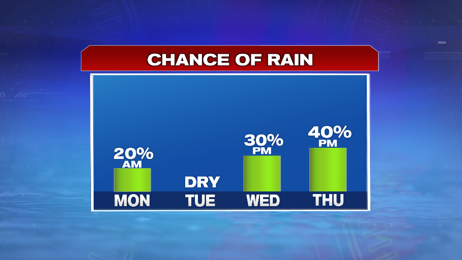
A cold front moves through tonight sparking up a few showers and storms. There could be one or two storms that are strong to severe with gusty winds being the main concern.
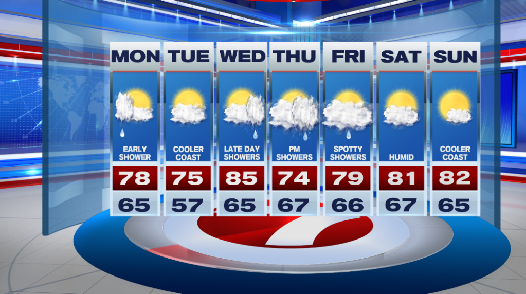
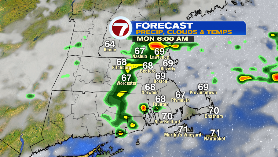
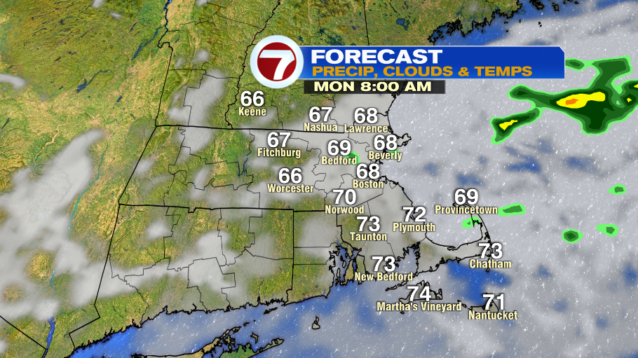
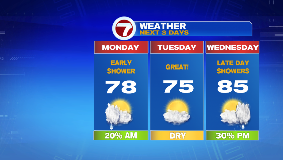
Some wet weather will linger into Monday morning. If you commute early between 5-6 AM, it is more likely that you will run into rain. Showers begin to move out between 6-8 AM. Skies gradually clear from there and humidity will also drop as we approach the afternoon. Temperatures start in the mid and upper 60s, and then highs hit into the upper 70s.

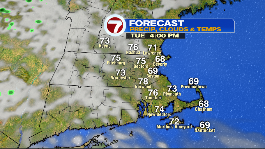
Tuesday starts sunny and refreshing. Lows are in the mid 50s early in the morning, and then we’re in the low 60s by 8AM. The afternoon has a mix of sun and clouds with temperatures in the mid 70s inland, and near 70º at the coast.

Humidity is on the rise again on Wednesday. A warm front lifts through the area early in the morning, bringing in muggy air. There will be a few hours of sun, but overall it is mainly cloudy. Highs reach into the mid 80s. A stalled front brings in showers north of the area. As it approaches us we could see a few late day showers Wednesday.
That stalled front is still around on Thursday and will likely produce rain Thursday afternoon. As of now Friday does not look like a washout with a spotty showers around the area throughout the day. It remains humid with highs in the upper 70s.