7Weather- A front moves through the area late on Wednesday, giving us the chance for a few afternoon storms, and it also drops humidity for the end of the week.
Like the last two nights, we have the chance to see areas of fog, and it is warm with temperatures in the upper 60s.
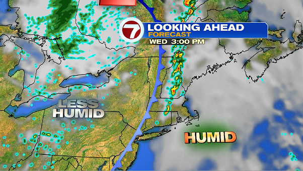
Wednesday will be humid with partly to mostly cloudy skies. Highs hit into the mid 80s early in the afternoon. There is a chance for a few storms between 2-6 PM ahead of a front. They will be hit or miss storms, everyone needs the rain, but only a few will get it.
The storms move into southern New Hampshire and Worcester County between 2-3 PM, and between 3-4 PM for Boston. They weaken as they get close to the coast, and should be out of the area around 6 PM. Skies gradually clear as we approach sunset and temperatures are in the low 80s. Humidity slowly drops overnight.


That front doesn’t drop temperatures too much, but it will drop humidity. We go from having tropical air on Wednesday, to comfortable air to end the week.

Thursday will have a mix of sun and clouds with highs in the mid and upper 80s. There is a slight chance for an isolated storm around sunset. Friday starts a bit muggy, but then it feels comfortable the rest of the day. Skies are mostly sunny and temperatures are in the upper 80s.
