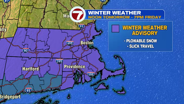
A Winter Weather Advisory has been issued for the Bay State ahead of our next round of snow that swings in Thursday afternoon and continues into Friday.
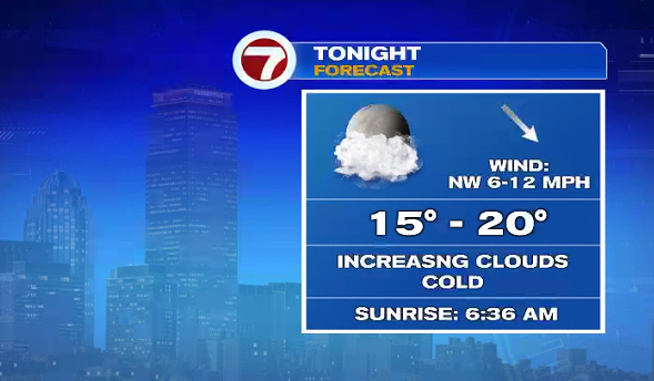
For your Wednesday night, we’ll see increasing cloud cover ahead of our next system.
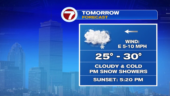
Tomorrow, we start off dry under cloudy skies, then the snow showers start off in the afternoon south of the Pike.
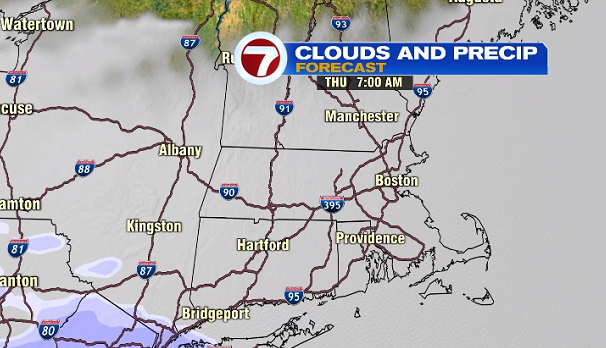
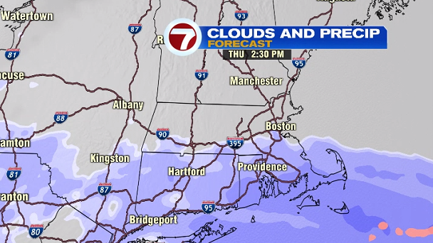
That first round of snow south of the Pike pushes out just before the evening commute followed by the main event with evening snow that fills in across the region later in the evening and continues through Friday.
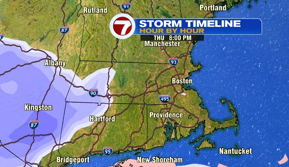
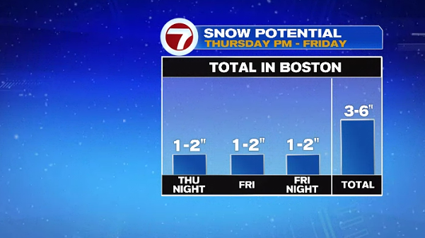
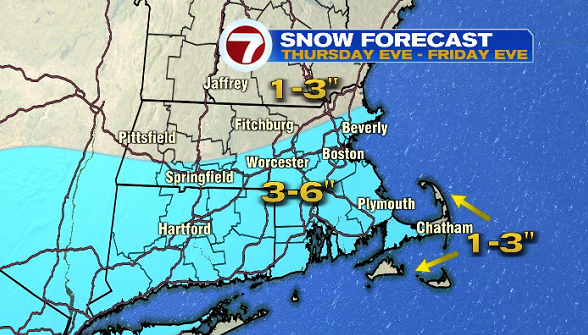
This is a prolonged system, dropping a plowable snowfall over a 30-hour period (so we are NOT looking at a significant snowfall with 1-2″ per hour snowfall rates; it’s more of a light snow over 2-days) with 3-6″ expected. Rather than 1-2″ per hour snowfall rates, we will see 1-2″ per 12-hour period for a snowfall total of 3-6″, slightly less amounts farther to the northwest and along the Outer Cape and Islands.
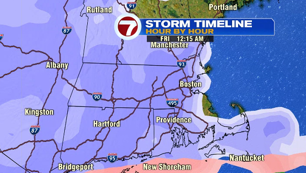
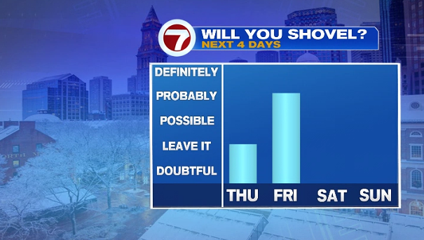
When will you need to shovel? Likely Friday morning or before any of your commutes.
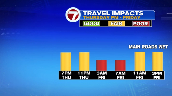
Speaking of commutes and traveling, the commute that will be the most impacted is the Friday morning commute with snow covered back roads and some slick roadways, too. Conditions improve by late morning and into Friday afternoon.
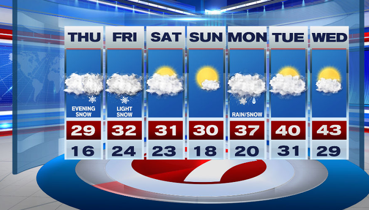
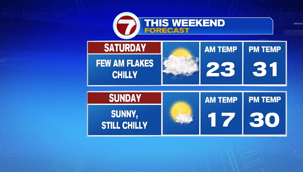
As the system pushes out of New England, a few lingering light snow showers are possible for eastern MA Saturday morning (especially closer to the coastline).
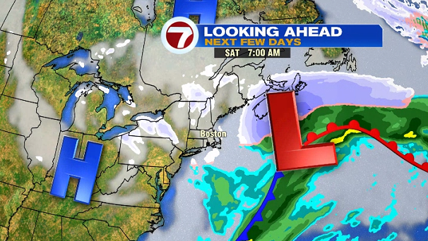
It will be chilly both weekend days with highs around 30°. Sunday will be the better of the two weekend days as we see the return of sunshine and dry conditions from start to finish.
Looking ahead to the next work week, we are greeted with a mix of rain/snow showers Monday, followed by drier and mild temperatures (above normal) for Tuesday & Wednesday.