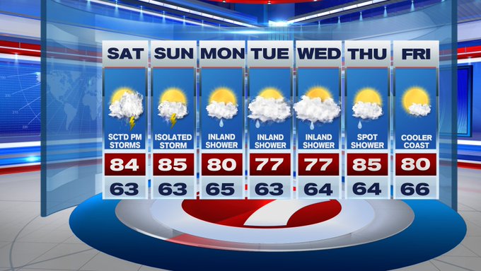
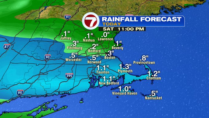
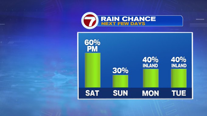
Yes, we’re tracking the return to thunderstorms both Saturday and Sunday afternoon, which is not the most ideal timing for your outdoor plans, however it is much needed rainfall. Both Boston and Worcester are over 2 inches below normal for the month so far, and it looks like today’s thunderstorms could put a dent in the deficit.


Today’s thunderstorm chances look to be more widespread compared to tomorrow’s pop-up spotty thunderstorm threat. Lets talk timing and location for this afternoon.
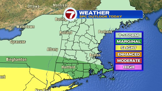
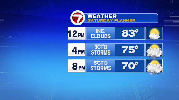
From 3PM to 8PM is the best chance for the thunderstorms, with some heavier downpours and a strong gusts mainly along and south of the Pike.
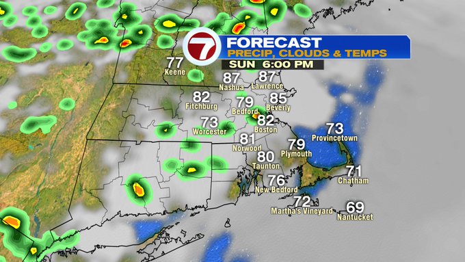
Plus, areas farther eastward, that’s you Cape and Islands, you’ll likely be in the clear until 6PM, so a good batch of beach time is still salvageable this afternoon.
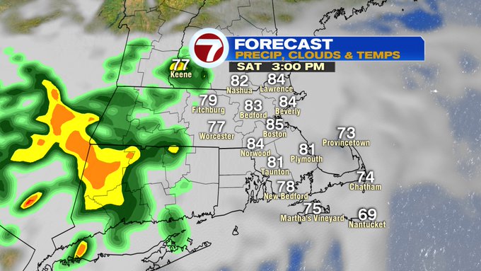
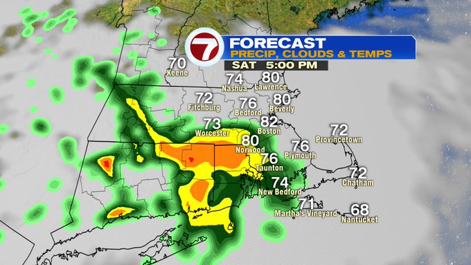

Areas along and south of the Pike could get a good drenching of rainfall under the heavier downpours with up to an inch of rainfall possible. North of the Pike those rainfall totals fall back to a tenth of an inch to a quarter of an inch.
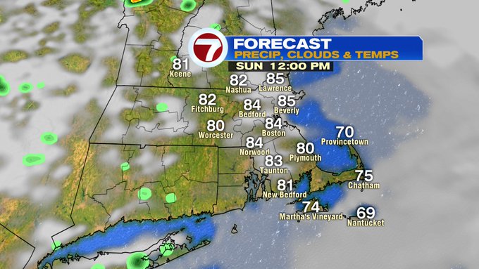
Tonight, the storm threat winds down by sunset (8:25PM), with muggy conditions sticking around and some areas of patchy fog lingering into early Sunday morning.
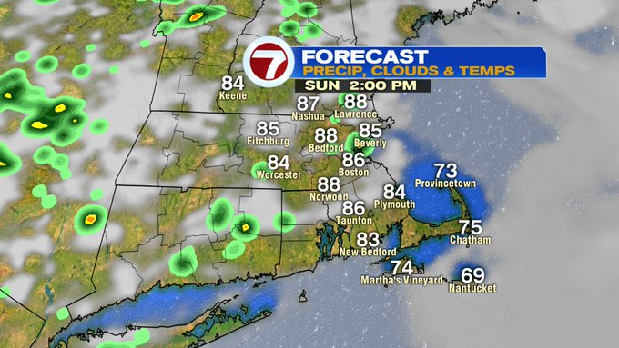
Another dry start tomorrow, followed by some pop-up thunderstorms developing by the afternoon. These will not be as widespread as Saturday and will be more hit or miss.

A few showers inland to kick off the work week and into midweek with a slight cool down Tuesday and Wednesday with highs into the upper 70s.
Drier conditions return by the end of the next work week.