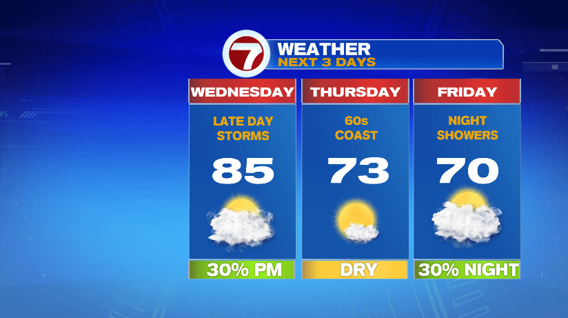
7Weather- A line of storms moves through the area Wednesday afternoon, and then Thursday is fall-like and dry. We then track Dorian late Friday into Saturday.
WEDNESDAY:
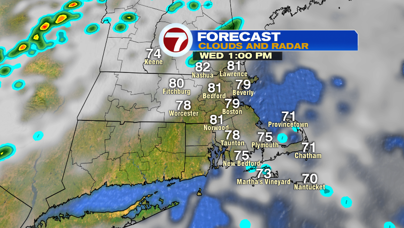
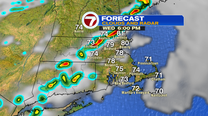
The day starts with patchy fog, and it is mild in the 60s. We hit our highs early in the afternoon between 80-85º.
A line of showers and storms moves in after 3 PM. The line moves into Southern NH and parts of Worcester County between 4-5 PM, and continues to move southeast.
There might be a delay for a lingering shower/storm at Fenway, but the storms move out quickly.
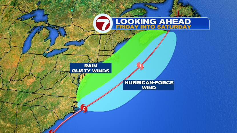
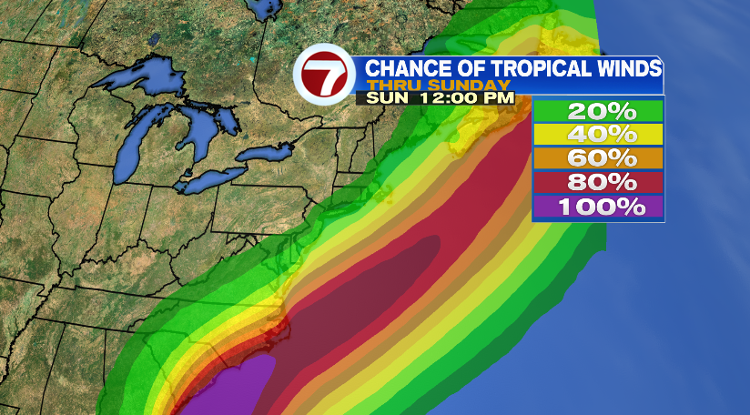
DORIAN:
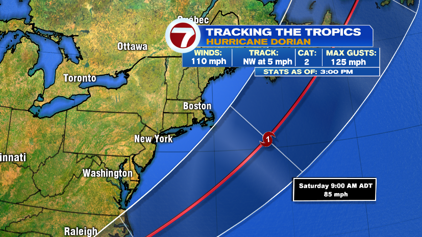
Dorian is forecast to be on the northern end of the coast of North Carolina on Friday morning. From there it will continue to move northeast.
The cone of uncertainty no longer includes Massachusetts, meaning the storm will be well off our coast.
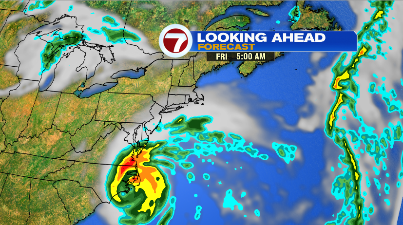
On the left side of the storm (area in green), there is a chance for rain and gusty winds, but it will really depend on the exact tract.
It will be a quick cut off. If its just a bit more out to sea than expected, then SE Mass, and the Cape & the Islands will just be breezy.
Regardless of the track, we will have rough surf (big waves), and dangerous rip currents.