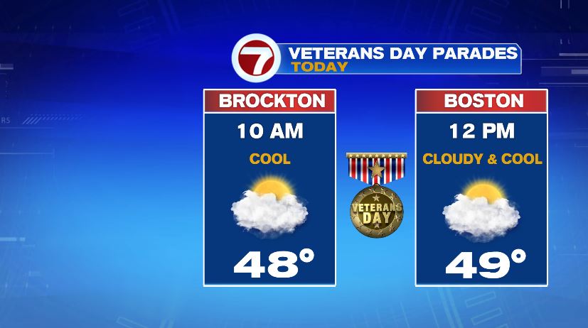
If you are lucky enough to have a 3 day weekend today, get out and enjoy the weather because this is as nice as it gets for the rest of the week. If you’re heading to a Veteran’s Day Parade grab a jacket with a hood just in case. I can’t rule out a stray sprinkle or shower but 95% of us for the day are dry. And the rain will be light and only last a few minutes — definitely not umbrella worthy.
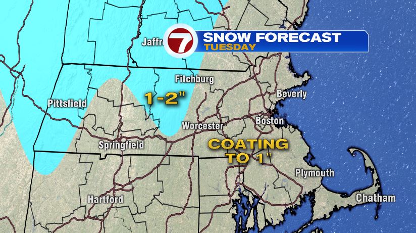
The bigger weather story is Tuesday and Wednesday. It’s almost a repeat of last Thursday and Friday where we had rain (with a few flakes) followed by cold and wind. Rain will move in mid morning Tuesday and transition over to snow by the afternoon. Temperatures will also plummet from the 50s to the 20s late in the evening. There is a little more snow with this one than last week, but it’s still not significant. The cold that follows is also a little more extreme than the last one.
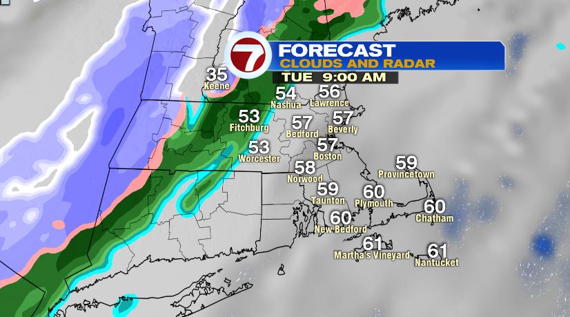
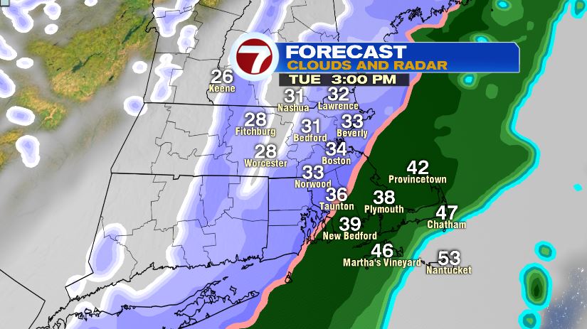
The ground temperatures are just too warm to support any accumulation on the roads. It’s definitely not a monster storm, but you could see a little accumulation on the grassy and elevated surfaces. Either way, it will be minimal. A coating to maybe an inch for most of us. Could see an isolated two inch report in the higher elevations.
The bigger story is again the cold air that follows. Wind chills Wednesday morning will be in the single digits! And we’ll only rebound to wind chills in the teens through much of the afternoon.

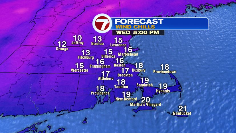
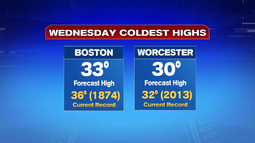
In fact, we’ll be in line to set records for coldest high temperatures on Wednesday for both Boston and Worcester.