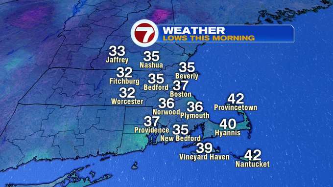
Not only was this morning cold, it was record-breaking cold for some, including Boston, which broke it’s previous record set back in 1882 of 38 degrees.
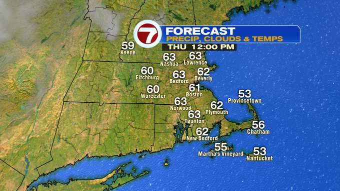
Temperatures rebounded nicely this afternoon with highs in the 50s to low 60s, with a breezy westerly wind through the day.
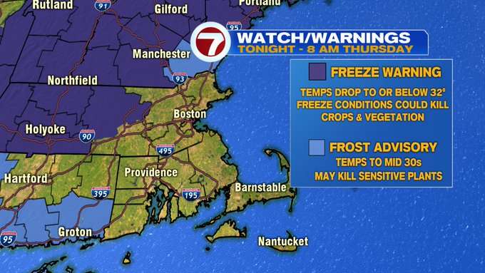
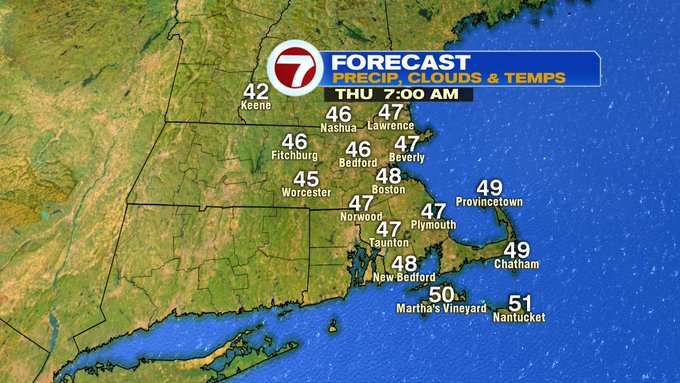
This evening, the wind will begin to weaken and skies will clear, allowing for temperatures to take a dive again overnight. A Freeze Warning has been issued for northern Worcester Co. and southern NH as temperatures will slip into the low 30s, while a Frost Advisory has been issued for the NH seacoast until 8AM Thursday.
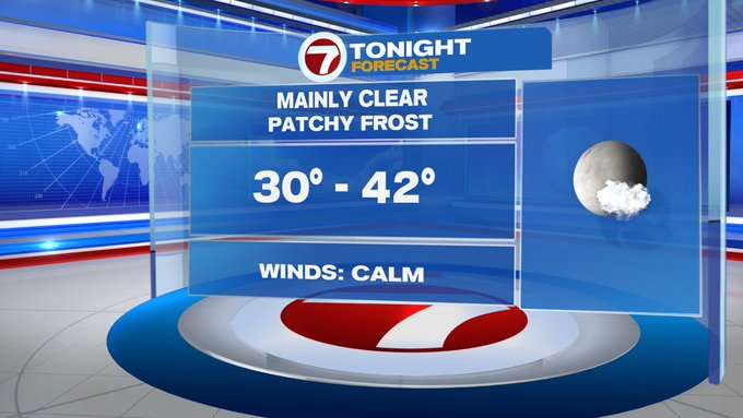
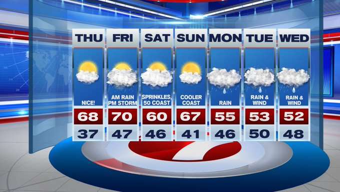
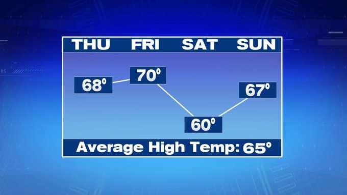
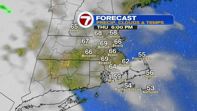
Similar to today, we will see a chilly start Thursday, but temperatures will rebound into upper 60s to low 70s (finally around seasonable high temperatures).
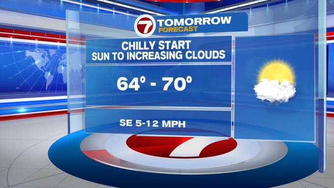
We will see increasing cloud cover through the late afternoon and into the evening ahead of the next system that will move in for Friday.
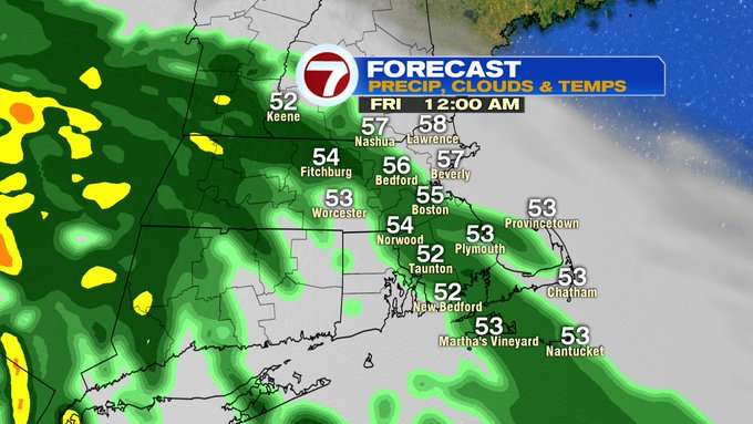
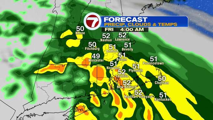
Showers become more widespread across the region after midnight early Friday. A few pockets of downpours between 4-6am, with the bulk of the rain out of here by 7am.
We do have some dry times on Friday before scattered thunderstorms stroll in by the afternoon.
Besides some drizzle early Saturday, the bulk of the weekend is dry with highs around 60 Saturday, upper 60s Sunday, with both days featuring slightly cooler conditions at the coast.
A cooler and wetter pattern to kick off the next work week with highs into the low to mid 50s.