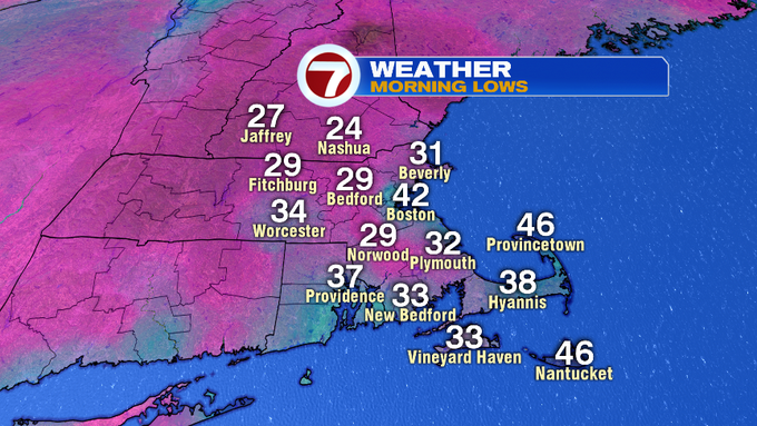
Very similar to yesterday morning, temperatures dove into the upper mid to upper 20s for the Merrimack Valley and even as far south as portions of SE MA dealt with the sub-freezing temperatures this morning, too.
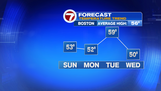
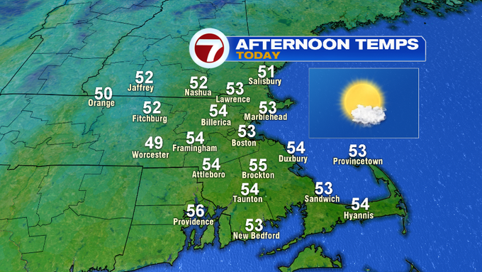
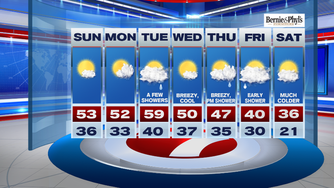
Now if you liked Saturday afternoon’s weather – you’re in luck. Today features much of the same, with slightly warmer temperatures with highs likely stretching into the low to mid 50s!
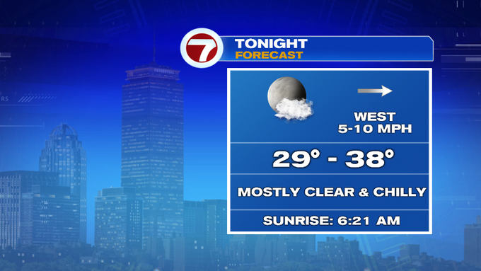
Tonight, under mainly clear skies (and with an earlier sunset…thanks Daylight Saving Time), temperatures will take a tumble through the overnight. Back into the upper 20s to upper 30s across the region.
Monday – we start off sunny – followed by increasing cloud cover into the latter half of the afternoon, with highs into the upper 40s to low 50s.
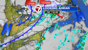
Tuesday is our next best chance of showers, with these being scattered across the region ahead of our next cold front.
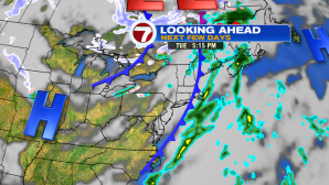
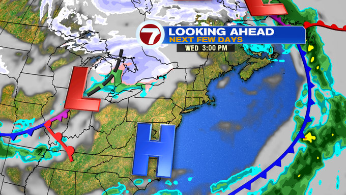
This front traverses the region late Tuesday, ushering in a slight cool down for Wednesday, but at least we see the return to sunshine after a cloudy day on Tuesday.


Now, we have another chance for showers later Thursday into Friday, and with rollercoaster temperatures, too – we do see the possibility of our first snowflakes possible into early Friday.
There is still uncertainty with timing and placement of the snow vs. rain, so be sure to check back often to the weather blog and stay up to date with the very latest on the air on 7News into the work week. High certainty of the bitter cold temperatures – taste of winter – by next Saturday with highs only into the mid 30s!
And on that note…I leave you with this: