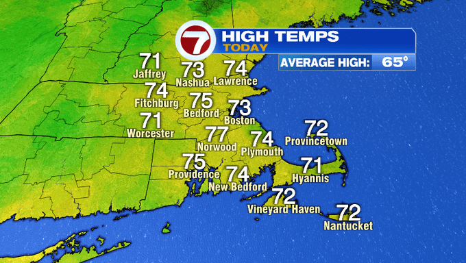
It was a nice fall day today as temperatures rebounded into the low 70s after starting off in the 40s to 50s earlier this morning.
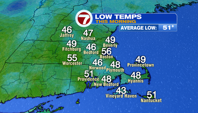
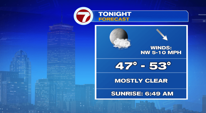
Similar to earlier this morning, our overnight temperatures will take a dip into the upper 40s inland, 50s closer to the coast and the city.
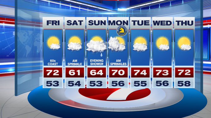
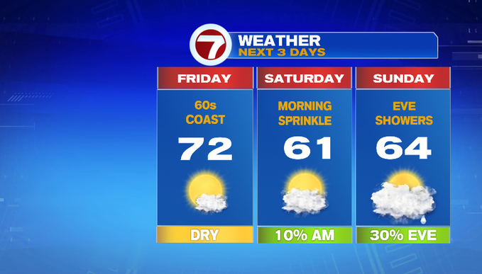
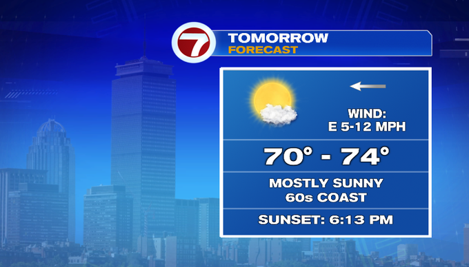
Friday brings the sunshine and highs into the low 70s inland, 60s at the coast due to an onshore breeze that will develop late morning and into the afternoon.
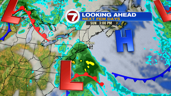
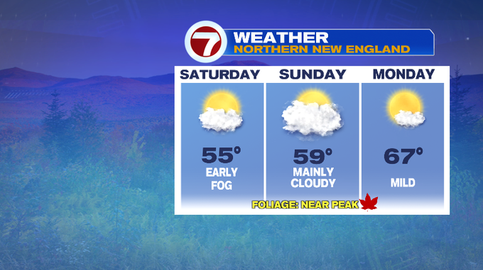
This weekend turns a bit cooler with highs in the 60s.
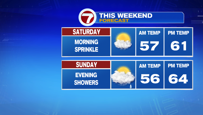
Saturday brings a mix of sun and clouds and with an onshore flow, could pop up a few sprinkles in the morning. Sunday is mainly cloudy with showers holding off until the evening as a system churns to our south.
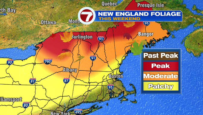
It’s a holiday weekend so if you’re planning a trip up north to check out the fall foliage, here’s a look at the forecast for northern New England (and don’t forget to take a ton of photos of the foliage and share them with us on social media!)
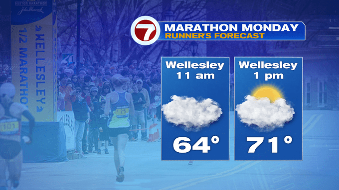
Speaking of the holiday weekend, for Marathon Monday, we do have a chance for a few lingering sprinkles in the morning and then we’ll have clouds starting to depart into the afternoon.


High pressure returns through the middle of the next work week providing us with quiet weather with highs in the low to mid 70s.