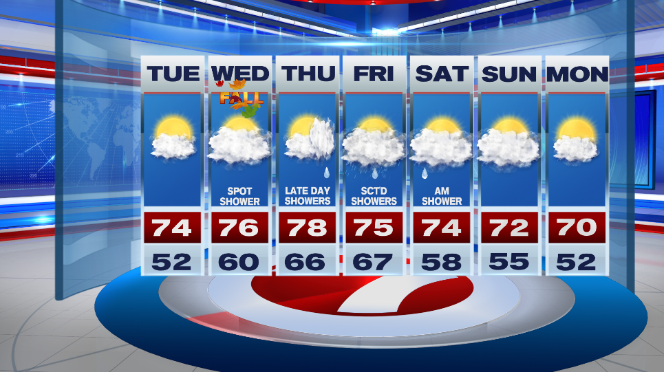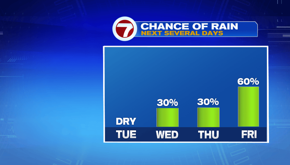
The great weather continues into tomorrow, and then clouds move in mid-week. Rain chances increase as we go into Friday.
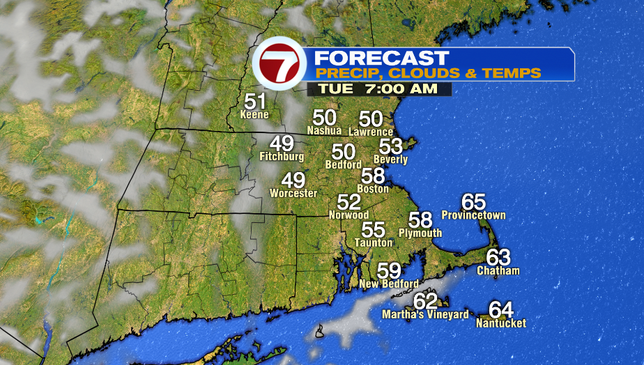
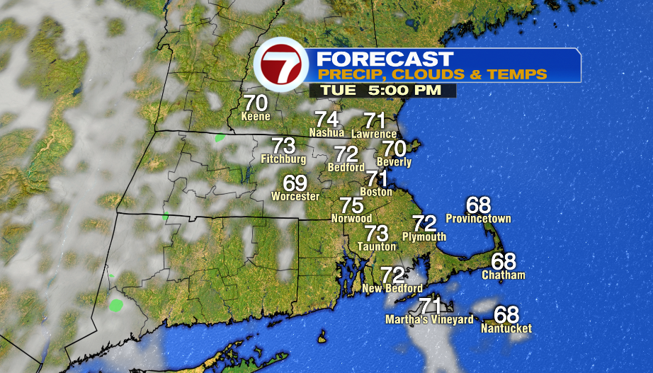
It is another cool, crisp start to the day tomorrow with temperatures between the upper 40s and mid 50s. The afternoon will have a mix of sun and clouds with highs in the low and mid 70s.
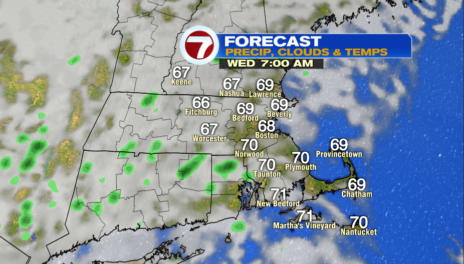
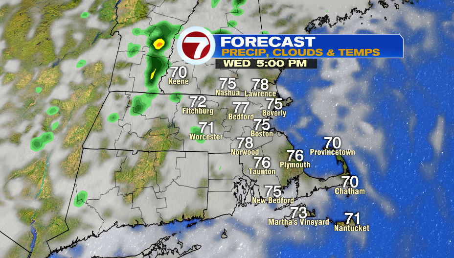
It won’t be as cool Wednesday morning with temperatures in the mid and upper 60s. There will be lots of clouds around and there will be a spot shower here and there throughout the day. Highs reach into the mid and upper 70s. It might start to feel a bit muggy by the end of the day.
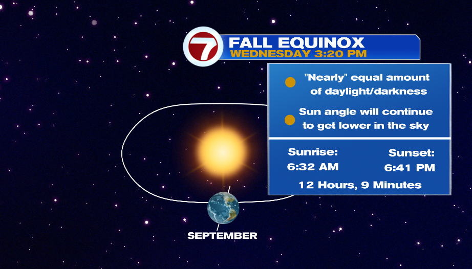
Wednesday is the first day of fall! The fall equinox means we have nearly equal amount of daylight and darkness. From here on out the sun angle will get lower and lower in the sky. Wednesday has 12 hours and 9 minutes of daylight.
Rain approaches the area late on Thursday. We could see a few light showers late in the day with the bulk of the rain arriving on Friday. Expect a wet end to the week with scattered showers on Friday.
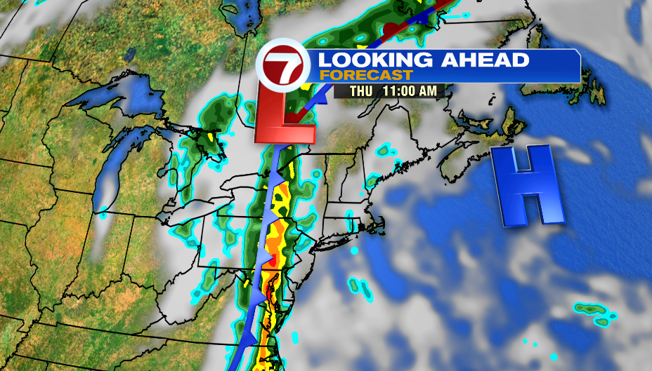
This system moves by very slowly, and it also looks like it’s falling apart as is gets closer to us. There could be a lingering morning shower on Saturday as it continues it continues to move out. Sunday still looks mainly cloudy with highs in the low 70s.