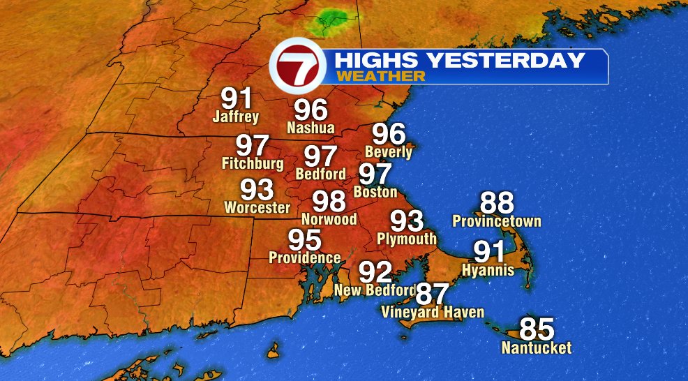
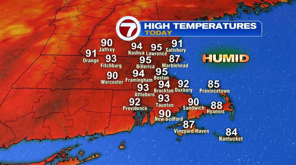
Heat wave number two is officially in the books, but the heat isn’t ending any time soon. Several days of 90+ degree temperatures are yet to come. Yesterday’s high temperature in Boston hit 97° which tied a record for the daily high temperature.
Regardless of the heat still to come, it’s officially our 2nd heat wave of the year/season for Boston. That part of the heat isn’t surprising, we average two heat waves every summer in Boston. Perhaps what a little more uncommon is the stretches of days within the heat wave, well surpassing the required three to achieve a heat wave.

In July, we had seven consecutive days of 90+ temperatures and this one is going to give that a run for its money… at least inland. Boston snuck in one sea breeze day on August 3rd to break the stretch but inland spots (I’m using Bedford as a proxy) is on day six today, day seven will come on Monday, and day eight on Tuesday!
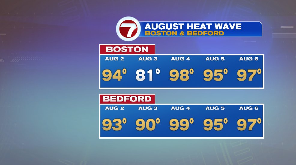
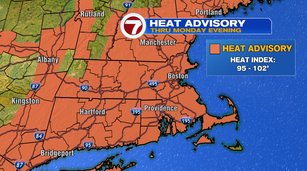
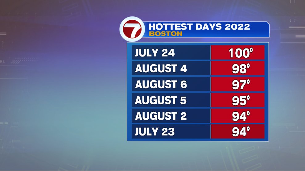
So it’s the stretch that’s the same and maybe worse than the July heat wave but also the temperatures and humidity are worse. Many of the days in July were plain hot without a ton of humidity. This stretch of heat is not only hot, but also very humid. In fact, aside from the one 100° day we had in July, the temperatures in this heat wave are topping the temperatures of July’s heat wave.
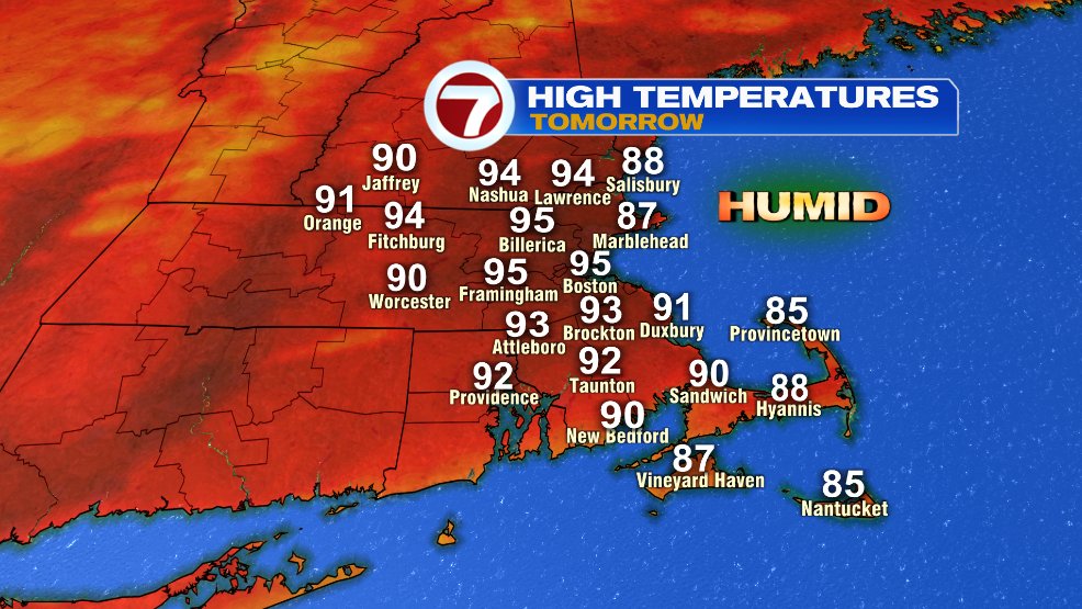
We’ll be back to the 90s again today. But keep in mind, despite temperatures below, it’ll feel like it’s closer to 100° with the humidity factored in.
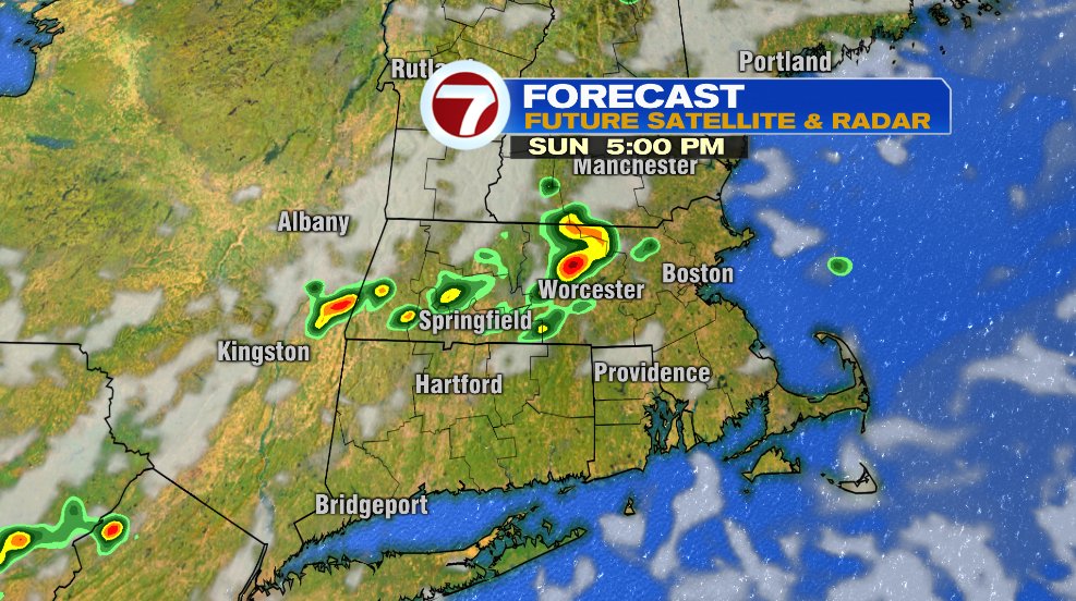
Much like yesterday, there’s a small chance of a little pop up shower or storm. They will be very isolated. Yesterday most of us didn’t even know that a few storms popped up in the afternoon/evening. But if you did see one, it was more than just a light shower. With the heat and humidity overhead, any storm that does develop has the potential to produce heavy rain and a lot of lightning. Here’s a snapshot of future radar. I wouldn’t hold on tight to the time or location but rather the takeaway of the storms will be isolated but any one that does develop could be stronger. The best window of time for this is about 1-6pm.
Monday is a rinse and repeat forecast with temperatures back in the 90s, feels like temperatures back near 100° and the chance of an isolated shower or thunderstorm Monday afternoon.