
What a difference a day makes as temperatures fell through the day today, dropping us into the 50s by the evening commute (which is back to the normal high for this time of year).
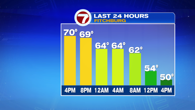
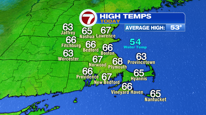
Speaking of high temperatures, we reached our highs today during the morning commute with temperatures in the 60s.
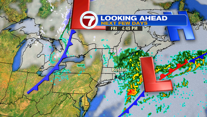
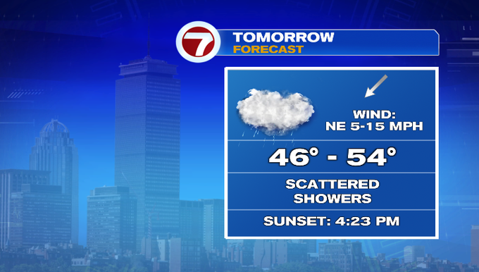
The cool down today is associated with a cold front that continues to push off the coastline this evening, but will bring a low pressure system off our coast Friday, bringing scattered showers through Friday afternoon and evening.
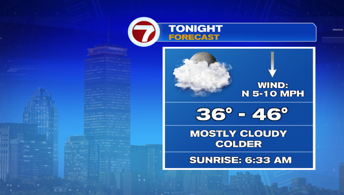
Ahead of tomorrow, tonight we’ll see mainly cloudy skies and lows slipping into the upper 30s for the northwest and higher elevations, 40s south and closer to the coastline.
Friday highs will only reach into the upper 40s to low 50s with a steady northeast wind, clouds and scattered showers (not the ideal way to end the week, but we still need the rain).
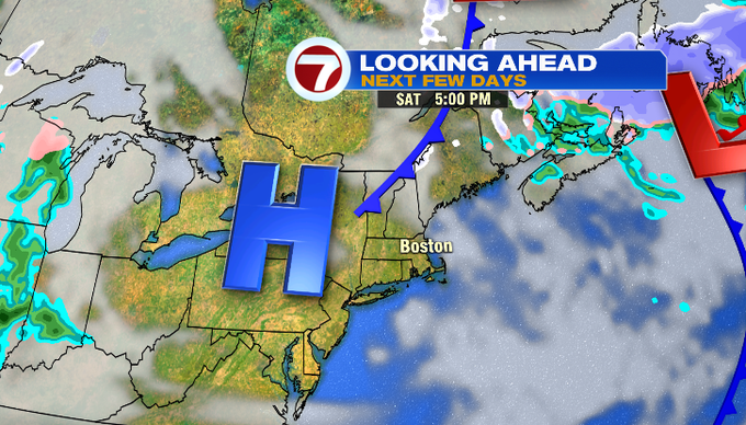
Drier conditions return for the start of the weekend. Saturday’s highs will be in the low 50s under mainly sunny skies and a chilly breeze.
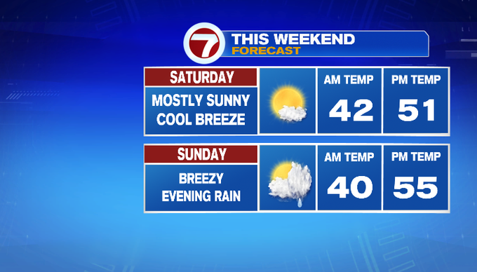
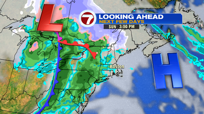
Sunday starts off dry with increasing cloud cover ahead of a system to our west that will usher in another round of rain after sunset Sunday evening. These rain showers will remain steady Sunday night and exit early Monday morning.
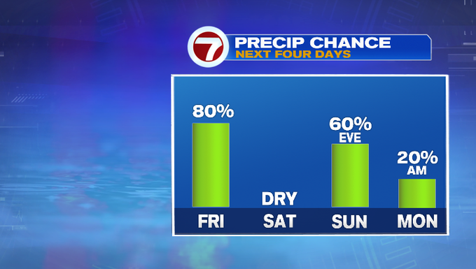
Highs remain in the 50s Monday before dropping through the middle of the week. By Wednesday, highs will be in the upper 30s.
