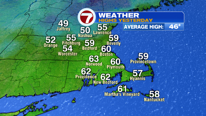
Yesterday we saw highs into the upper 50s to low 60s ahead of a cold front that swept through late last night. That cold front sparked some strong thunderstorms containing some damaging gusts. Those showers and storms have cleared the region and now much colder air has settled in.
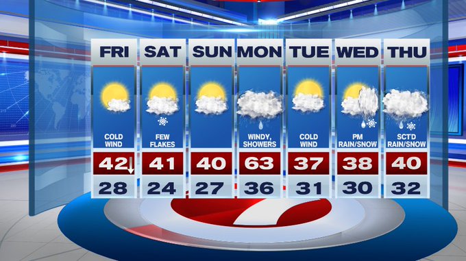
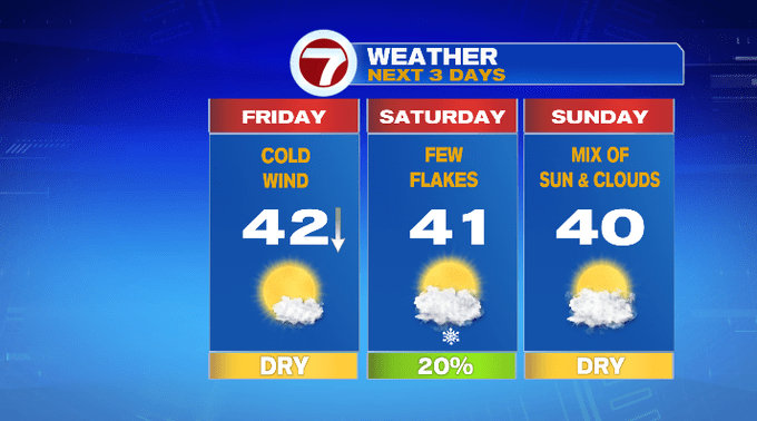
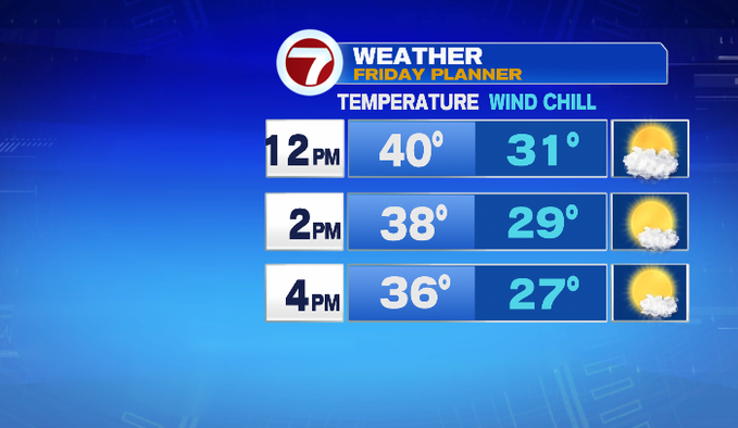
It’s back to reality today with highs this afternoon in the upper 30s to low 40s (we likely reached our official high temperature just after midnight earlier this morning as temperatures will gradually fall through the day).
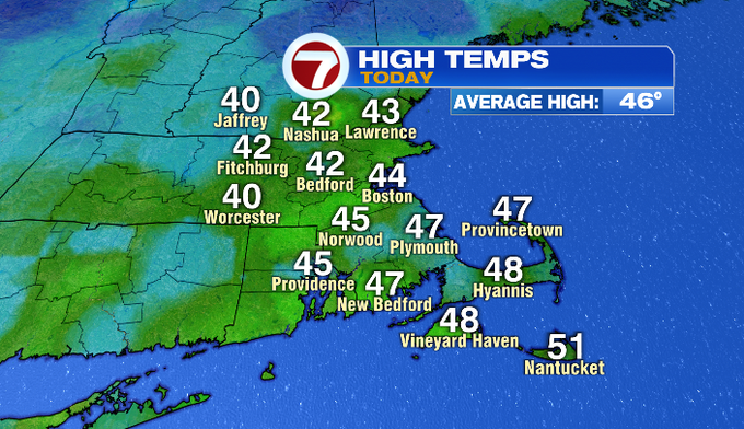
Not only is it noticeably colder, we have a cold gusty wind out of the northwest, which will make it feel around 10-degrees colder than the thermometer today. The wind and the cold will not be ideal for outdoor holiday decorating today, we could see a few gusts over 30 mph this afternoon.
It will be a cold night ahead under mostly clear skies with lows into the 20s.
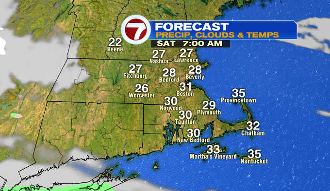
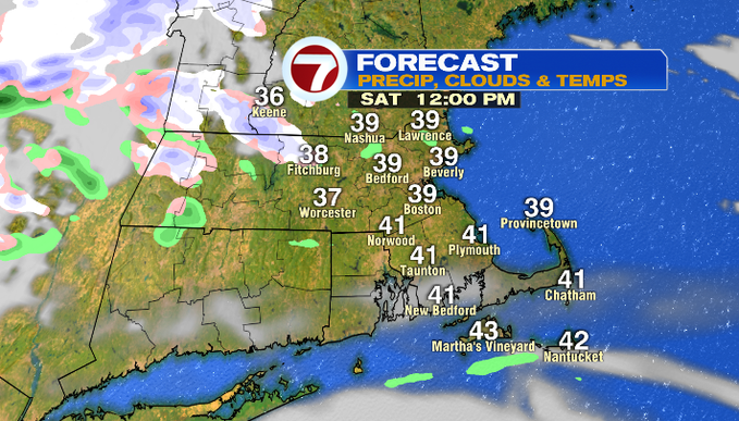
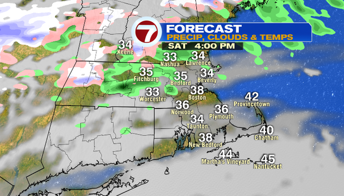
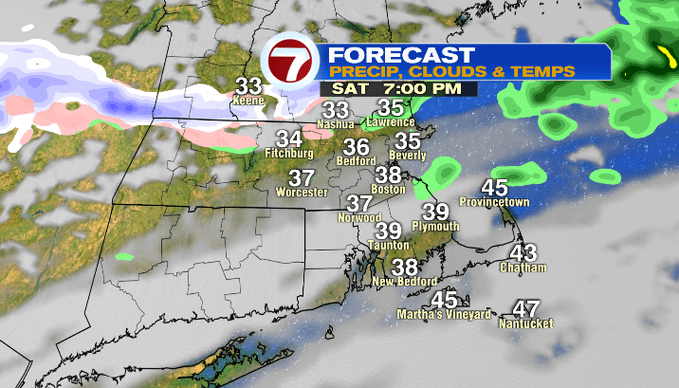
Saturday brings partly cloudy skies and a chance for a few sprinkles or flurries in the afternoon hours.
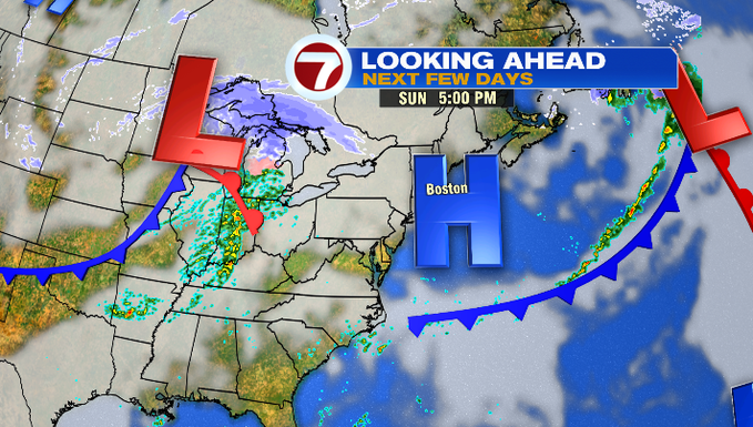
High pressure returns Sunday ahead of our next system that slides in Monday.
That system will bring another warm-up, with 60s bouncing back into the region. However, this warm-up will be accompanied by strong wind gusts and showers.
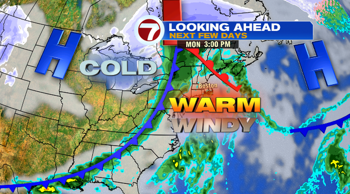
It’s a brief warm-up considering a cold front swiftly ushers in the winter chill by Tuesday with highs in the upper 30s with a cold wind, too.
We have rain/snow showers to wrap up the 7-day later on Wednesday and into next Thursday.