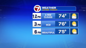
Today, the more quiet of the two days of the holiday weekend.
Yesterday, we saw temperatures crank into the low to mid 90s, with dewpoints into the 70s, creating heat index values into the triple digits! As the cold front approached by the afternoon, the battling airmasses created thunderstorms that provided tropical downpours, frequent lightning and strong wind gusts, prompting severe thunderstorm warnings as well as flood warnings.
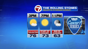
Thankfully, that cold front has cleared just to our south, and we are seeing much more comfortable air taking over. Today is the pick of the weekend for any of those outdoor plans, whether that includes grilling the rest of your 4th of July leftovers or if you’re heading out to Gillette Stadium for the Rolling Stones Concert.
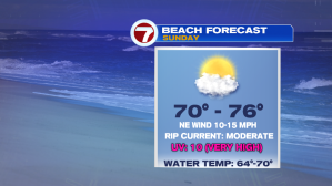
The beach also is a good spot, just be sure to watch the waters, the rip current risk today is moderate.
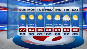
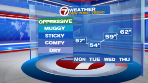
High pressure is in control over the next several days, giving us ample amounts of sunshine through midweek and low dewpoints, even though temperatures will start to warm up by midweek.
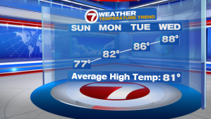
Looks like you picked a good week if this is your vacation week in southern New England- rain holds off until at least late Thursday into Friday. Next Saturday looking beautiful with highs into the mid 80s.