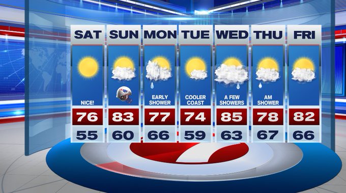
This weekend is shaping up to be great for any of your outdoor plans.
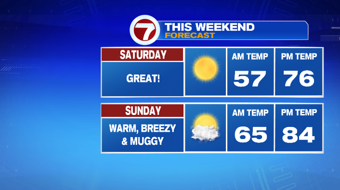
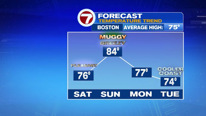
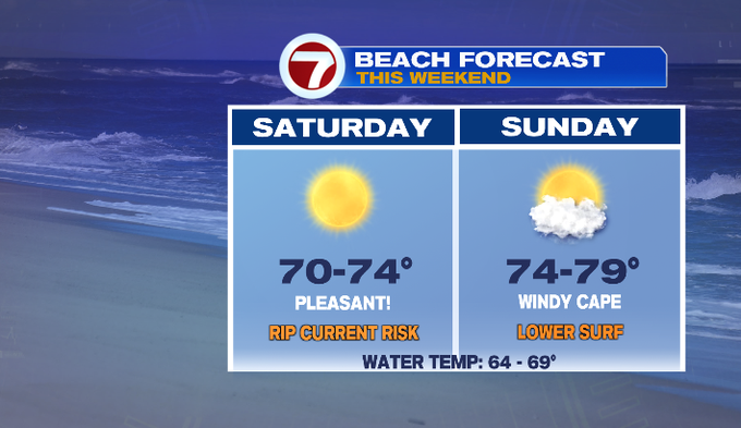
After a fall-like, crisp start to the morning, temperatures will rebound into the mid to upper 70s under sun-filled skies.

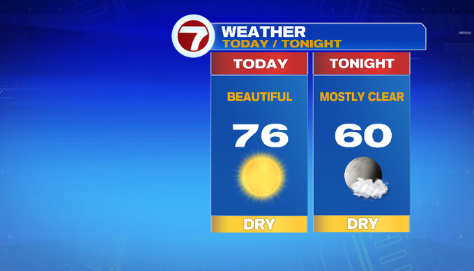
Tonight, under mainly clear skies temperatures will dip into the upper 50s to low 60s.
Sunday is a bit more summer-like with highs into the low to mid 80s alongside an uptick in the dewpoints, making it feel muggy. It will also be breezy with winds out of the southwest at 10 to 20 mph. A few gusts could reach up to 30 mph.
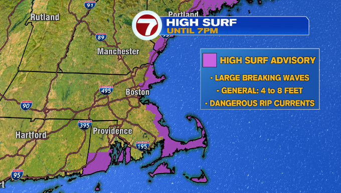
If you’re planning on heading to the beach this weekend, just be aware of the High Surf Advisory that is in place due to the swells from Hurricane Larry creating large breaking waves and dangerous rip currents.
For the season opener at Gillette, temperatures will be in the upper 70s for tailgate, around 80 by kickoff, sliding back into the mid 70s by the end of the game.

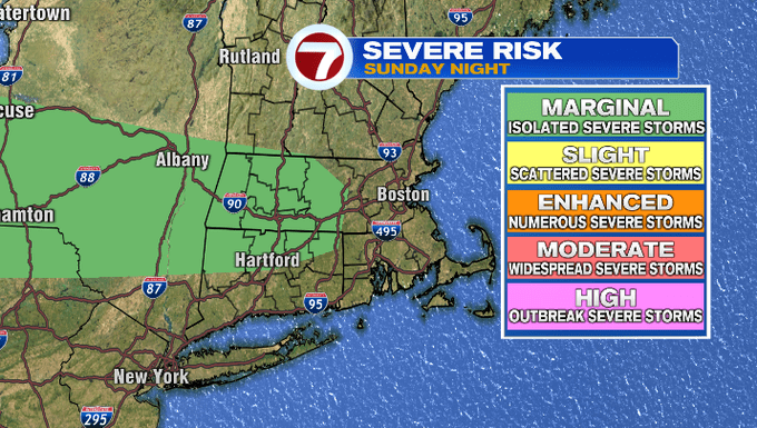
With a cold front diving south, a few thunderstorms are possible late Sunday night (after sunset). A few of these storms could be on the strong side with damaging gusts being the main threat.
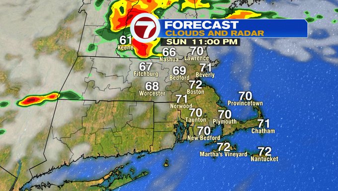
The Storm Prediction Center has placed portions of Worcester County as well as western MA under a marginal risk of severe weather, meaning there’s an isolated threat for severe storms.
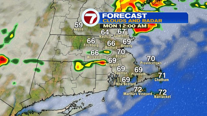
A shower could linger into early Monday morning, otherwise we’ll see emerging sunshine with highs into the upper 70s.
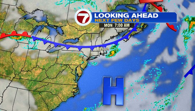
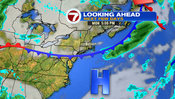
Tuesday is sun-filled with highs into the mid 70s, a touch cooler at the coast due to an onshore breeze. We warm up yet again on Wednesday into the mid 80s ahead of a front that will bring shower chances to the region. A few showers could linger into early Thursday, otherwise a drier pattern prevails to round out the work week.