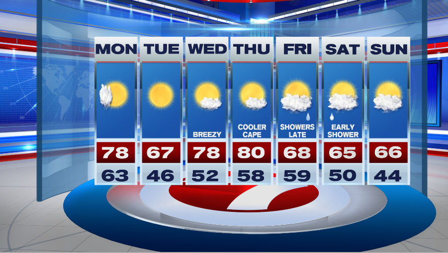
7Weather- We get another stretch of nice weather to start the week.
Monday starts with a few clouds and it will feel a bit muggy. Humidity quickly drops, and skies clear as a cold front moves through the region. Dew points start in the low 60s (muggy), and end up in the 40s (very comfortable) by the end of the day. Highs reach into the mid and upper 70s early in the afternoon.
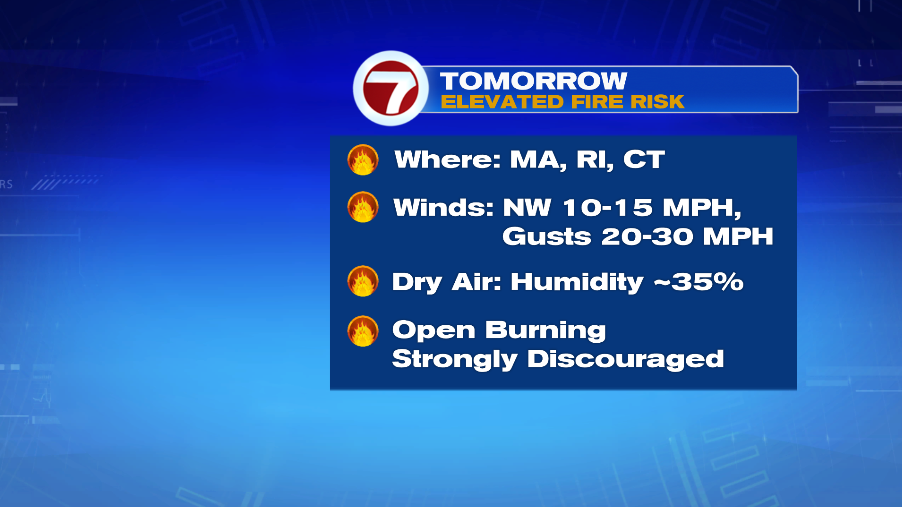
It will also become breezy behind this front, and with the dry air moving in, Massachusetts, Rhode Island, and Connecticut are at an elevated fire risk. Open burning is strongly discouraged Monday.

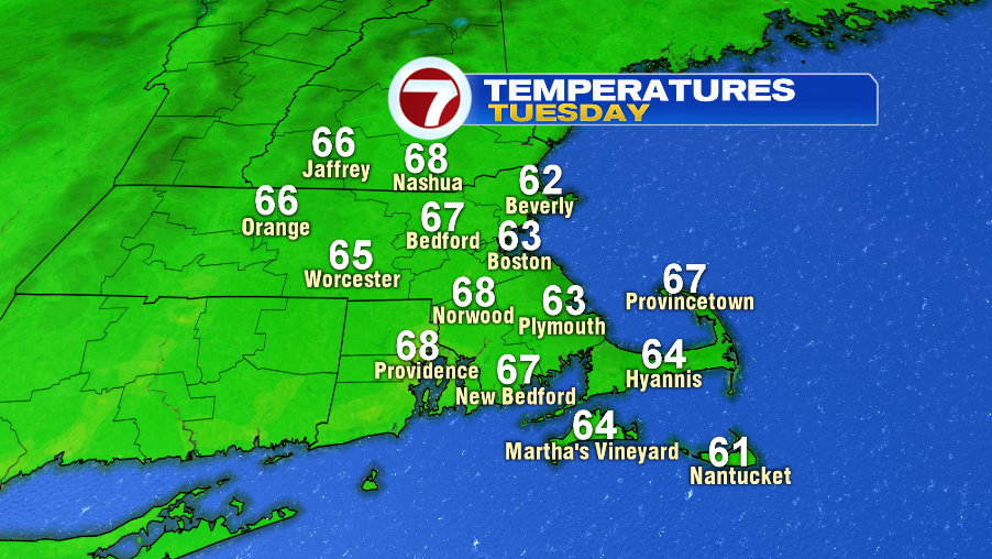
Are you ready for fall? We’ll get a taste of it on Tuesday, even more than we did this weekend. Dew points will be in the upper 30s to low 40 (crisp air), and highs reach into the upper 60s inland, and into the low 60s at the coast. Expect a light breeze, and plenty of sunshine.
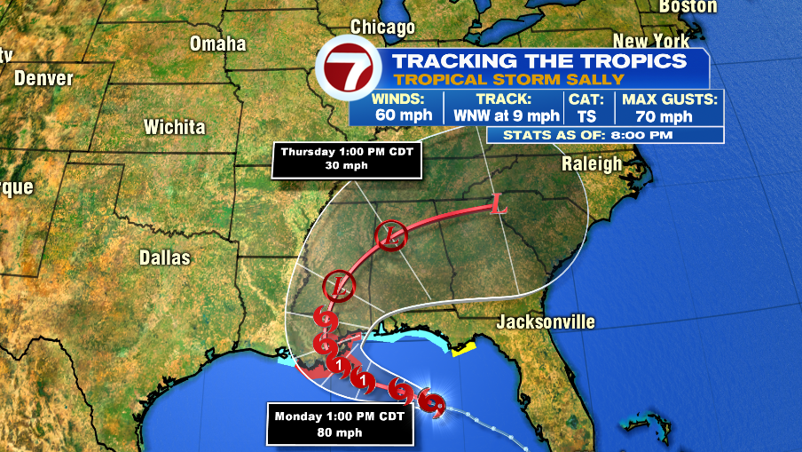
We warm back up Wednesday and Thursday with temperatures near 80. The forecast for Friday and Saturday is dependent on the location of the remnants of Sally. The low pressure will pass by south of New England, but some of the tropical moisture could give bring us a few showers late Friday into Saturday. There is the chance that a high pressure blocks it all together, leaving the end of the week dry. We will continue to fine-tune the forecast as we get closer.