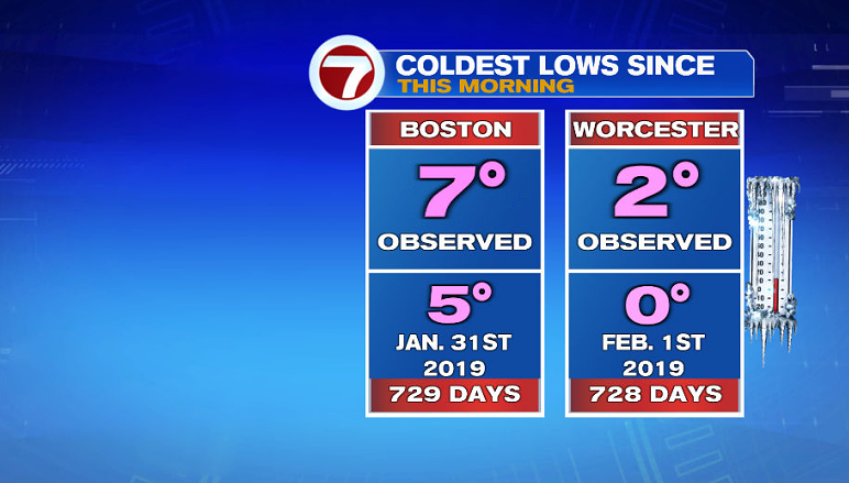
The bitter cold that greeted us this morning was the coldest air since late January of 2019 (nearly 730 days ago!).
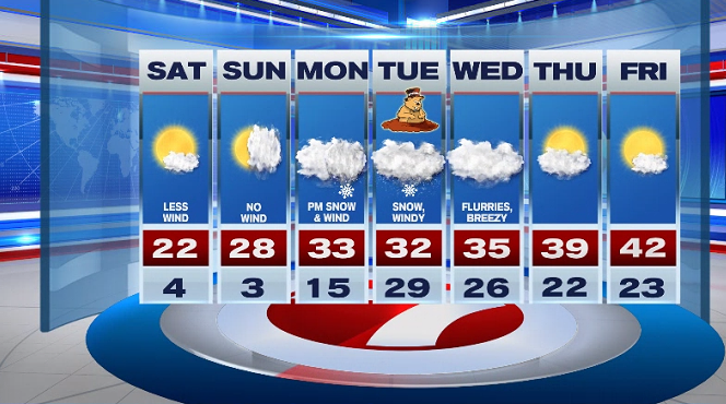
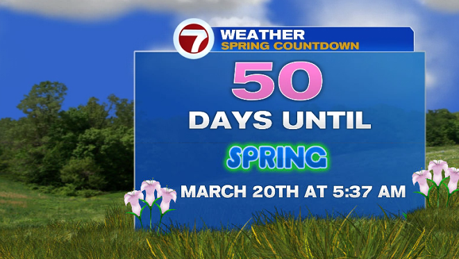
Yes, it was a frigid Friday, but at least it’s only 50 days until spring (and in our 7-day forecast, more wintry weather is on the way).
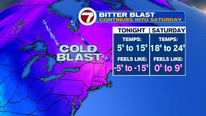
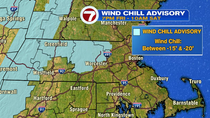
Through this evening, temperatures will dip along with the wind chills. A Wind Chill Advisory goes into effect at 7PM tonight and continues into early Saturday morning for north central MA and NW Middlesex County for dangerously cold wind chills as low as -15 to -20.
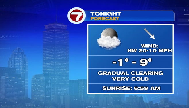
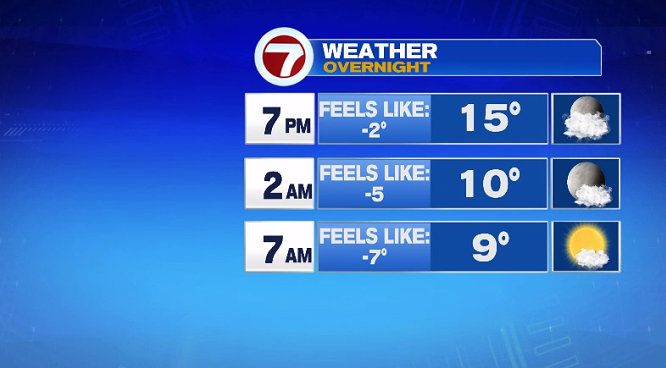
Overnight, temperatures dip into the single digits with a gradual clearing of the skies.
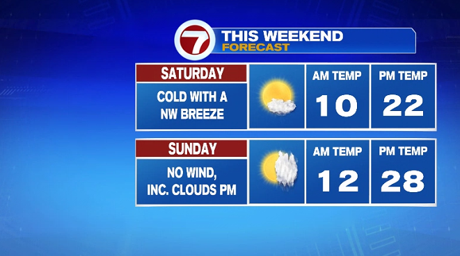
The bitter blast sticks around for Saturday, but at least it will not be nearly as windy as Friday. Wind chills will still be subzero when we wake up Saturday morning, with some improvement into the afternoon.

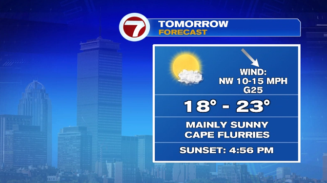
A few flurries are possible along the Cape, otherwise we’re looking at mainly sunny skies with highs into the upper teens to low 20s.
Sunday is the pick of the weekend with little to no wind and slightly higher temperatures. We start off with sunshine with increasing clouds in the afternoon ahead of our next system that will bring more snow to the region for the first half of the next work week.
We start off dry on Monday, then the snow pushes in from a low to our south. The snow becomes more widespread across the region as early as the Monday evening commute.
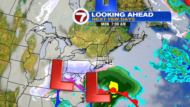
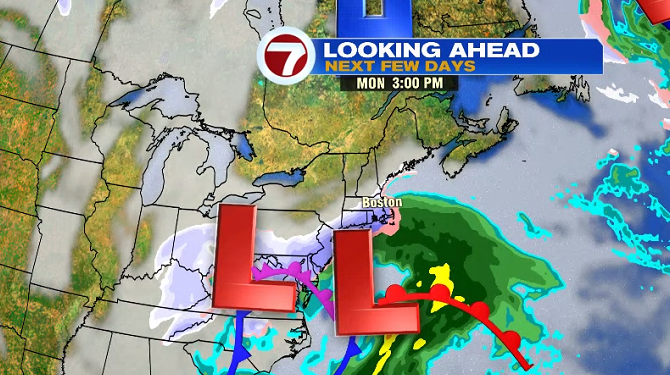
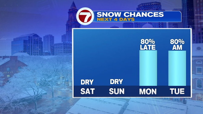
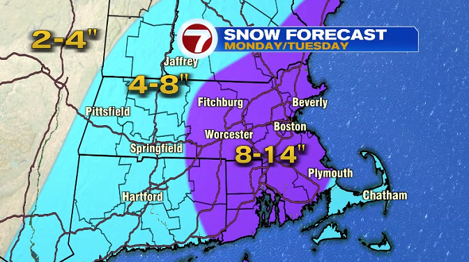
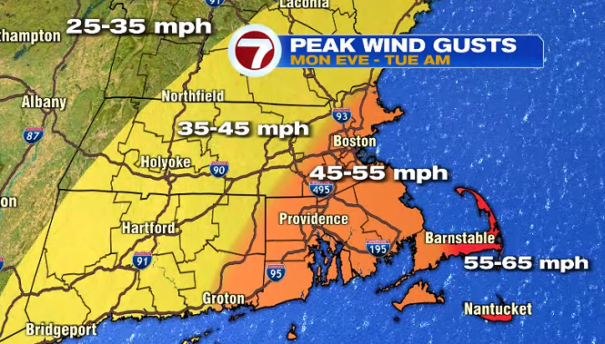
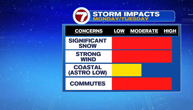
The snow continues Monday night into Tuesday, heavy at times overnight, with strong wind gusts. The higher snowfall totals are expected across most of eastern MA (where up to a foot of snow is possible). We will continue to fine tune this forecast over the next 24 to 48 hours as we get closer (since there is still some uncertainty on timing and extent of snow coverage), but expect several inches of accumulating snowfall that could impact travel late Monday into Tuesday.
Speaking of Tuesday, it’s Groundhog Day and our first 5PM sunset of 2021.
Flurries are in the forecast for Wednesday followed by a slight warm-up by the end of the week with highs into the low 40s by Friday.