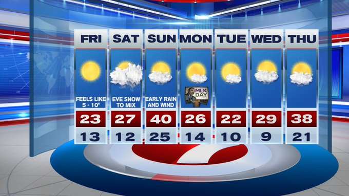
From the record-breaking 70+ degree highs last Saturday and Sunday, this upcoming cold snap and accumulating snow this weekend will likely be a shock to the system. A Wind Advisory remains in effect through early Friday for gusts up to 50 MPH, which could result in downed power lines and trees damage.
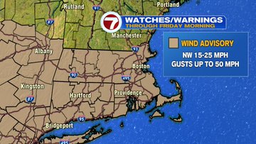
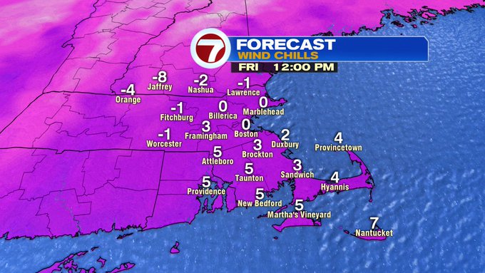
Overnight tonight, expect actual lows to slip into the teens, but with a blustery wind out of the northwest, with a few gusts between 40 – 50 mph, the wind chills will be around zero into Friday mornings commute, making it dangerously cold if you’re not properly bundled up.
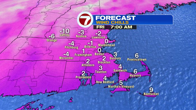
Although, we’re tracking sun-filled skies for Friday afternoon, the wind chills will not recover much from the morning, with feels like temperatures likely in the single digits into the afternoon.
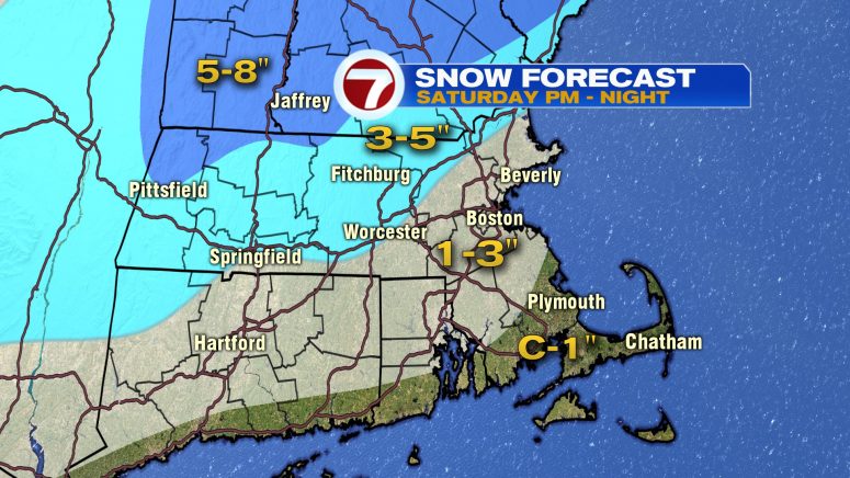
Saturday features dry conditions for the first half of the day, with increasing cloud cover and snow showers moving in through the evening hours. Those snow showers stretching in from west to east. For snowfall totals, 1-3″ within the 495-corridor, 3-5″ off to the northwest (especially for the higher terrain in the Worcester Hills, southern NH, and portions), even higher amounts for the Berkshires and portions of southern VT.

As the system moves out, the rain/snow line lifts northward, resulting in light rain showers into early Sunday morning. The rest of Sunday looks dry, but it will be windy through the afternoon under partly cloudy skies.
Into the next work week, expect highs unseasonably cold – into the 20s to 30s. Although cold, it will be dry into midweek.