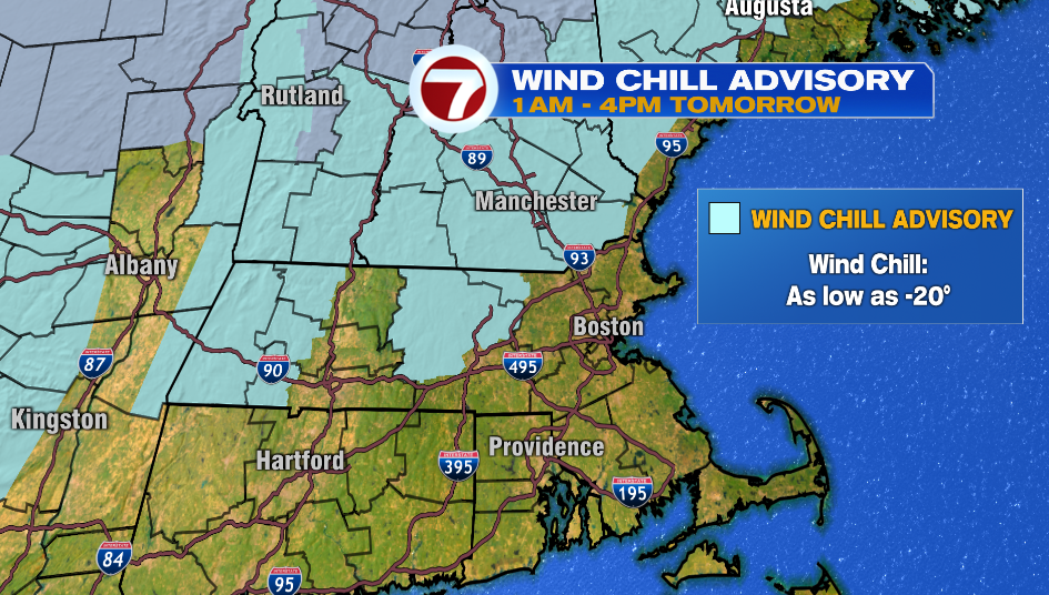
A Wind Advisory is in effect for parts of Worcester County and northwest Middlesex County from 1AM -4PM Tuesday. Wind chills could be as low as -15º to -20º. When the feels like temperature is near or below -15º you can get frostbite on exposed skin (fingers, toes, noes, & ears) in as little as 30 minutes.
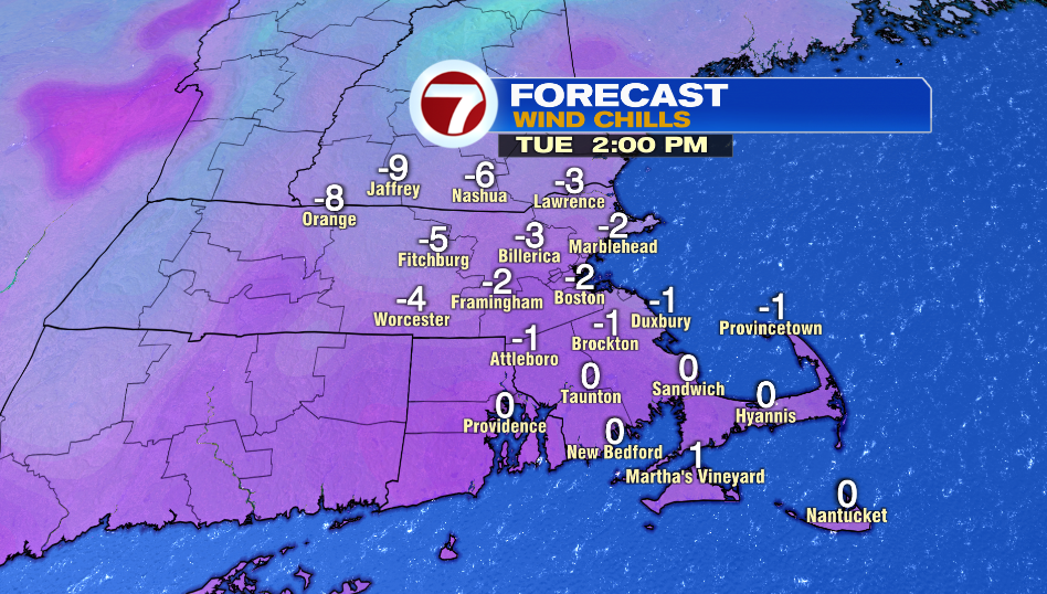
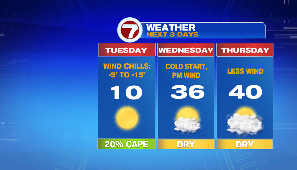
For the rest of the area it will still be frigid with wind chills between -5º to -10º. Things improve at least a little bit into the afternoon as wind dies down.
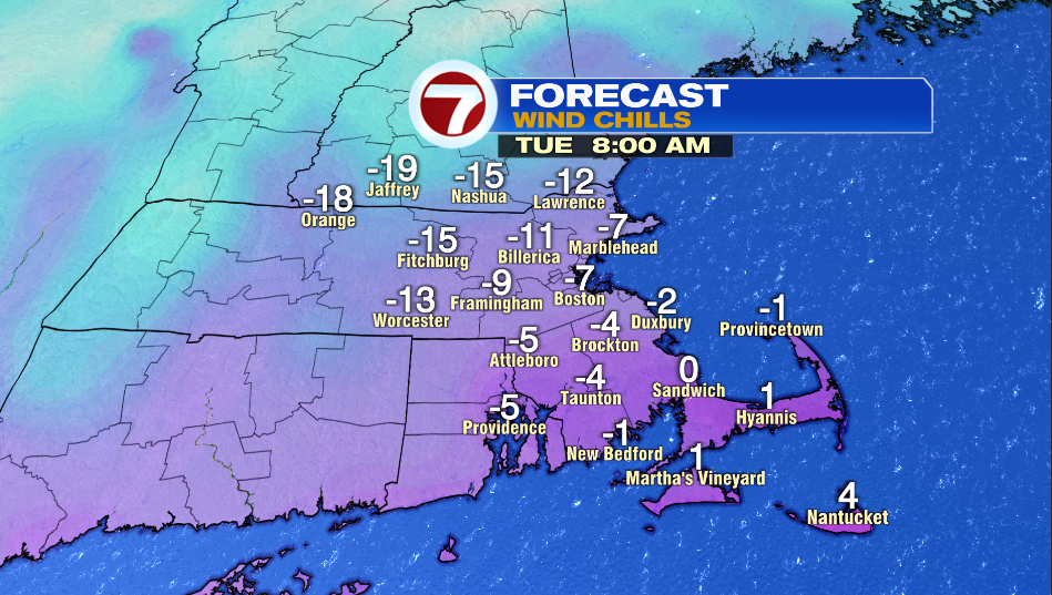
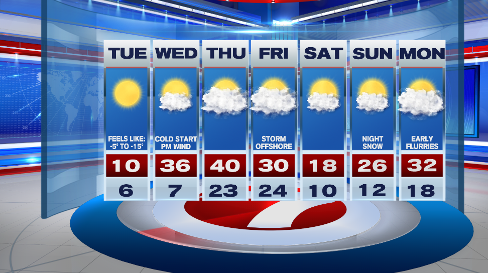
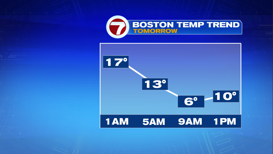
It looks like high temperatures for Tuesday will hit right around midnight tonight in the upper teens in Boston. The afternoon temperature will be near 10º, but the high for the day will likely be around 17º. This means we won’t break the record cold high temp of 12º set back in 1981.
This arctic air won’t be around for too long. Wednesday starts in the single digits and teens and then a warm front allows our highs to jump into the mid 30s. It will become windy as that front moves through the area in the afternoon. Thursday has less wind and it is mild compared to the cold we’ll feel tomorrow.
We’re watching a storm offshore Friday that could bring light snow into the area. Right now it’s looking like most of the that system misses us. Highs only reach into the teens on Saturday and skies are partly sunny.