
That phrase is in play this week as we are in the middle of another dry stretch of weather. The proverbial blip is in the form of a cold front that will produce clouds and a few showers on Wednesday evening. You can see that front on the surface map for tomorrow…
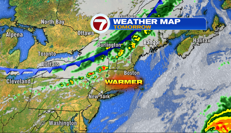
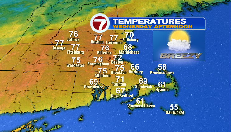
you may also notice that *warmer* symbol as well. i do think we’ll see afternoon temps reach the low to mid 70s before that cool front swings through during the evening hours.
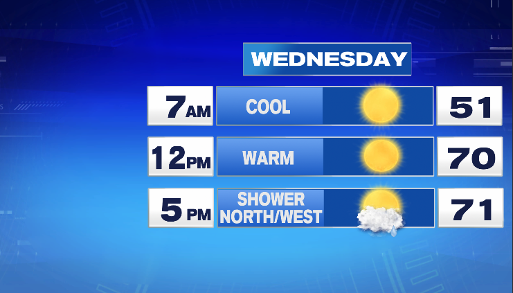
In terms of the showers, I think it happens late day and more likely the farther north you are…

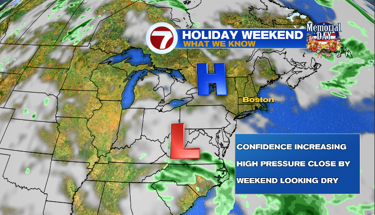
I don’t think it will rain continuously between 4-9pm but somewhere in that 5-hour window, showers are most likely to occur. The cities and towns (IE lawns & gardens) that do see evening showers, the amount is nothing like this past weekend, rather, around 0.20″ or less. Afterwards, the dry pattern resumes for the remainder of the week and likely into the upcoming Holiday Weekend. Here is the setup..
and that setup leads to a 7-day forecast looking like this…
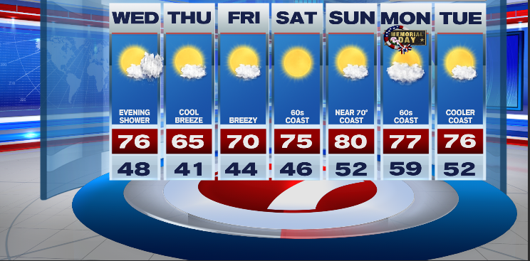
As of now (Tuesday evening), outdoor plans should be A-OK for much of the region for all three days. The beaches will be cooler than inland locations with light onshore breezes each day. The Memorial Day Weekend is typically the coolest of the *Big 3* Holiday Weekends (Memorial Day/ July 4th/ Labor Day) as the ocean is still an invigorating 55 degrees this time of year. More on the weekend forecast in the coming days.
~JR