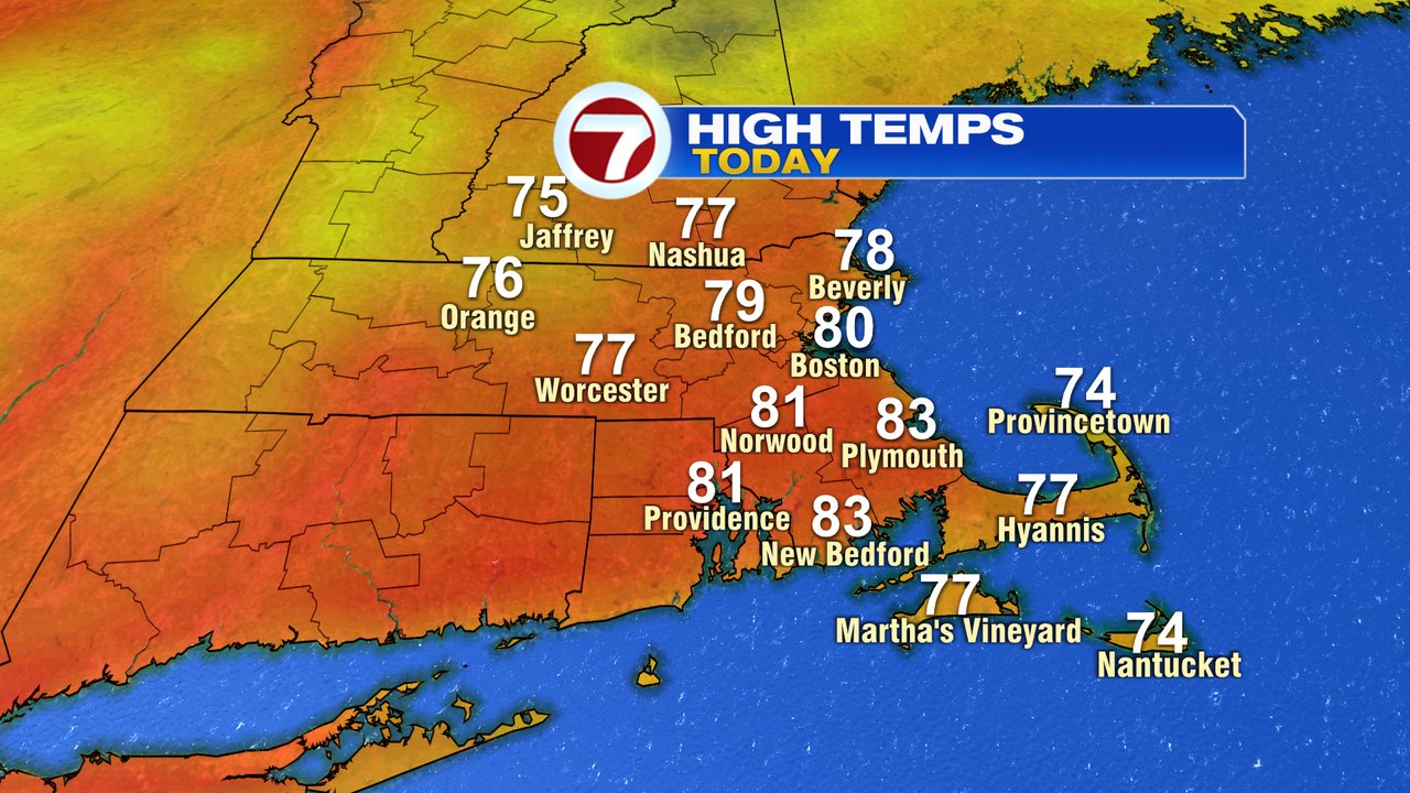
As an area of low pressure continues to spin it’s wheels to the northeast of us this morning, we’re seeing some showers backing through southern New Hampshire and drifting into northern Mass. The best chance for a few sprinkles or a touch of light rain this morning favors areas north of Route 2. The shower activity fades through mid morning as much of the day remains dry. Cloudy to partly sunny skies prevail with just an isolated shower popping up midday/afternoon. Temps near 80 this afternoon. It’ll be a breezy day too with gusts 20-30mph out of the west to northwest.
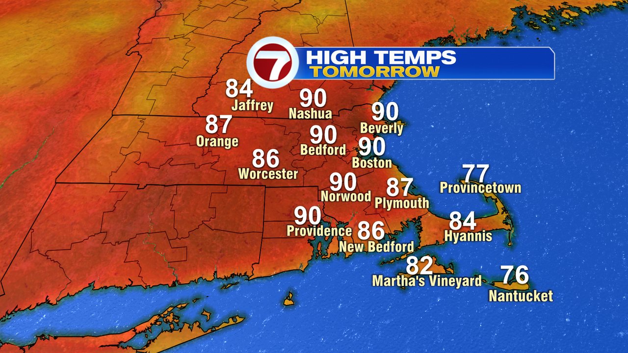
Mostly sunny skies return tomorrow and temps take off with highs near 90 in the afternoon. It’ll be a dry heat though as dew points run close to 50. Pretty much the same forecast is in place Saturday, although a few high clouds mix in for time to time. The west wind won’t be all that strong, so expect localized sea breezes.

Sunday will be warm too, a touch more humid, but still relatively comfortable.
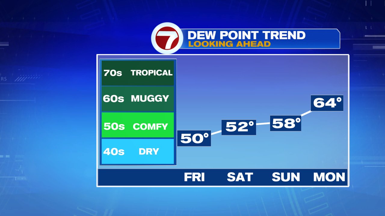
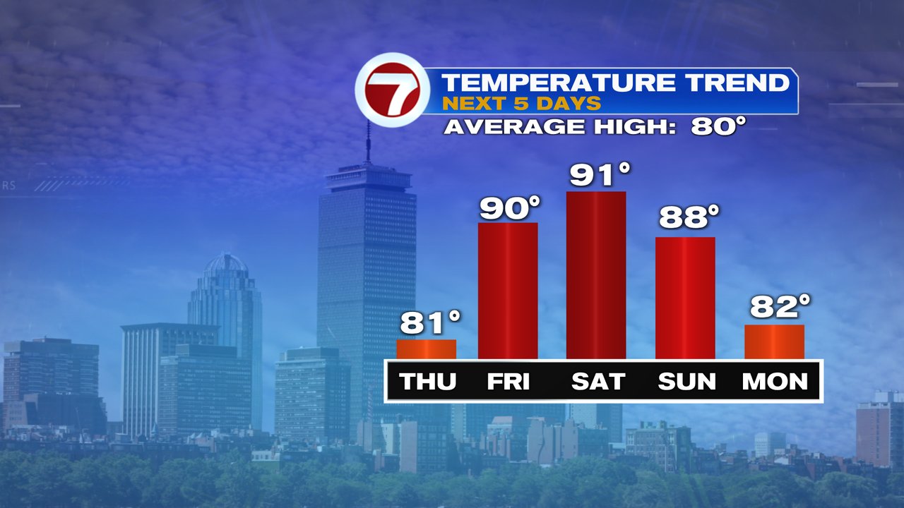
Early next week, we’ll increase the mugginess, but temps won’t be as high and scattered showers and storms return to the forecast.