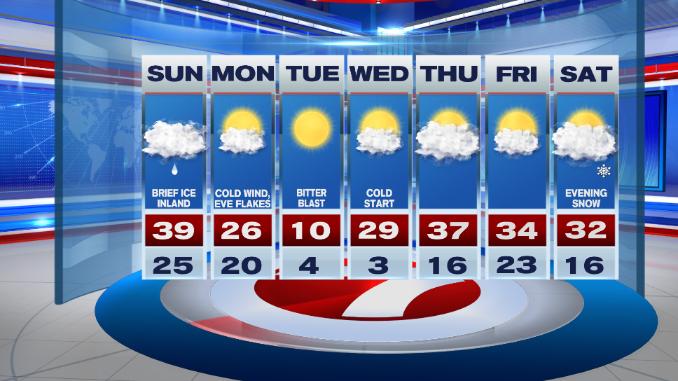
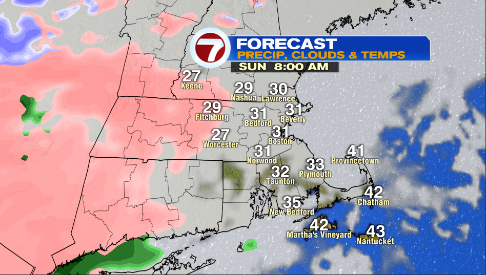
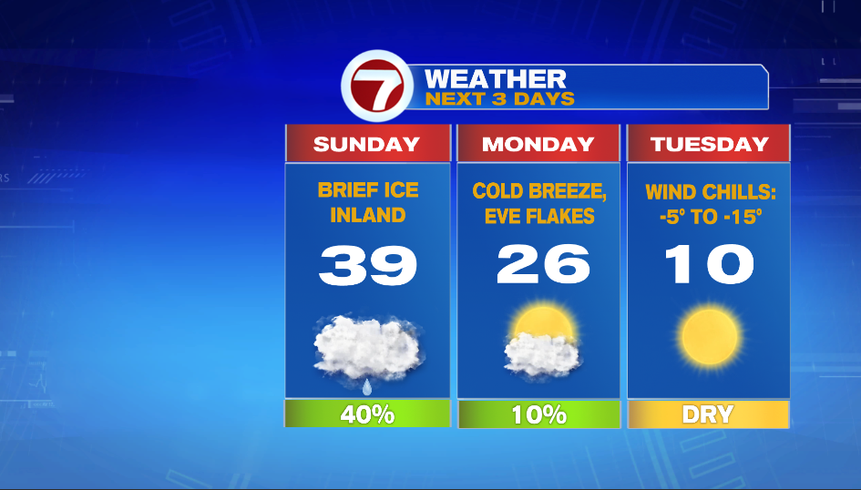
A Winter Weather Advisory is in effect for Sunday for Worcester County, northwest Middlesex County, and parts of southern New Hampshire. Light freezing rain will make for slick spots on untreated surfaces, especially in the morning.
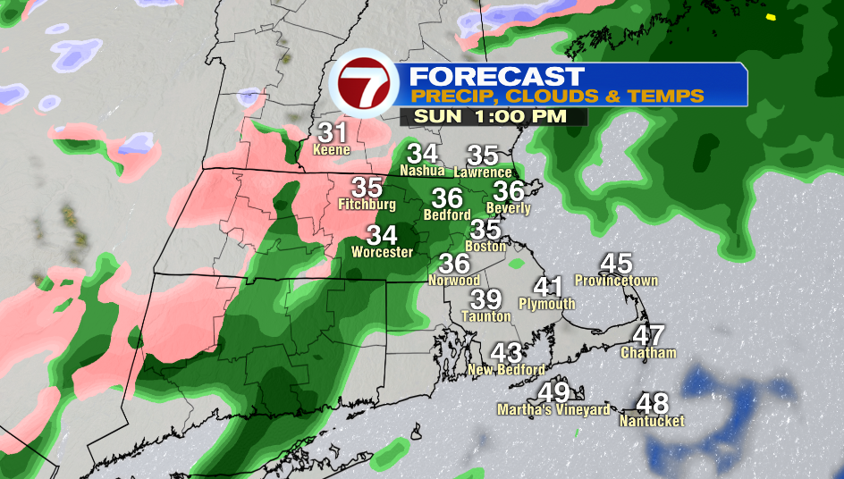
We’ll jump into the mid 30s by lunch time, but some inland areas might get stuck near freezing keeping that chance of freezing drizzle.
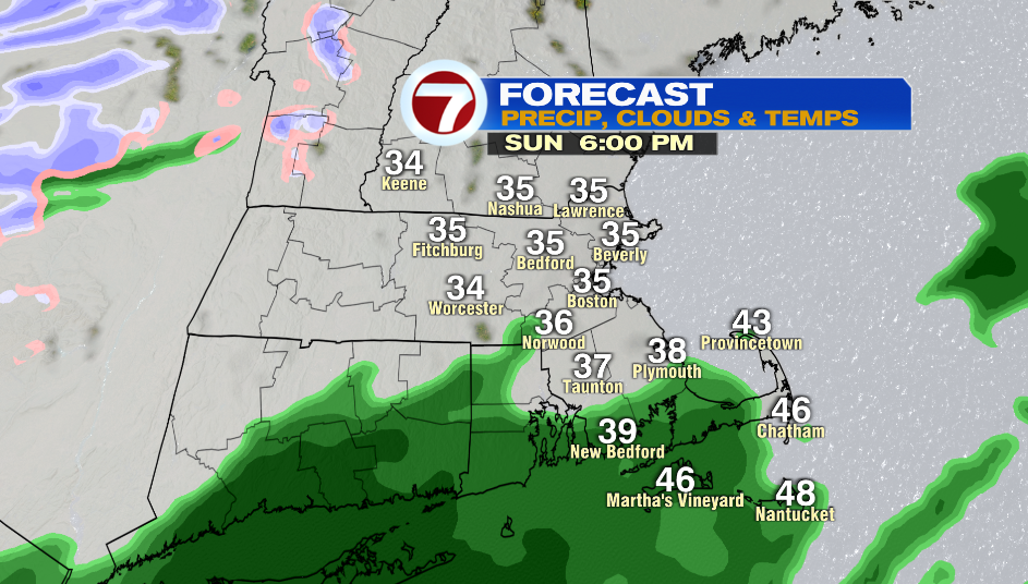
Areas inside of I-495 will see a few rain showers in the early afternoon, and then spotty rain in the evening. It is not a washout. Highs reach into the mid and upper 30s and it is breezy with winds are 10-20 mph.
Monday will have a mix of sun and clouds with highs in the mid 20s. A cold breeze will make it feel like the mid 20s. We’ll see evening flakes as an arctic front moves in. Snow squalls are possible for central/northern New England.
That artic front will really be felt on Tuesday! Wind chill values will be dangerously cold between -5º to -15º throughout the entire day.
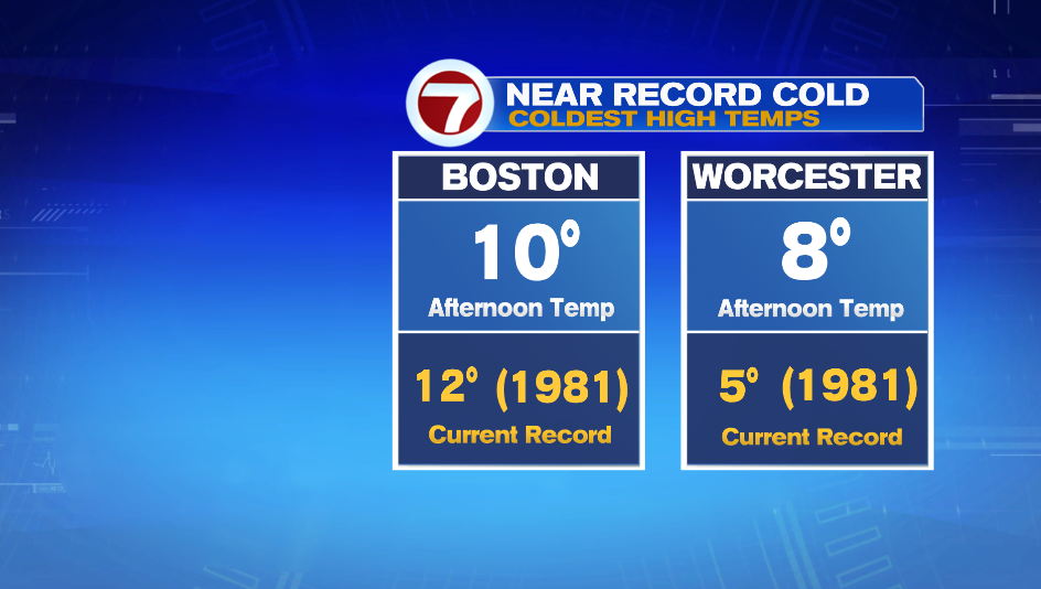
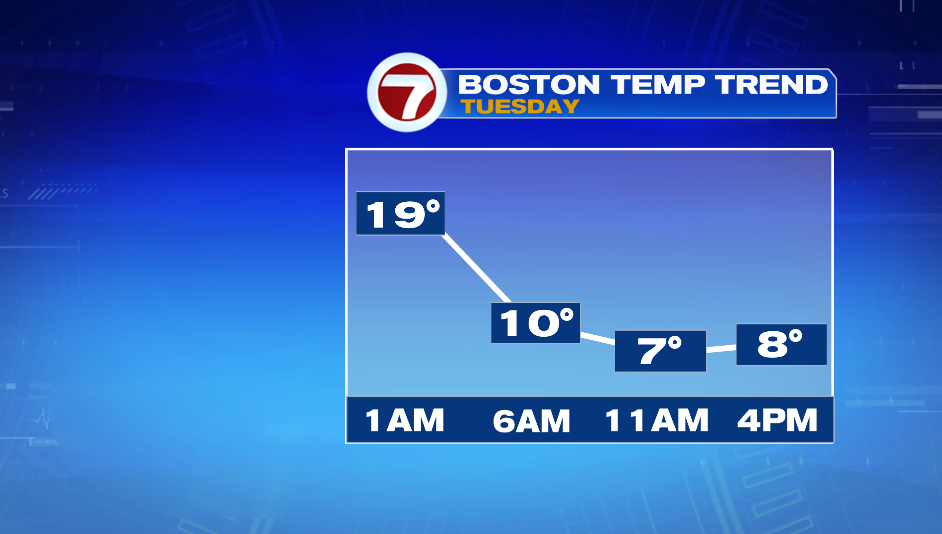
We will be near record cold on Tuesday, but as of now it doesn’t look like we’ll break these records for coldest highs. Official high temps will hit around midnight-1AM in the upper teens and then we fall from there.
Wednesday morning will have dangerously cold wind chills again. It won’t be as cold in the afternoon with highs in the upper 20s. Thursday and Friday are closer to average highs in the mid 30s.