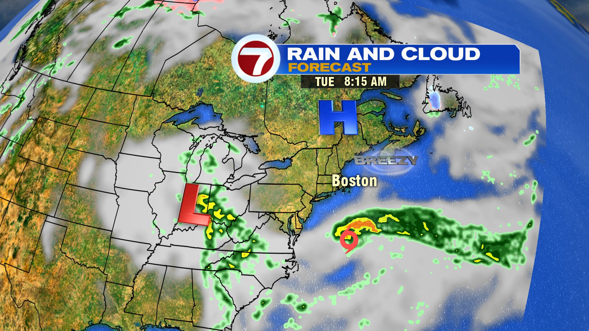
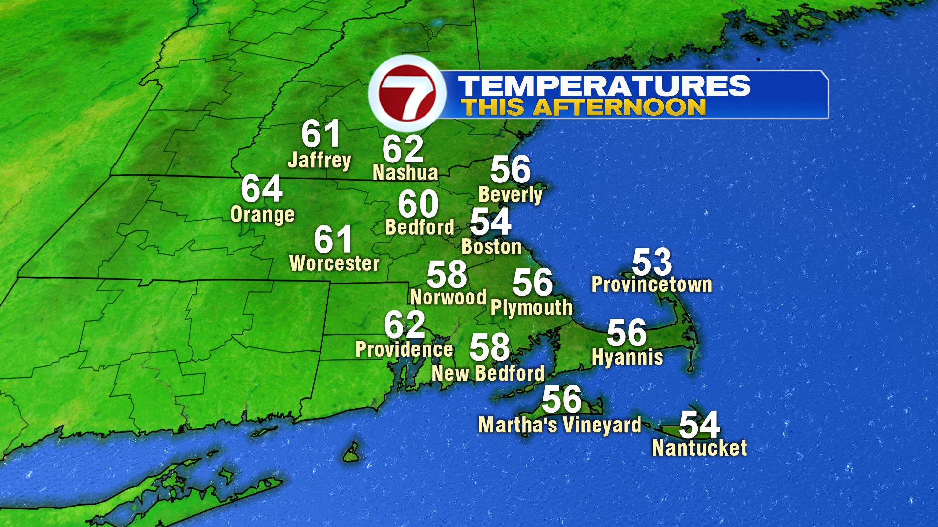
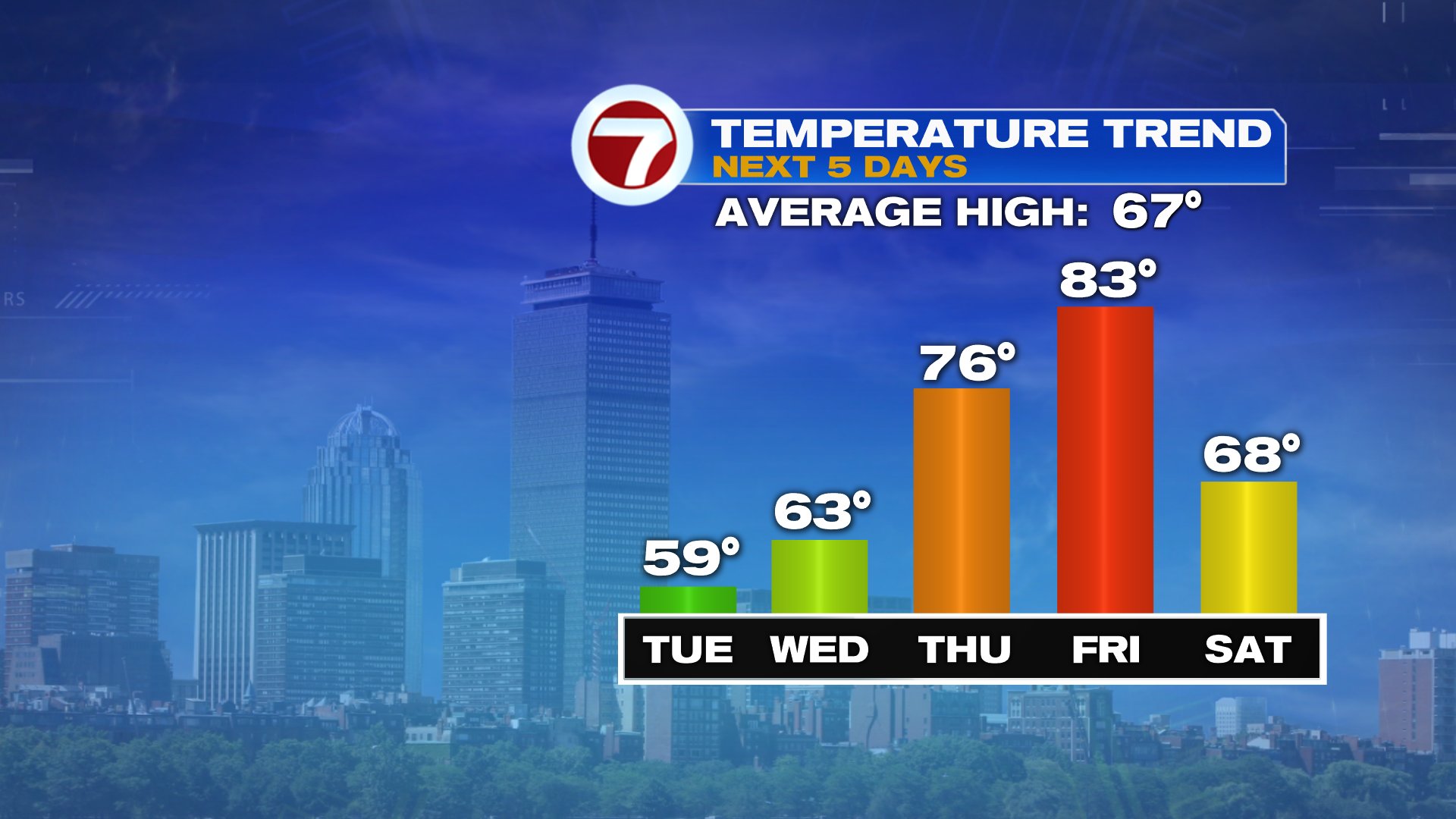
Like a big rock in a stream… everything must flow around it and not through it. That “rock” in the atmosphere is a dominate area of high pressure that’ll force Tropical Storm Arthur south of us and the low in the Ohio Valley to stay southwest of us. Initially, with the center of the high parked north of us, it’s busy northeast wind that’ll prevail today, providing a chill coming in off the ocean as highs hold in the 50s at the coast and near 60 inland. Winds gust 25-35mph, strongest at the coast. As that center of high pressure settles east of us, winds around it turn more south in Southern New England. That’s when temps start to ramp up, Thursday and Friday. Friday, highs will soar into the low to mid 80s away from the south coast, and humidity stays low!

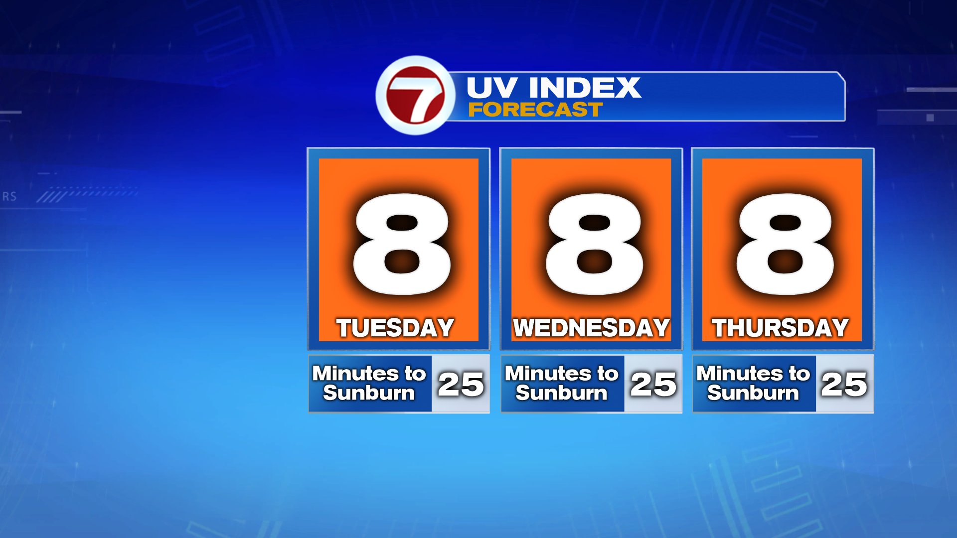
It doesn’t matter if its 55 and sunny or 85 and sunny. The UV index is high this time of year when sunny skies prevail. Sunscreen it up the next several days!
While rain likely stays just south of us Saturday, winds turn back to the northeast and get gusty out of the northeast late in the day and on Sunday. That once again promotes cooler air for the midst of Memorial Day Weekend, but with another area of high pressure building in, it also looks dry Saturday-Monday. Monday, temperatures likely return into the 70s after being stuck in the upper 50s to mid 60s on Sunday.