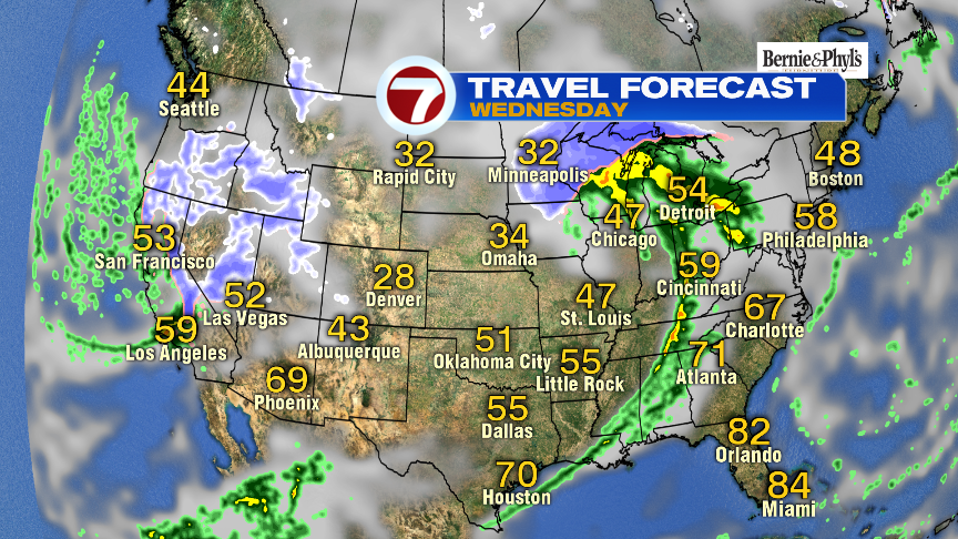
Well, yesterday was certainly a step in the right direction with sunshine back in place and temperatures much closer to seasonable levels. Today, we’ll step it up another notch, with highs approaching 60 degrees! That, combined with the fact that we’re dry up and down New England, and through much of the east coast, will mean it’s a great travel day overall weather-wise up and down I-95.
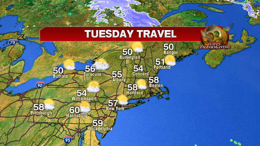
Tomorrow, out fortune starts to change by midday as we track scattered showers in here. While no snow or ice falls, the wet weather will be enough to slow us down on the roads as puddles and road spray occasionally becomes an issue tomorrow midday through tomorrow night.
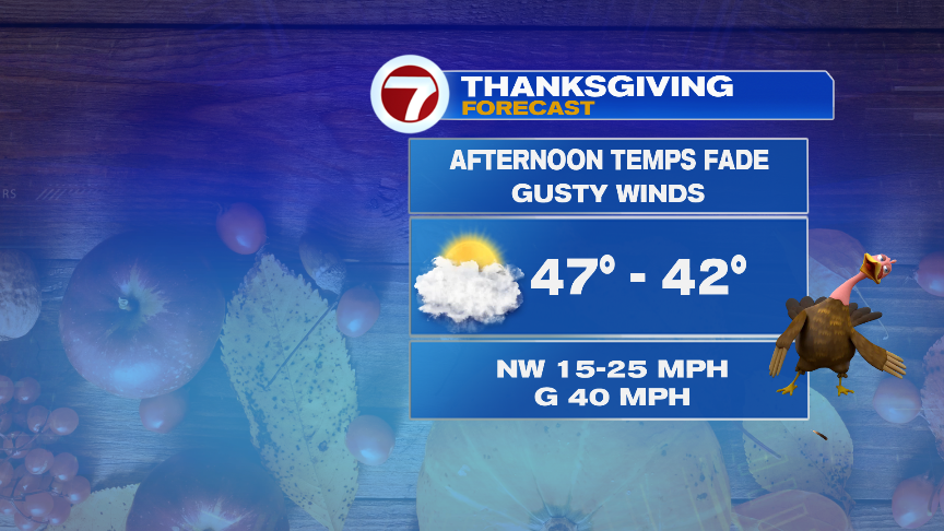
By Thanksgiving morning, an early sprinkle/flurry should taper off, yielding to a mix of sun and clouds and a gusty wind. With wind gusts to 40mph, it’ll be a hold on to your hat type day while your out at those high school football games.
Friday and Saturday look dry but chilly with stronger breezes on Friday.
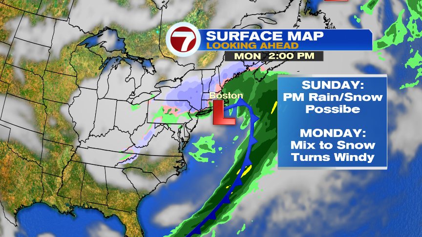
By Sunday afternoon, into Monday, the next storm works in with a mix of coastal rain and inland snow. Pending the track of the low, any rain may change to snow by Monday across much of the area as cold air continues to work into this system. Winds likely pick up too. Way too early for any snow amounts, but it’s certainly worth keeping an eye on toward the end of the weekend.