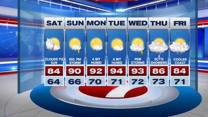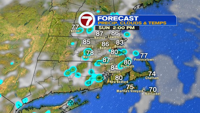
We certainly need the rainfall with a chance for some showers both weekend days, but we’re not tracking washouts, and most locations remain dry. Sunday, which features more sunshine through the morning and into the early afternoon will fuel the a few thunderstorms Sunday afternoon.
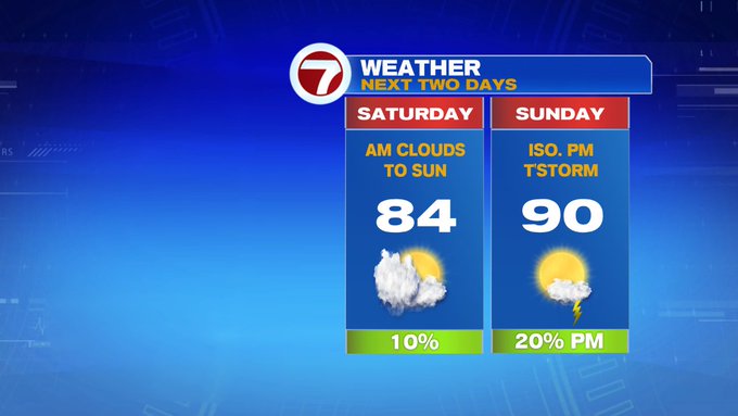
Today, we’re tracking highs into the low to mid 80s inland, upper 70s at the coast due to an onshore breeze. After starting off with some clouds, we’ll see some sunny breaks emerging through the afternoon.

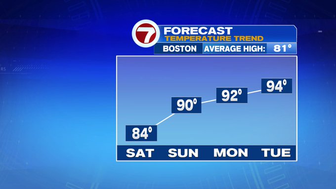
Sunday could be the start of the next heat wave for some spots as highs near 90 into the afternoon.

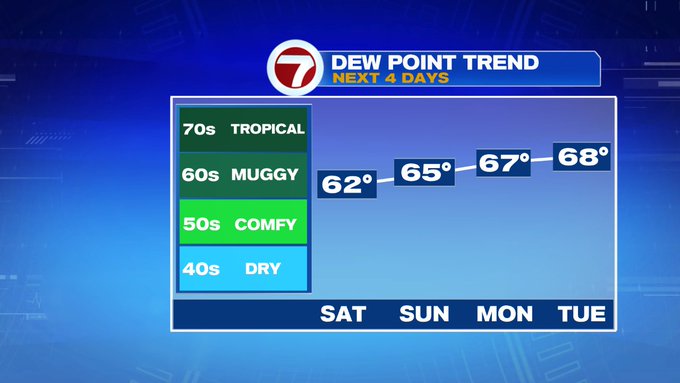
The heat wave will likely continue through Wednesday as dewpoints also are on the rise, with the peak of the heat and humidity Tuesday and Wednesday.
Wednesday, an approaching cold front to our northwest, will bring a chance for some showers and thunderstorms by Wednesday evening with some showers lingering into Thursday.

This will also push the heat and humidity out of here by the end of the week with highs settling into the 80s both Thursday and Friday.