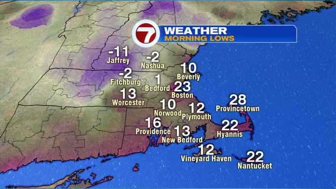
It was a bitter cold start to our Sunday morning. High pressure was overhead, with the fresh snowpack from the storm early last week, clear skies and calm conditions, temperatures took a nose dive overnight into this morning. Quite a few spots woke up to temperatures below zero!
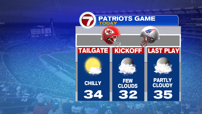
If you’re heading to the Pats game later today, be sure to wear the layers…it will be chilly for tailgating, but at least we are not tracking any precip.
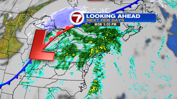
Now that temperatures are gradually warming up through this afternoon under a mix of sun and clouds, be sure to get outside to soak up as much sun as you can, since we’re tracking a cloudy, wet, and warm start to the week before temperatures tumble by midweek.
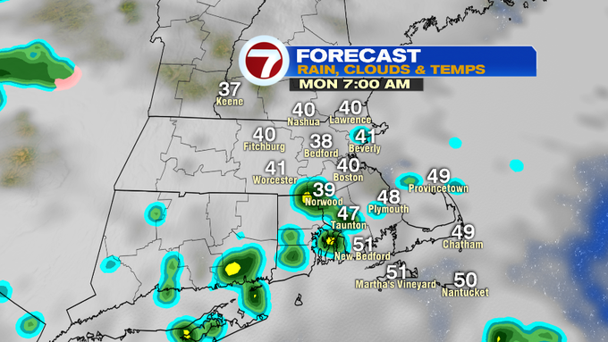
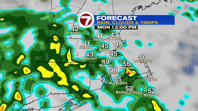
Temperatures rise through the overnight ahead of the rain showers that will fill in through tomorrow.
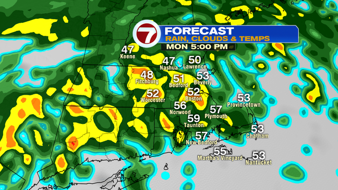
A few spotty showers possible for the Monday morning commute, otherwise the focus turns more towards the evening rush as we’ll likely see a few pockets of downpours, making for tough travel since this heavy rainfall will put a dent into the snow pack.
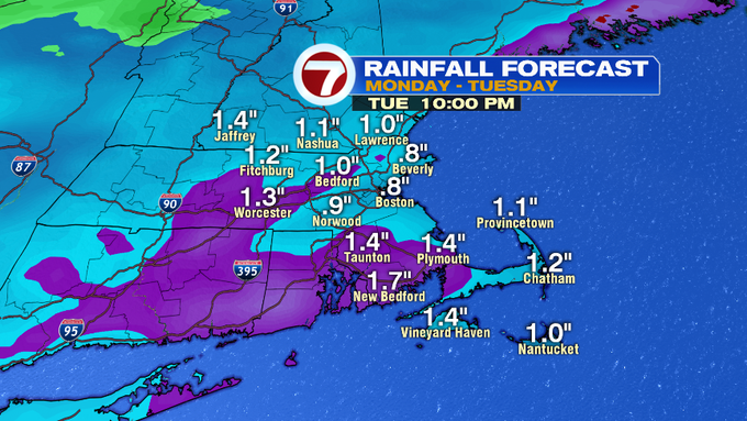
Ponding on roads, and some minor flooding in low lying areas are possible since we will likely see between 1 to 2 inches of rainfall through Tuesday night.
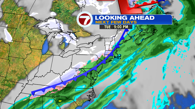
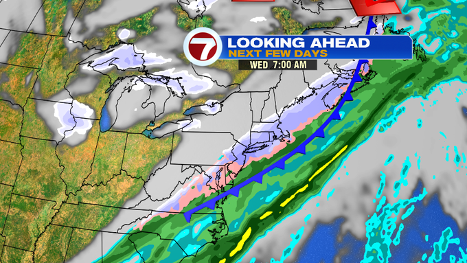
The trailing cold front will approach the area Tuesday afternoon, but ahead of that front, we will likely see high temps near 60, followed by a cool down into Wednesday. Scattered showers are expected on Tuesday too, with that rain changing over to snow into early Wednesday before drying out by Wednesday afternoon.

Colder and drier air settles in for Thursday with highs into the upper 20s and lows into the teens. Still unseasonably cool into Friday before another round of showers slides in for the start of next weekend.
