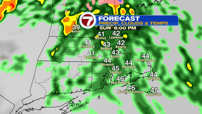
It was nice to open up the windows yesterday to let the fresh air come in and what a difference a day makes, right? Today, it’s back to the clouds, fog, and rain that will be sweeping across the area through the afternoon and evening.
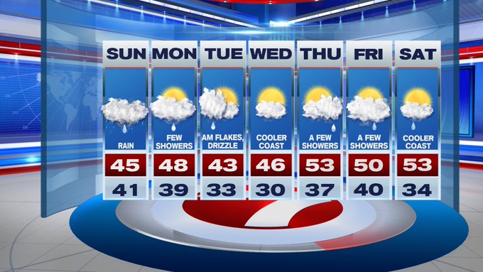
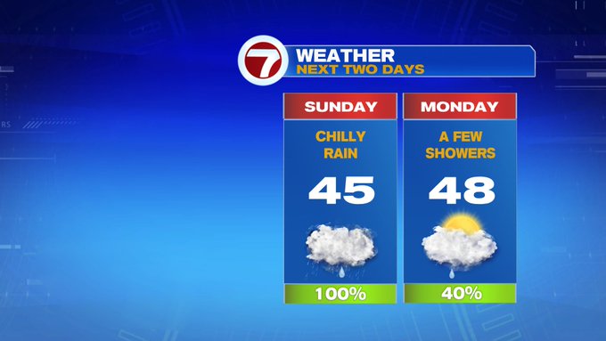
For your Sunday, we’re tracking highs only into the 40s. but with the breeze, it will feel like it’s in the upper 30s for most of the day…talk about a cold rain!
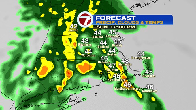

Also, developing by the afternoon, a few pockets of downpours set-up, and a rumble of thunder cannot be ruled out.
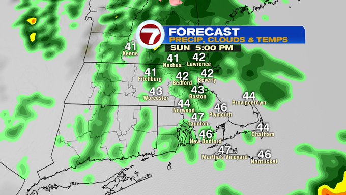
This soaking rain continues tonight, with widespread showers still with us through 8PM.

The rain finally tapers by midnight, with a spot shower possible early Monday morning in southern NH.
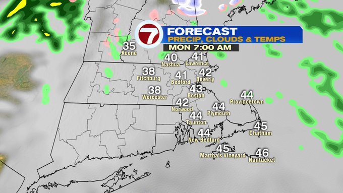
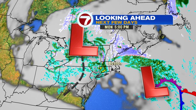
Another round of showers possible Monday afternoon and evening.

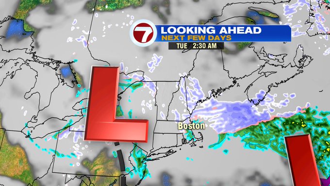
Late Monday night into early Tuesday, with colder air sinking southward into southern New England, we can’t rule out a chance for a few snow flurries mixing in with some drizzle ahead of sunrise Tuesday at the coast. No accumulation is expected, and we’ll see some breaks in the cloud cover Tuesday afternoon.

Wednesday is the pick of the week, although it’s still on the colder side for the first day of April, at least we’re tracking dry conditions and some sunshine! A few showers still possible Thursday, Friday and early Saturday, but at least highs will return to the 50s.