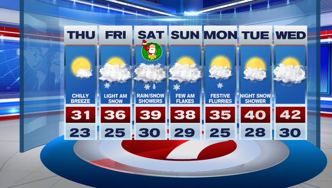
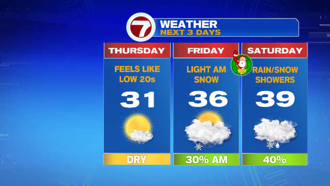
After today’s precipitation, we’ll see a clearing overnight along with colder air filtering in. Overnight lows will dip into the upper teens to low 20s into Thursday morning.
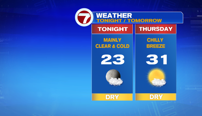
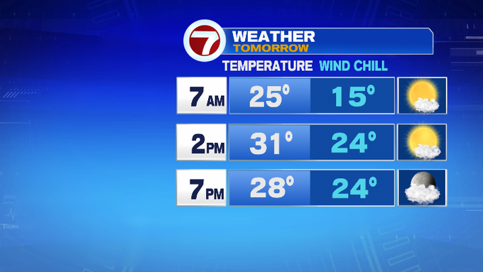
The cold coupled up with a chilly northwest breeze from 10 to 20 mph and a few gusts to 30 mph, wind chills will be in the 20s for most of the afternoon with highs struggling to make it to the freezing mark Thursday.
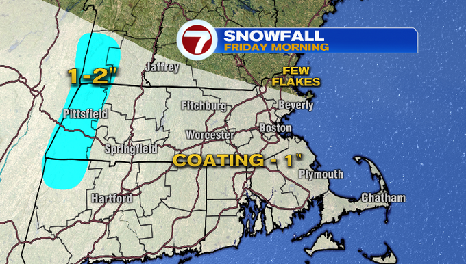
Friday, just in time for Christmas Eve, we’ll see some snow showers in the morning, which could bring a coating to an inch of snowfall across the region.
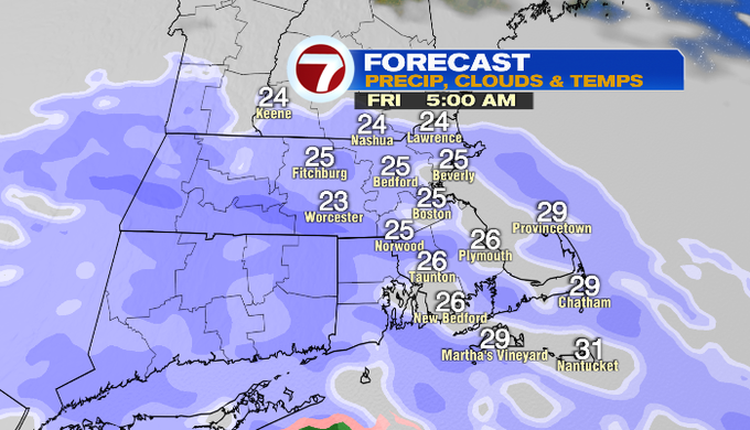
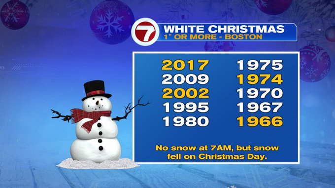
If that 1″ of snow remains on the ground through 7am Christmas morning, that would reach the criteria to declare it to be a “White Christmas.”
Speaking of Christmas Day, temperatures moderate back into the upper 30s, and since we have precipitation in the forecast, we are tracking the threat for rain and snow showers, so be sure to take it slow on your travels and watch for slick spots.
Snow chances remain in the forecast for Monday as well as Tuesday night.