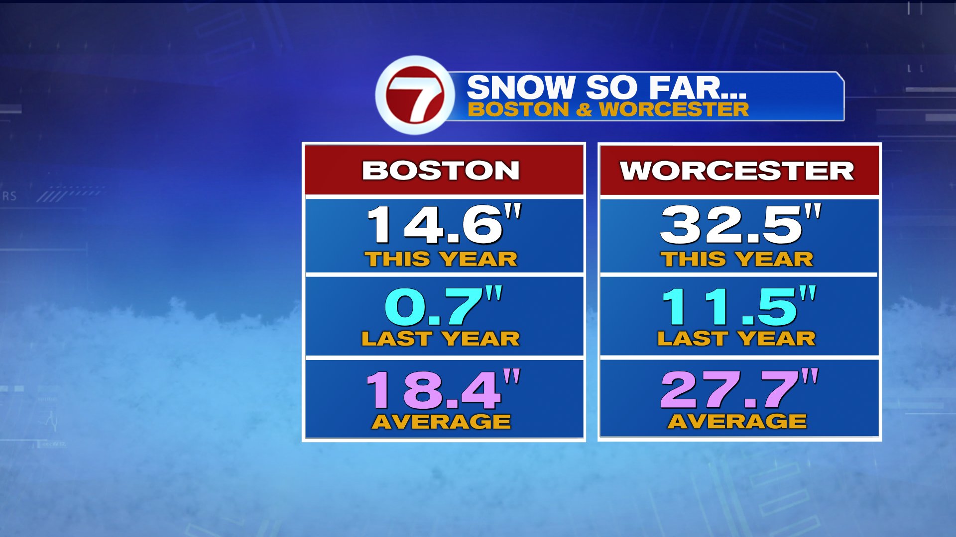
After a prolonged snow break for much of the area, we did get a widespread 3-6″ of snow over the weekend and as of now, the winter snow totals across southern New England aren’t that far from average. Boston Worcester and Boston are within several inches of their respective average season to date. Of course, the fast start to winter/snowstorms helped pad the stats early, before the warmer and drier pattern settled in through the Holidays and into the first half of January.
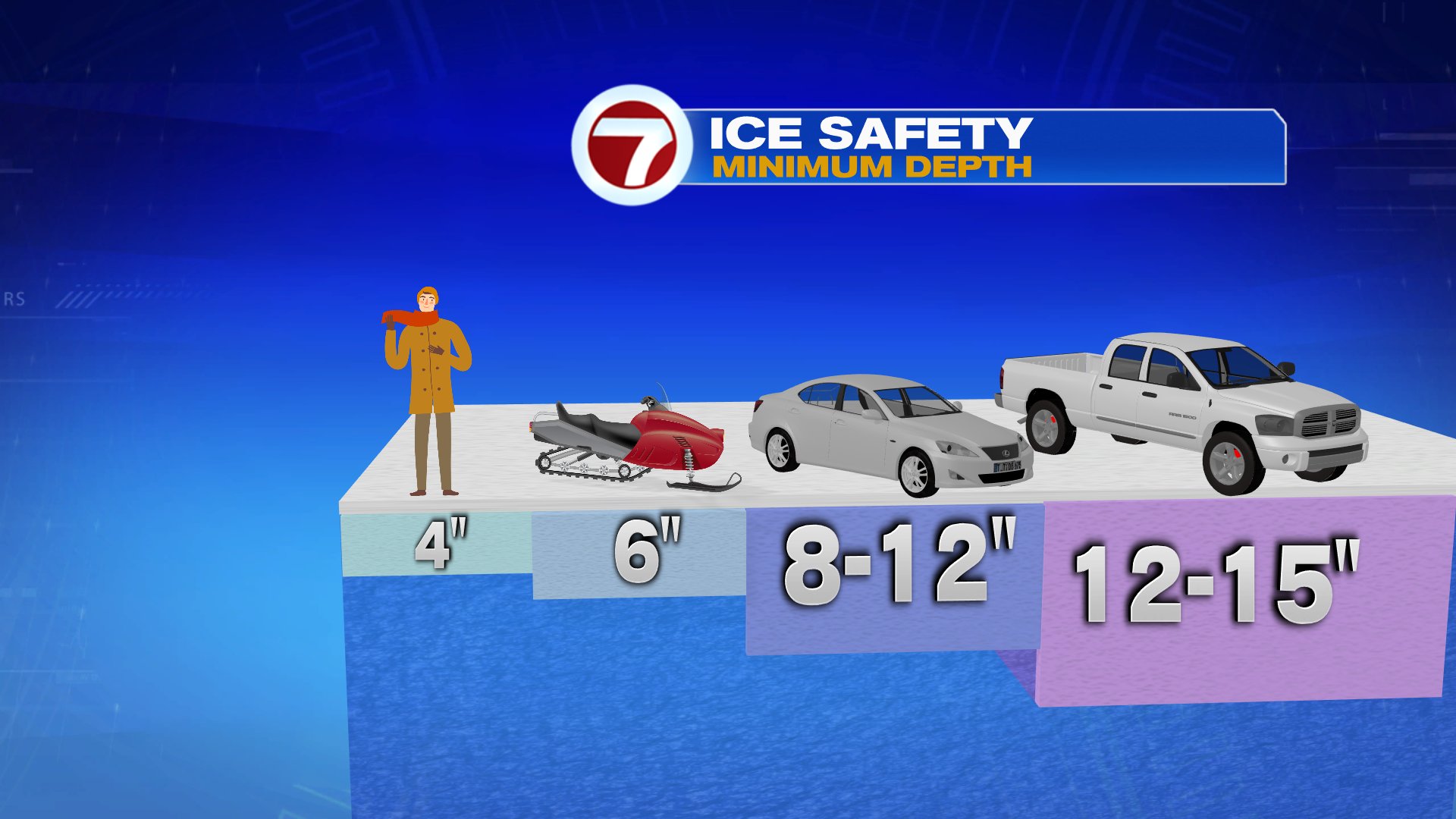
With the very mild start to January, the local ponds thawed out and all the early winter’s ice melted away. Of course, since last Friday, much colder air came back, starting the refreeze process. Although ice is now starting to cover those ponds back up, thin ice is an issue. You need 4″ thickness for ice to be safe to walk on. Keep that in mind this week as pond ice continues to gradually thicken the next few days. Watch out for thin ice!
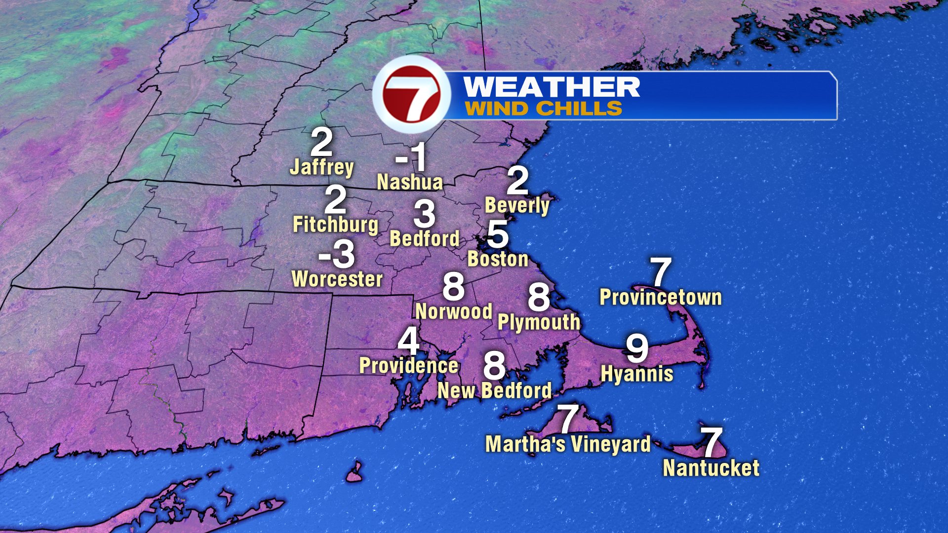
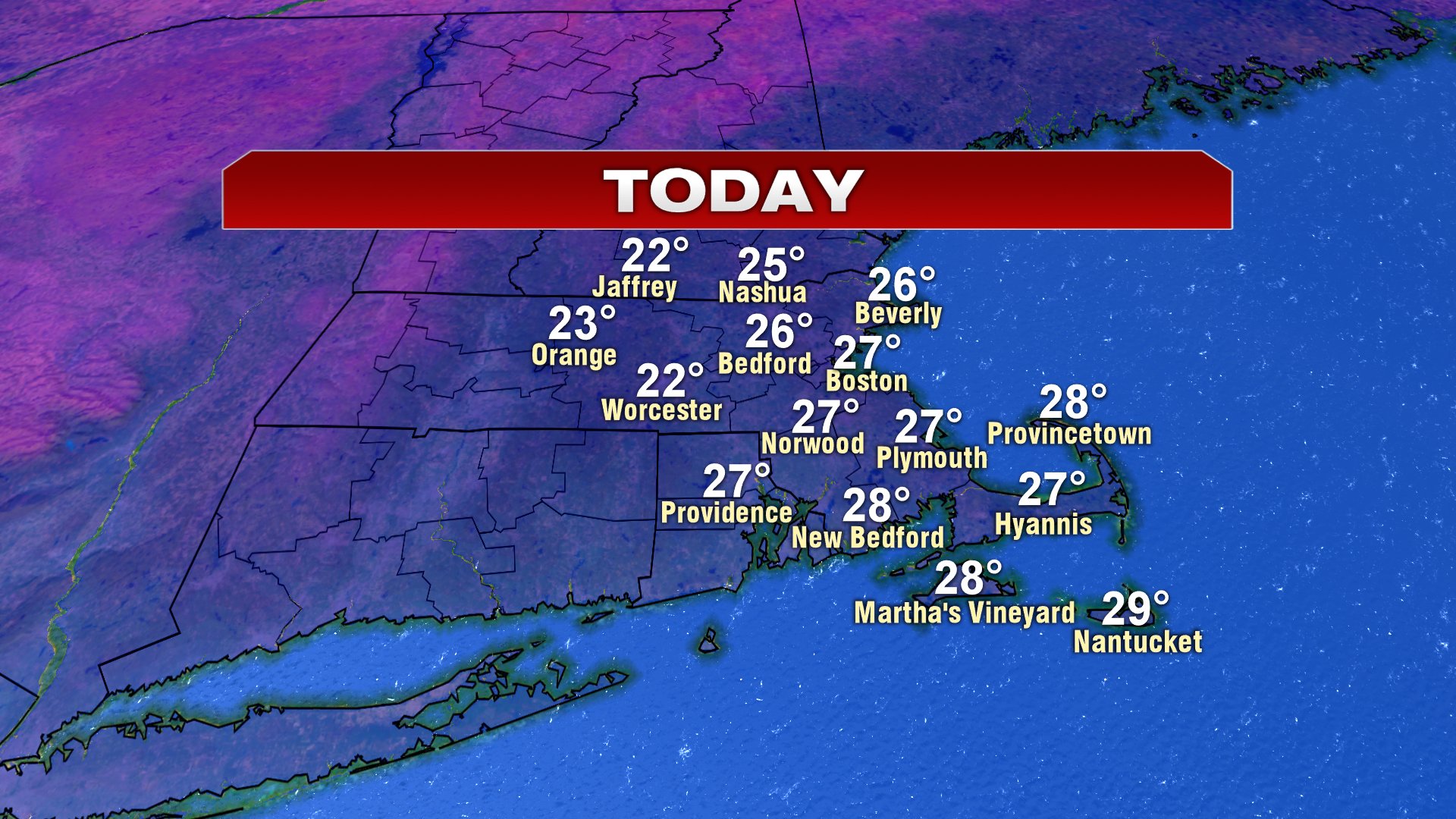
We start the week of cold with wind chills near 0 this morning. Sunshine wins out today and tomorrow as highs recover into the mid to upper 20s.
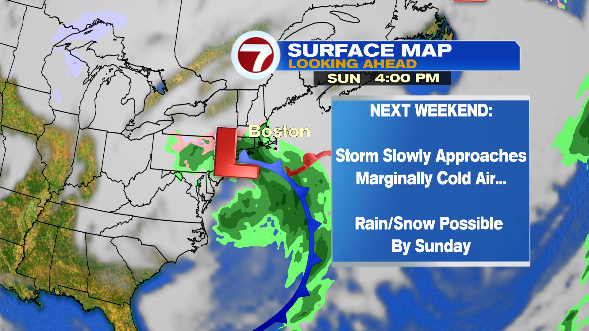
Temps moderate back to the 30s Wednesday and 40s Thursday and Friday. By the weekend, we’ll track the next storm as rain and snow are possible Saturday night and Sunday. Where the rain/snow line sets up will be predicated on the track and strength of the low.