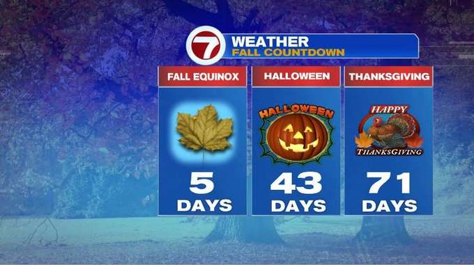
We’re just 5 days away from the Fall Equinox and we can make the argument that it has already felt like fall this entire week.
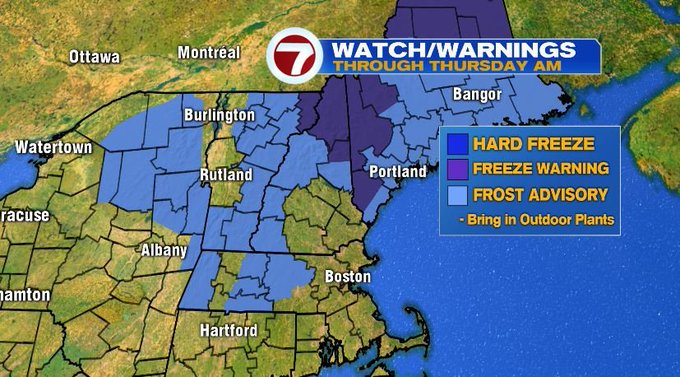
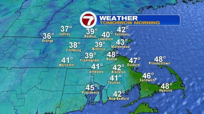
We have one more chilly night ahead before seeing a slight warm-up into the end of the week. Overnight lows tonight will likely slip into the mid to upper 30s for those in the Worcester Hills and southern NH (away from the coastline). These colder temps has prompted a Frost Advisory to be issued tonight into early tomorrow morning for northern Worcester Co. and the Berkshires.

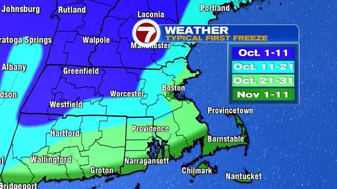
So, be sure to cover or bring in those plants that are not a big fan of the cold. Our typical first FREEZE is in October for most of the region.
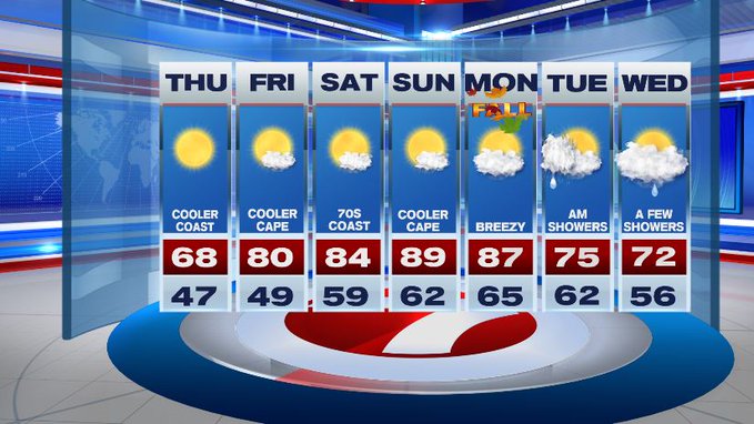
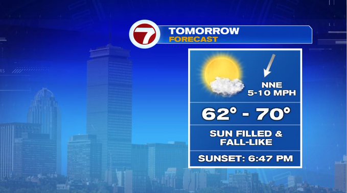
Thankfully, temperatures after tomorrow’s chilly morning commute rebound back into the 60s under ample amounts of sunshine!
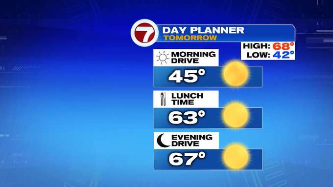
We do see a slight shift in the wind direction tomorrow afternoon to out of the NE, which means slightly cooler at the coast at times.
High temperatures this weekend rise back into the mid to upper 80s, making the last official weekend of “summer”, feel like “summer”. Autumn officially begins on Monday at 3:50AM.
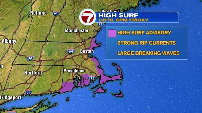
Speaking of summer, we’re still keeping an eye on the tropics. Hurricane Humberto is veering just to the west of Bermuda, and as a Cat. 3, it’s making for large breaking waves and strong rip currents along our very own coastal beaches, which is why a High Surf Advisory has been issued through Friday at 6PM.
Temperatures still feel summer-like for the first day of fall, but we return back to the 70s by Tuesday and Wednesday with showers returning to the forecast.