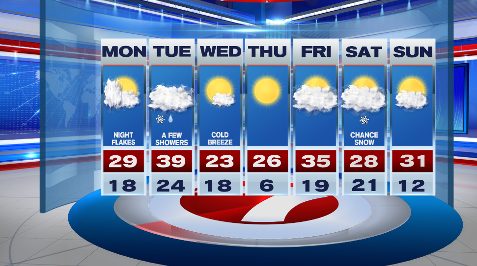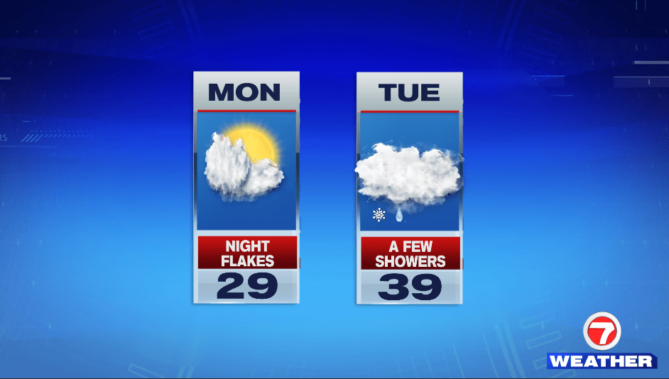
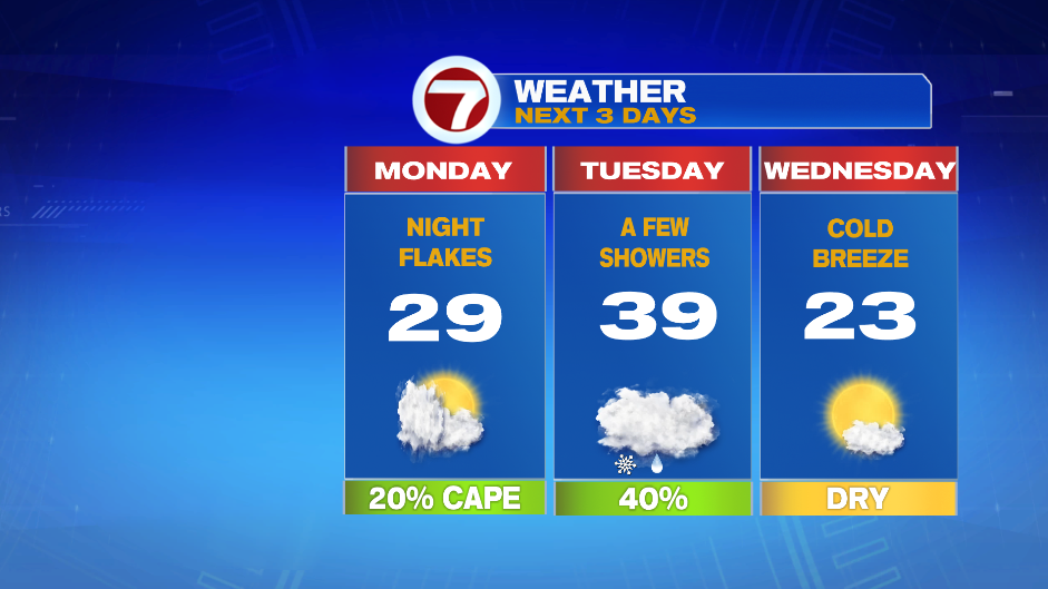
7Weather- We’ll have lots of clouds around and flurries tonight as a cold front moves through the region.
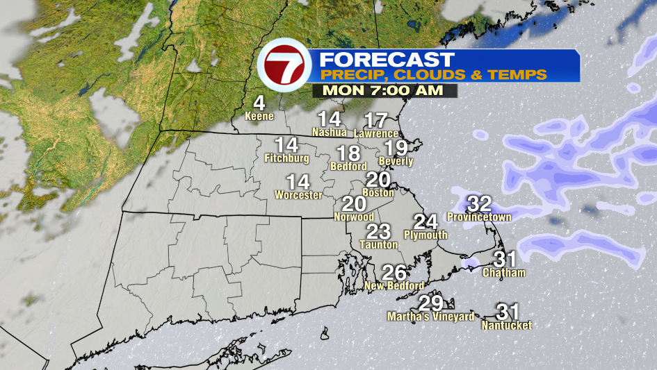
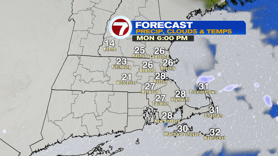
It looks like there will be lingering clouds around in the morning with a few snow showers on the Cape. Temperatures start off in the teens and low 20s.
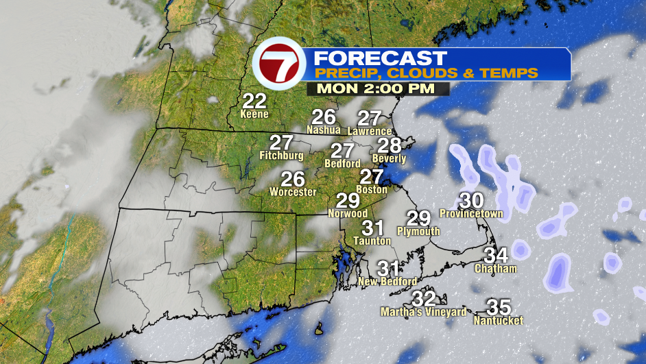
There will be some clearing in the afternoon and it is about 5-8º colder with high in the upper 20s and low 30s. Wind is light so we won’t be dealing with much of a wind chill. The clouds come right back around sunset as the next weak system moves in.
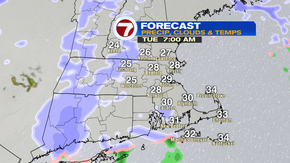
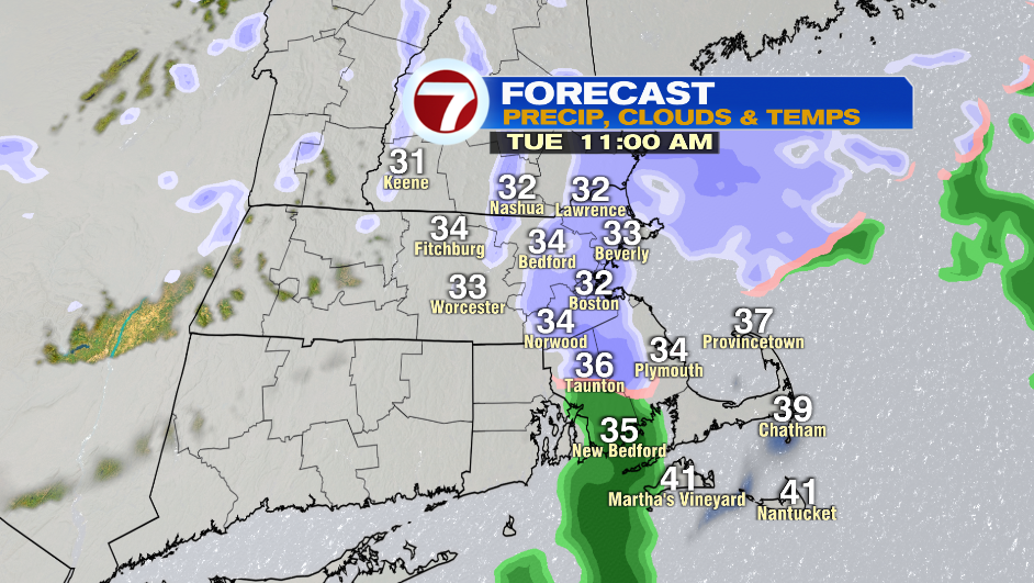
A weak low pressure moves over us Tuesday morning bringing in a few snow/rain showers. There could be isolated slick spots for the morning commute, but it’s mainly light precipitation that will make you turn on your windshield wipers. Patchy coatings are possible. The light mix ends between 11AM – 1 PM.
The day starts with temperatures in the mid and upper 20s and then we get into the mid and upper 30s in the afternoon.
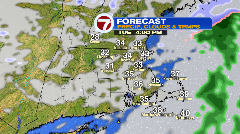
Clouds clear out Tuesday night and cold air moves back in on Wednesday. The day starts with temperatures near 18º and we only get to 23º in the afternoon. A cold breeze at 10-15mph will make it feel colder.
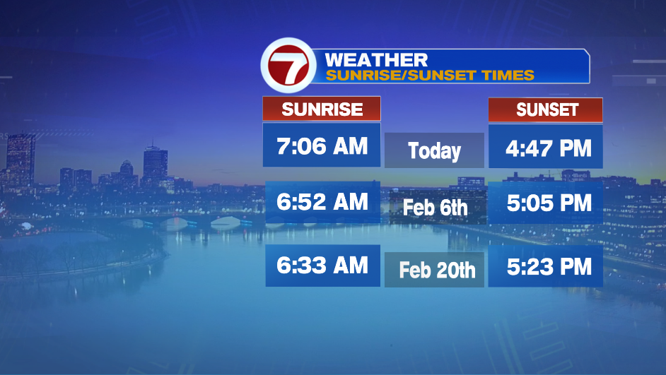
Things are looking up! Boston gains about 1 hour 10 minutes of daylight in the next 4 weeks. Our first 5:00PM sunset is February 2nd.
Temperatures start in the single digits on Thursday, and then highs reach into the mid 20s in the afternoon. Friday is mainly cloudy and there could be a few sprinkles/flurries in the afternoon.
There will be a coastal storm offshore on Saturday. Right now it looks like a “miss” as it looks to stay well offshore. I kept it in the forecast just as a heads up in case things change throughout the next few days.