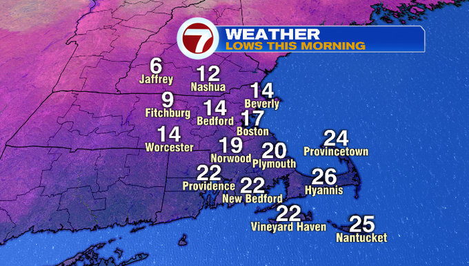
It was another cold start this morning with temperatures dipping into the single digits into southern NH and for north central MA.
Temperatures will only rebound into the mid to upper 20 this afternoon with increasing clouds ahead of a system that will bring light snow and a wintry mix to portions of southern New England.
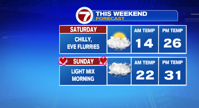
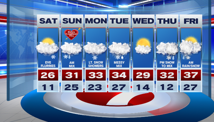
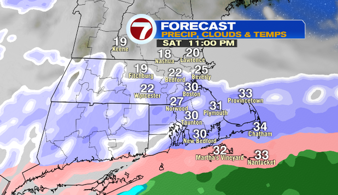
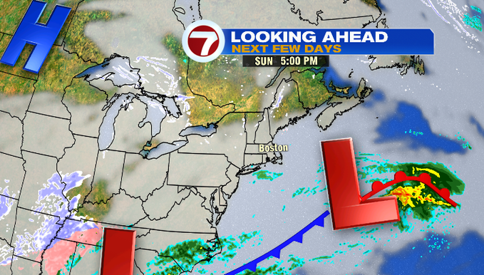
The bulk of our Saturday is dry. It’s not until after sunset this evening, that the leading edge of snow showers build in from the south and fill in across the region through 11PM.
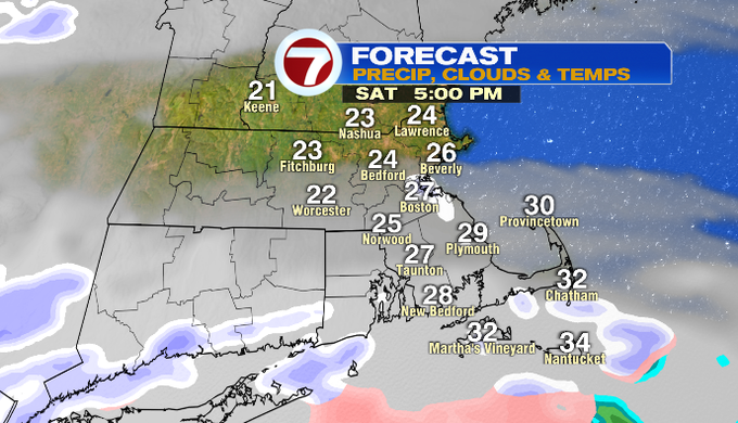
Minor snow accumulation expected with this system with a coating to an 1″ of snow possible.
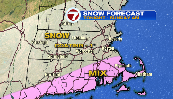
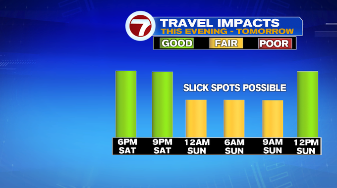
For SE MA and the Cape and Islands, a period of wintry mix will make for some slick conditions. An icy glaze is possible into early Sunday morning so exercise some caution on your travels.
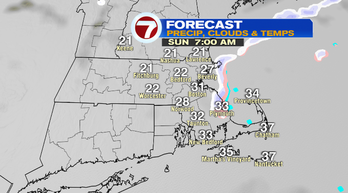
Better conditions arrive by late morning Sunday, giving may to mainly cloudy skies and highs into the low 30s for the afternoon on Valentine’s Day.
For the work week (or for Vacation Week for students and teachers across Massachusetts), it’s an active weather pattern. Several systems pass by just to our south, with Tuesday’s system slightly closer, which means we’re looking at a messy mix.
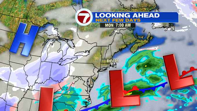
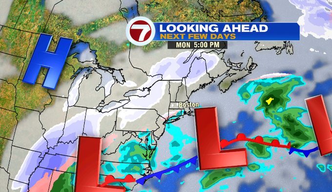
Monday is a just a few snow showers, while Tuesday starts off as snow and then the mix of rain & snow moves slightly, cutting across southern New England, making for tricky and icy travel.
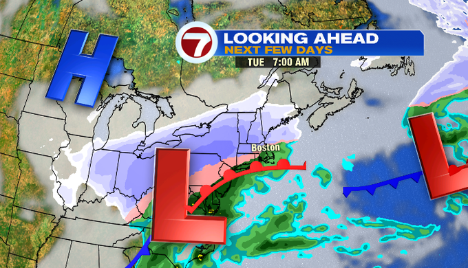
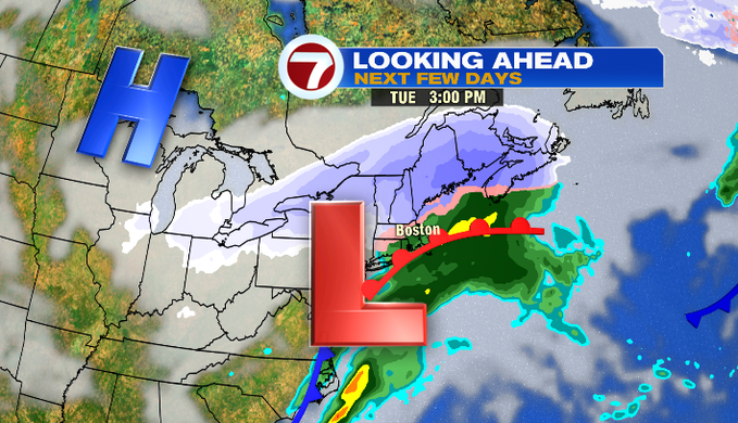
Higher snowfall totals expected for north central MA and southern NH, with a slushy mix of snow and sleet for Boston and areas SE. A better idea of snow totals will be issued as we get closer to Tuesday.
A brief break in the action Wednesday before another system moves in Thursday afternoon with another dose of snow that transitions to a rain/snow mix through early Friday morning.